The Dominican Republic fills the eastern two thirds of Hispaniola, with Haiti on
the other side of a long, straight-looking border and the Atlantic and the
Caribbean on its other two. Its first tier is a set of provinces plus the
National District around the colonial centre of Santo Domingo, and together they
cover the country without a gap. Anyone planning a drive from the capital to the
beaches of Punta Cana, or over the mountains to Santiago, crosses most of them.
- The quiz
- Name to place, on the map
- Grouped by
- The Cibao, the south coast, the southwest and the east
- In the game
- 32 provinces
What you are looking at
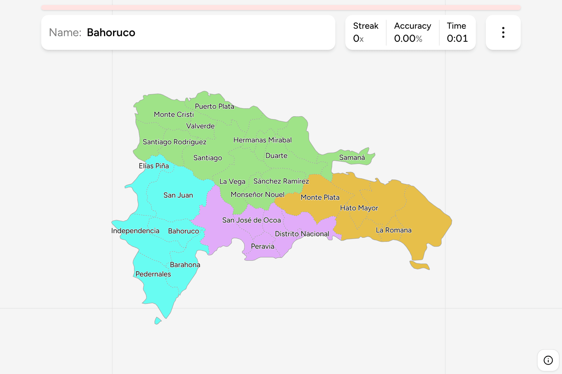
The provinces and the National District of today, named in Spanish. The National
District is the capital's own division and is not part of Santo Domingo province,
which wraps around it on three sides, so the two are separate answers and the
smaller one is easy to miss. Some older maps use outdated spellings for a few
provinces, such as "El Seybo" for El Seibo and "La Estrelleta" for Elías Piña.
This game uses the names the provinces carry today.
The groups are not an official classification. The country has ten development
regions, which is too many to learn as groups, so these are the four parts it is
usually described in: the Cibao valley and north coast, the south coast around
the capital, the southwest on the Haitian border, and the east. They are a way to
learn the map a piece at a time.
How to place one
- Start with the capital. The National District sits on the south coast
with Santo Domingo province around it, San Cristóbal to the west and Monte
Plata inland.
- Follow the south coast west. Peravia, Azua, then Barahona on the bay, and
Pedernales at the Haitian border.
- Cross the mountains. San Juan and Elías Piña fill the western interior,
with La Vega, Santiago and the rest of the Cibao to the north.
- Finish in the east. La Altagracia is the eastern tip with the resorts,
with La Romana and San Pedro de Macorís along the south coast to the capital.
Every province, by group
- Cibao14 provinces
- Dajabón, Duarte, Espaillat, Hermanas Mirabal, La Vega, María Trinidad Sánchez, Monseñor Nouel, Monte Cristi, Puerto Plata, Samaná, Sánchez Ramírez, Santiago, Santiago Rodríguez, Valverde
- South coast6 provinces
- Azua, Distrito Nacional, Peravia, San Cristóbal, San José de Ocoa, Santo Domingo
- Southwest6 provinces
- Bahoruco, Barahona, Elías Piña, Independencia, Pedernales, San Juan
- East6 provinces
- El Seibo, Hato Mayor, La Altagracia, La Romana, Monte Plata, San Pedro de Macorís
Worked examples
Distrito NacionalThe smallestThe National District is a small patch on the south coast, enclosed by Santo
Domingo province on its other sides.
La AltagraciaThe eastern tipLa Altagracia takes in the whole eastern end of the island, including Saona
Island off its southeast coast.
PedernalesThe far southwestPedernales is the southwestern corner on the Haitian border, with Beata Island
off its coast.
Frequently asked questions
How many provinces does the Dominican Republic have?
Thirty-one, plus the National District, which is the capital's own division. The game counts the District as a separate answer, so there are 32 in the first tier.
What is the National District?
The division around the centre of Santo Domingo. It ranks with the provinces but is not part of Santo Domingo province, which surrounds it.
Why no municipalities game?
The country has 158 municipalities, and the boundary files we can use still draw 155 or 156 of them, so the map would be missing places. It will come once a source draws all of them.
Sources