The fifty states are the first thing most people think they know about the
United States and the last thing they can draw. The shapes are familiar and the
positions are not: the rectangles of the Mountain West look interchangeable, the
north east is a pile of small states with long names, and a surprising number of
players put Kentucky where Tennessee is. This page is the states and the District
of Columbia, the four Census regions they are grouped into, and what separates
the pairs that get confused.
- The quiz
- Name to place, on the map
- Where it helps
- Plates, area codes, road signs, landscape, climate
- In the game
- 51 states
What you are looking at
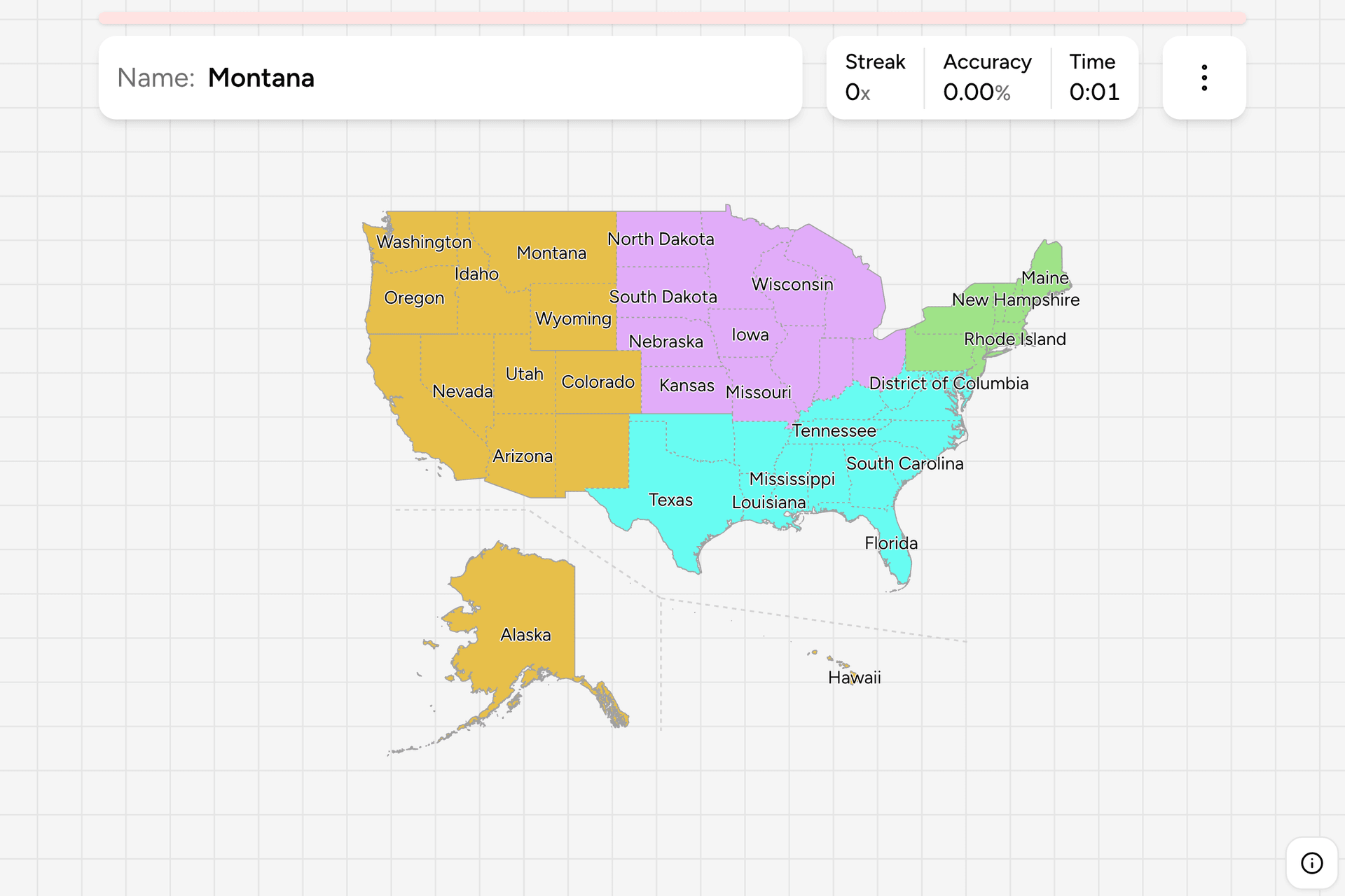
The map is the fifty states and the District of Columbia, which is the federal
capital district and is not part of any state. The territories (Puerto Rico,
Guam and the rest) are not states and are not here. Alaska and Hawaii are moved
into the empty space below the south west and drawn smaller than life, behind a
dashed line, which is the usual way of fitting the whole country on one screen.
Alaska is really more than twice the size of Texas, and Hawaii sits some four
thousand kilometres west of California.
Below a state sit the counties (Louisiana calls them parishes and Alaska
boroughs), of which there are about three thousand. A state is the tier that sets
the traffic law, issues the number plate and owns the highways, which is why it
is the tier a photograph points at.
How to place one
- Start with the plate. Every state issues its own design, and a handful are
unmistakable: Florida's orange, Colorado's mountains, Texas' lone star.
The US License Plates quiz drills exactly this.
- Then the phone number. An area code names a state or part of one. The
US Dialing Codes quiz is the companion.
- Then the road. Interstates are numbered so that even numbers run east to
west and odd ones north to south, and the numbers rise from south to north and
from west to east. A two digit number tells you roughly where on the grid you
are before you see a state name.
- Then the land. The Atlantic coast is forest and small towns, the
Appalachians run behind it, the Midwest is flat and farmed, the Great Plains
are treeless, and everything west of the hundredth meridian gets steadily
drier until the Rockies.
The traps are the neighbours that look alike.
Dakotas. North Dakota is the upper one and South Dakota the lower, and the
Black Hills and Mount Rushmore are South Dakota.
Kentucky and Tennessee. Tennessee is the long thin one that touches eight
states, and Kentucky sits above it with a western tail along the Mississippi.
Virginia and West Virginia. West Virginia broke away in 1863 and is the
mountainous one with the panhandles. Virginia is the bigger one that holds the
Chesapeake coast.
The Four Corners. Utah, Colorado, Arizona and New Mexico are the only four
states that meet at a single point, and Colorado and Wyoming are the two that are
almost perfect rectangles.
Every state, by region
- The North East9 states
- Connecticut, Maine, Massachusetts, New Hampshire, New Jersey, New York, Pennsylvania, Rhode Island, Vermont
- The Midwest12 states
- Illinois, Indiana, Iowa, Kansas, Michigan, Minnesota, Missouri, Nebraska, North Dakota, Ohio, South Dakota, Wisconsin
- The South17 states
- Alabama, Arkansas, Delaware, District of Columbia, Florida, Georgia, Kentucky, Louisiana, Maryland, Mississippi, North Carolina, Oklahoma, South Carolina, Tennessee, Texas, Virginia, West Virginia
- The West13 states
- Alaska, Arizona, California, Colorado, Hawaii, Idaho, Montana, Nevada, New Mexico, Oregon, Utah, Washington, Wyoming
These four are the Census Bureau's regions, the cut the federal government
publishes its statistics in and the one most Americans will recognise: the North
East, the Midwest, the South and the West. They are the same four the plates and
area code games use, so a player who learns one of them learns the others. The
District of Columbia is filed under the South, and each region can be switched on
and off on its own in the game's start dialog.
Worked examples
Rhode IslandThe one that is easy to missThe smallest state, under three thousand square kilometres, tucked between
Connecticut and Massachusetts with Narragansett Bay cut into it. It has a
tap area on this map for exactly that reason. Its nickname is the Ocean State, and its
coast is the clue: a sandy New England shore south of Boston and east of New
London is this one.
West VirginiaThe one that looks like a mistakeAn odd shape with a panhandle at each end, because it was drawn along the
mountain counties that stayed loyal to the Union and split from Virginia in
1863. Everything inside it is Appalachian: steep forested ridges, coal
towns, narrow valleys and almost no flat ground. Neighbouring Virginia has the
coastal plain and the capital's suburbs, so flat land and sprawl mean you left.
WyomingThe rectangle with nothing in itWyoming and Colorado are the two states drawn entirely from straight lines.
Wyoming is the empty one, with the smallest population in the country, big sky,
sagebrush, Yellowstone in the north west corner and the Tetons below it. Colorado
below it has the high Rockies and a lot more people along the Front Range.
Frequently asked questions
How many states are there in the United States?
Fifty. The last two to join were Alaska and Hawaii, in 1959. The District of Columbia is the capital district and is not a state, which is why this quiz has fifty-one regions to place.
Why are Alaska and Hawaii drawn under the map?
Because placed where they really are they would stretch the map across the Pacific and shrink the other forty-eight states to a strip. Both are moved into the empty corner below the south west, Alaska is drawn at well under its real size, and a dashed line separates them from the mainland.
What are the four regions of the United States?
The North East, the Midwest, the South and the West, as defined by the Census Bureau. The Census Bureau also splits each region into divisions, nine in all, and that is the tier below. The regions are the standard way federal statistics are broken down.
Which is the largest state, and which is the smallest?
Alaska is the largest by a wide margin, and Rhode Island the smallest. Texas is the largest of the forty-eight mainland states. By population California is the largest and Wyoming the smallest.
Which states are easiest to confuse?
The Dakotas, Kentucky and Tennessee, Virginia and West Virginia, and the rectangles of the Mountain West: Wyoming, Colorado and Utah. In the north east, New Hampshire and Vermont are another pair that trips people up, since Vermont is the one on the New York side.
Is Washington, DC a state?
No. It is a federal district created from land given up by Maryland, it has no voting representation in the Senate and it belongs to no region in law. The Census Bureau counts it in the South, and this quiz does the same.
For the same country by other clues, try US License
Plates and US Dialing Codes. For
another federal country's first tier, Canada Provinces and
Australia States are the closest.
Sources