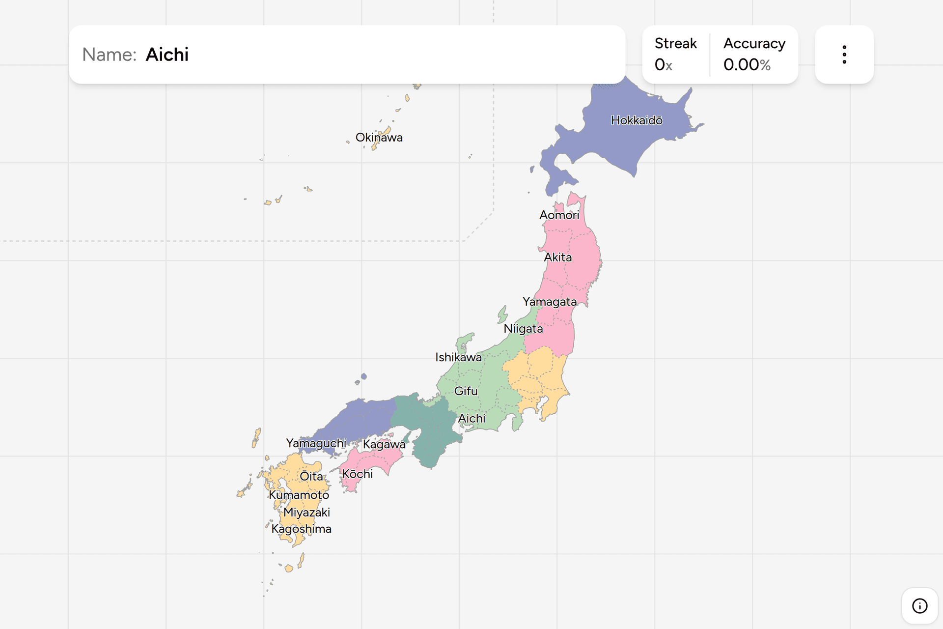
Japan is administered by 47 prefectures, and they are the unit everything else
is counted in: weather, dialects, licence plates, the news. The archipelago
makes them learnable in a way a square country never is, because almost every
prefecture has a coast, and a coast is a shape you can remember. This page is
the whole set, region by region, and the game asks you to put each name on the
map.
- The quiz
- Name to place, on the map
- Names
- Romanized or Japanese
- In the game
- 47 prefectures
What you are looking at
The formal word is todōfuken, and it is a list of the four suffixes a
prefecture can carry rather than a word in its own right. Tokyo is a to
(都), a metropolis. Hokkaidō is the dō (道), a circuit, which is why the
name already ends in the thing that classifies it. Kyōto and Ōsaka are fu
(府), the old imperial cities. The other 43 are ken (県), ordinary
prefectures. The four types differ in a handful of legal details and in
nothing you can see from the road.
The romanized names drop that suffix, which is why the game offers to write
them the local way instead: switch on the local name in the start dialog and
Aomori becomes 青森県, with 東京都, 京都府, 大阪府 and 北海道 as the four that
do not take 県. If you are learning the names to read them off a road sign, the
Japanese setting is the one to practise in.
Prefectures are numbered as well as named, and the numbers run in the order
the regions do: 01 in the far north, 47 in the far south. The game's own
groups are those regions.
How to place one
- Find the island first. Hokkaidō is one prefecture and the whole northern
island. Shikoku is four and the small one in the south. Kyushu is seven,
plus Okinawa trailing off to the southwest. Everything else is Honshu, and
Honshu is where the work is.
- Then pick the coast. On Honshu, most confusions are between a Sea of
Japan prefecture and a Pacific one at the same latitude. Akita and Yamagata
face west, Iwate and Miyagi face east, and the pairs are otherwise easy to
swap.
- Then work out from the anchor. Tokyo, Ōsaka and Nagoya (which is in
Aichi) hold the three big plains, and most of the map can be reached in one
or two steps from one of them.
The names that catch people out are the ones that sound alike rather than the
ones that sit close together. Yamagata is in Tohoku, Yamanashi is next to
Tokyo, Yamaguchi is at the far western tip of Honshu, and there is nothing in
the names to sort them. The same goes for Miyagi in the northeast against
Miyazaki in the south, and for Tottori against Shimane, which are the two Sea
of Japan prefectures in Chugoku: Tottori is the eastern one, Shimane the
western one, and everyone gets that wrong at least once.
Okinawa is drawn as an inset on the map, because the Ryukyu islands trail off
several hundred kilometres beyond where a frame around the mainland would end.
It is a real prefecture in a box, not a decoration.
Every prefecture, by region
- Hokkaido1 prefecture
- Hokkaidō
- Tohoku6 prefectures
- Aomori, Iwate, Miyagi, Akita, Yamagata, Fukushima
- Kanto7 prefectures
- Ibaraki, Tochigi, Gunma, Saitama, Chiba, Tokyo, Kanagawa
- Chubu9 prefectures
- Niigata, Toyama, Ishikawa, Fukui, Yamanashi, Nagano, Gifu, Shizuoka, Aichi
- Kansai7 prefectures
- Mie, Shiga, Kyōto, Ōsaka, Hyōgo, Nara, Wakayama
- Chugoku5 prefectures
- Tottori, Shimane, Okayama, Hiroshima, Yamaguchi
- Shikoku4 prefectures
- Tokushima, Kagawa, Ehime, Kōchi
- Kyushu & Okinawa8 prefectures
- Fukuoka, Saga, Nagasaki, Kumamoto, Ōita, Miyazaki, Kagoshima, Okinawa
Those are the eight traditional regions, the way Japanese geography is taught
and the way weather forecasts are read out. Okinawa is grouped with Kyushu, as
it conventionally is. Each region can be switched on and off on its own in the
game's start dialog, which makes Shikoku a two minute drill and Chubu an
evening.
Worked examples
HokkaidōAn island to itselfOne prefecture covering an entire island, a fifth of Japan's land and a
twentieth of its people. It is the only name in the set that already carries
its own suffix, and the only click on this map that cannot be got wrong by a
neighbour.
KagawaThe smallest oneThe smallest prefecture in Japan, on the northeast corner of Shikoku facing
the Inland Sea. Small prefectures are worth learning early precisely because
they are hard to hit: knowing that Shikoku reads Kagawa, Tokushima, Kōchi,
Ehime clockwise from the northeast is worth more than four separate memories.
OkinawaThe one in the insetThe southernmost prefecture, closer to Taipei than to Tokyo, and the reason
the map has an inset at all. Subtropical, with its own architecture and its
own history as the Ryukyu Kingdom, so it is also the prefecture that looks
least like the rest of the country on the ground.
Frequently asked questions
How many prefectures does Japan have?
47, and they cover the whole country with nothing left over. They are grouped into eight traditional regions, from Hokkaido in the north to Kyushu and Okinawa in the southwest, and the game lets you drill one region at a time.
What is the difference between to, do, fu and ken?
They are the four kinds of prefecture, and the difference is administrative rather than visible. Tokyo is a to, or metropolis. Hokkaido is the do, or circuit. Kyoto and Osaka are fu, the historic imperial cities. The remaining 43 are ken, ordinary prefectures. All 47 sit at the same level of government.
Why do Japanese prefecture names look different in Japanese?
Because the romanized form drops the suffix. Aomori is written 青森県, Aomori-ken, and the same is true of every ken in the list. The four exceptions keep their own suffix: 東京都 for Tokyo, 京都府 for Kyoto, 大阪府 for Osaka and 北海道 for Hokkaido. The game can show either form, so you can learn the one you expect to read.
Which Japanese prefectures are easiest to confuse?
Tottori and Shimane, which sit side by side on the Sea of Japan coast with Tottori to the east. Yamagata, Yamanashi and Yamaguchi, which are in three different parts of the country. Miyagi in the northeast against Miyazaki in the south. And the three prefectures immediately north of Tokyo, Gunma, Tochigi and Ibaraki, which run west to east in that order.
Are prefectures useful for GeoGuessr in Japan?
Very. Prefecture names appear on road signs, on boundary markers and on official notices, so reading one is often the fastest way from a rural Japanese road to a region. Knowing where each name goes turns that from a lookup into an instant guess.
More Asian administrative maps to learn: Philippines
Provinces, India States, Thailand
Provinces and Vietnam Provinces.
Sources