Armenia is a landlocked country in the South Caucasus, bordered by Georgia to
the north, Azerbaijan to the east and the Nakhchivan exclave to the south-west,
Iran to the south and Turkey to the west. It is divided into ten provinces, known
as marzer, and the capital Yerevan, which has a province's standing of its own.
The provinces are the tier that the census, the regional governors and the
country's statistics are organised around.
- The quiz
- Name to place, on the map
- Grouped by
- Yerevan and the provinces around it, the north, and the south and east
- In the game
- 11 provinces
What you are looking at
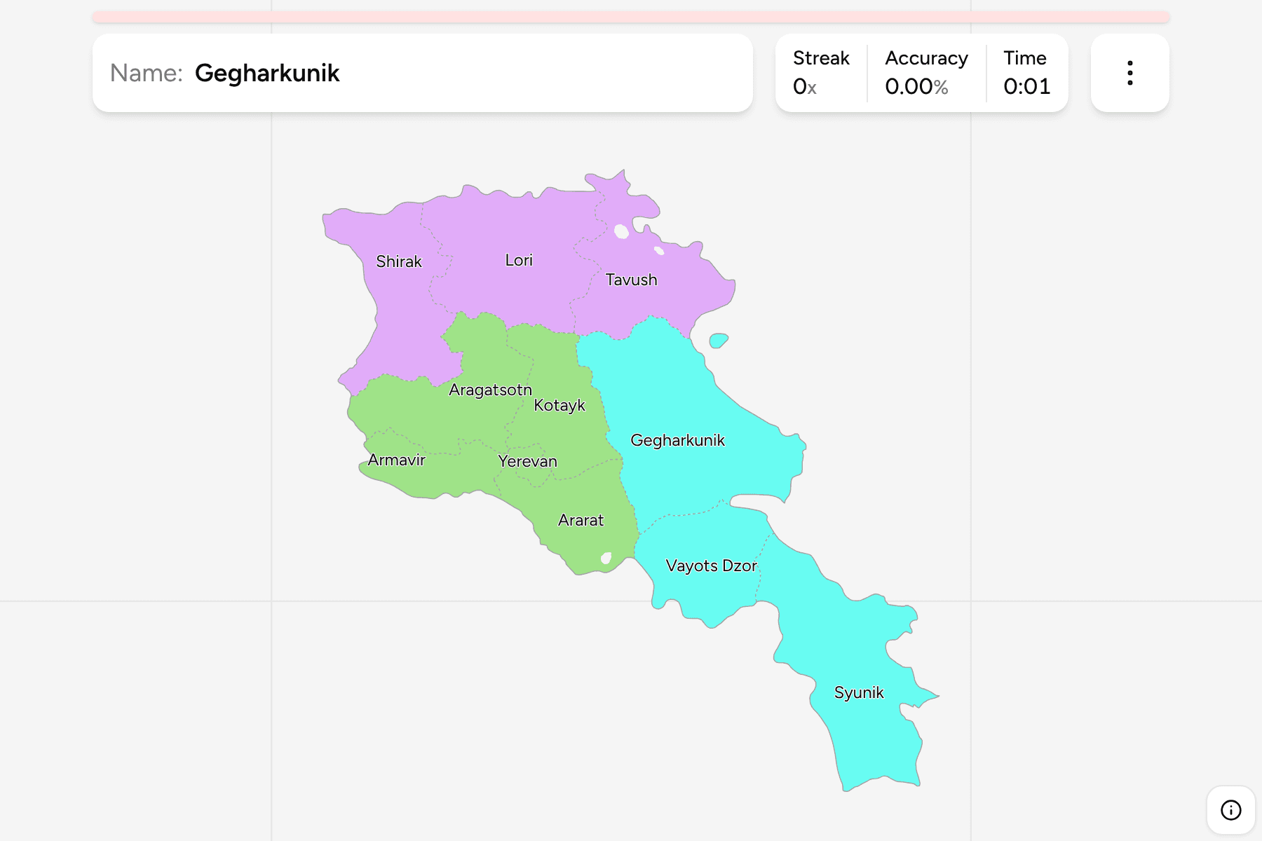
The ten provinces and Yerevan, with the borders of today. Yerevan is a small
city province squeezed between Kotayk, Armavir and Ararat, and the other four
provinces of the central group are all packed round it in the Ararat plain and
the foothills of Mount Aragats. At the other extreme, Syunik is the long southern
province that runs down to the Iranian border, and Gegharkunik wraps around Lake
Sevan, the largest lake in the Caucasus.
The groups are not an official classification. They are the three parts the
country is usually described in, and a way to learn the map a piece at a time:
the crowded centre, the north along the Georgian border, and the south and east.
How to place one
- Start with the capital. Yerevan is the tiny province in the west of the
centre, and Kotayk, Armavir and Ararat are the three that touch it.
- Follow the western border. Armavir and Ararat run along Turkey, with
Aragatsotn above Armavir and Shirak above that, in the north-west corner.
- Go along the top. Shirak, Lori and Tavush are the three northern provinces
on the Georgian border, from west to east.
- Finish in the east and south. Gegharkunik is the broad province around
Lake Sevan, with Vayots Dzor below it and Syunik at the bottom.
Every province, by group
- Central5 provinces
- Aragatsotn, Ararat, Armavir, Kotayk, Yerevan
- North3 provinces
- Lori, Shirak, Tavush
- South and East3 provinces
- Gegharkunik, Syunik, Vayots Dzor
Worked examples
YerevanThe capitalYerevan is the smallest province by far and sits inside the area of Kotayk,
Armavir and Ararat. Kotayk is its neighbour to the north and east.
GegharkunikThe lakeGegharkunik is the large eastern province that holds Lake Sevan. Kotayk is
its western neighbour, and Vayots Dzor and Syunik lie to its south.
SyunikThe southern tipSyunik is the long province at the very bottom of the country, between
Azerbaijan to the east and the Nakhchivan exclave to the west, ending at the
Iranian border.
Frequently asked questions
How many provinces does Armenia have?
Ten, called marzer, and the city of Yerevan, which is governed as a province of its own. This game draws all eleven.
Why are there small gaps inside the border?
A few pockets inside the border are Azerbaijani exclaves, and a small piece of Gegharkunik lies apart from the rest. They are drawn as the source draws them.
Does Armenia group its provinces into regions?
Not in a way this game relies on. The groups here are the three parts the country is commonly described in, and they will not match every list you find.
Sources