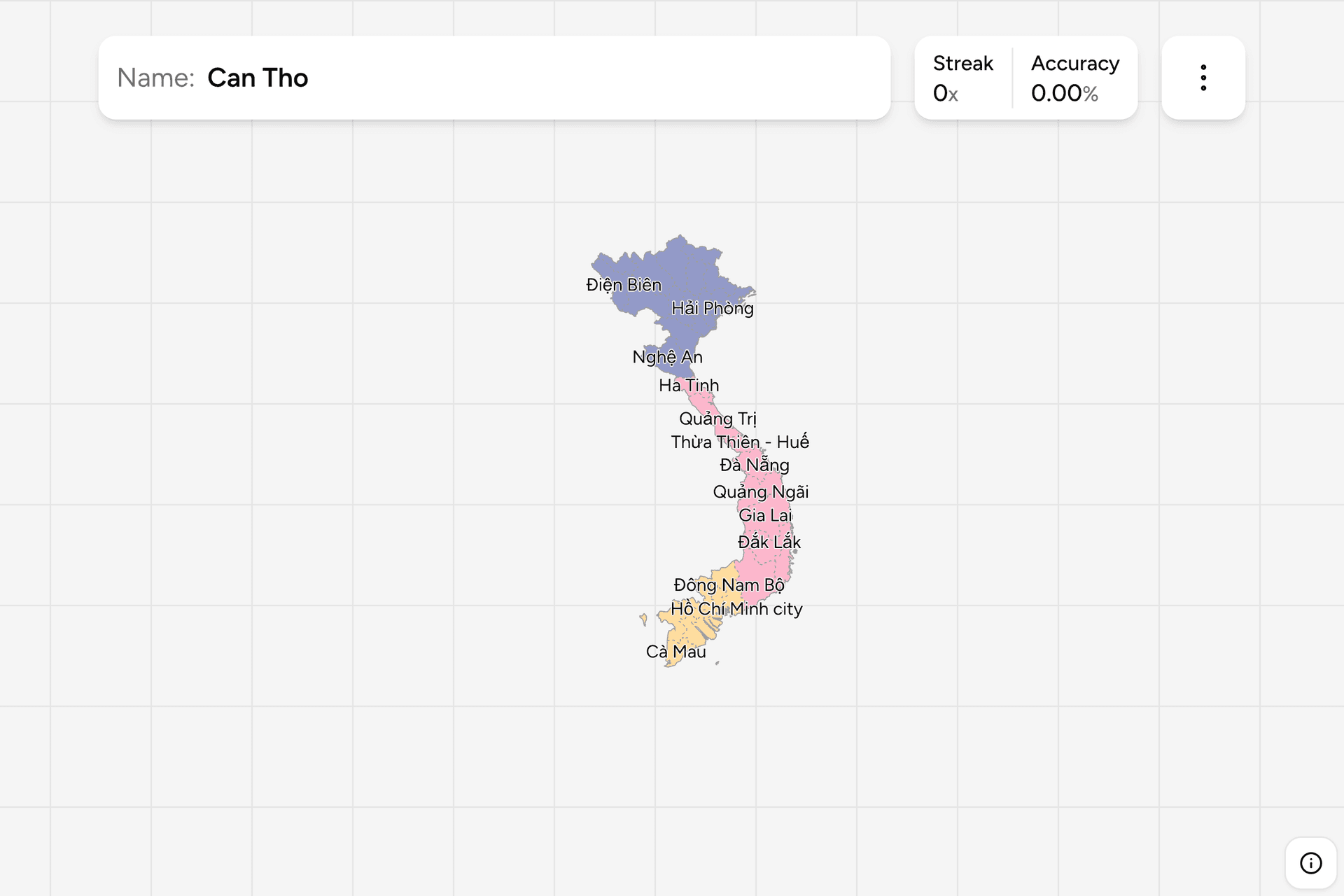
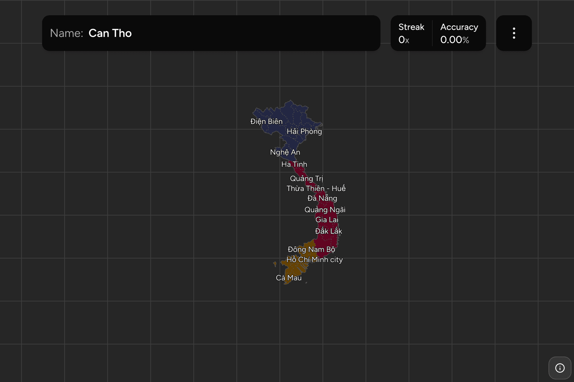
Vietnam redrew itself in 2025. Sixty three provinces and municipalities were
merged into thirty four, which means every map, every quiz and most of the
mental furniture built before that year is now wrong. This game uses the new
arrangement, and this page is the whole of it: what a province is, how the
merger changed the list, and how to find each name on a country shaped like a
letter S.
- The quiz
- Name to place, on the map
- Grouped by
- North, middle and south
- In the game
- 34 provinces
What you are looking at
Vietnam's first level units are provinces (tỉnh) and centrally governed
municipalities (thành phố trực thuộc trung ương). A municipality is a city
with the rank of a province, and there are six of them: Hà Nội, Hải Phòng,
Huế (which this map still labels with its older name, Thừa Thiên Huế), Đà
Nẵng, Hồ Chí Minh City and Cần Thơ. Everything else is a province, and both
kinds are a single target here.
The 2025 merger is the thing to understand about this map. Provinces were
combined in pairs and threes, mostly a coastal province with an inland one, and
the surviving unit usually kept the more prominent of the two names. Đà Nẵng
took in Quảng Nam. Hồ Chí Minh City took in Bình Dương and Bà Rịa Vũng Tàu, so
the city now reaches the sea. Lâm Đồng absorbed Đắk Nông and Bình Thuận and
became the largest unit in the country. Names that were on every map a few
years ago, Bình Định, Ninh Thuận, Hà Giang, Bạc Liêu, are simply gone.
Two of the merged units carry the name of the wider region rather than their
own in the boundary data this map is built from: the unit north of Hồ Chí Minh
City, which should read Đồng Nai, appears as Đông Nam Bộ (the southeast
region), and the one southeast of Hà Nội, which should read Hưng Yên, appears
as Đồng Bằng Sông Hồng (the Red River delta). Everything else carries its own
name.
How to place one
- Split the S. The north is the Red River delta and the mountains around
it. The middle is the narrow coastal strip, in places only fifty kilometres
from the sea to the Laotian border. The south is the southeast around Hồ Chí
Minh City and the Mekong delta below it.
- Work along the coast. Almost every unit in the middle of the country is
a coastal strip running inland to a mountain border, stacked north to south
in order, so the coast is a list rather than a shape.
- Then place the deltas. The two ends of the country are dense clusters of
small units: the Red River delta around Hà Nội, and the Mekong delta below
Hồ Chí Minh City. That is where most of the map's remaining difficulty lives
now that the merger has thinned it out.
The names that catch people are the compounds that share a first word. Quảng
Ninh is in the far northeast, Quảng Trị in the middle, Quảng Ngãi further south
again. Hà Nội and Hà Tĩnh are three hundred kilometres apart. And a merged unit
sits where the older of its two names used to be, not halfway between them, so
if you learned the old map, place the name you know and then widen it.
Every province, by part of the country
- North17 provinces
- Điện Biên, Son La, Thanh Hóa, Nghệ An, Cao Bằng, Lào Cai, Lai Chau, Lạng Sơn, Quảng Ninh, Ninh Bình, Hải Phòng, Tuyên Quang, Phú Thọ, Ha Noi, Đồng Bằng Sông Hồng, Bắc Ninh, Thái Nguyên
- Middle9 provinces
- Đắk Lắk, Gia Lai, Ha Tinh, Quảng Trị, Thừa Thiên - Huế, Khánh Hòa, Quảng Ngãi, Đà Nẵng, Lâm Đồng
- South8 provinces
- Tây Ninh, Ðong Tháp, An Giang, Hồ Chí Minh city, Cà Mau, Vĩnh Long, Đông Nam Bộ, Can Tho
North, middle and south, which is how Vietnam is usually divided in
conversation as well as on paper. Each group can be switched on and off on its
own in the game's start dialog, and the northern group is the biggest of the
three, so it is the one worth a session by itself.
Worked examples
Ha NoiThe capitalThe capital, in the middle of the Red River delta rather than on the coast,
and one of the six municipalities. It is surrounded by the densest cluster of
units in the country, which is why the delta rewards learning as a group
instead of one name at a time.
Đà NẵngA city that grewThe central coast, and much larger than it used to be: the municipality
absorbed Quảng Nam in 2025, so it now runs from the beach up to the Laotian
border. If you remember Đà Nẵng as a dot on the coast, this is the shape to
relearn.
Đông Nam BộĐồng Nai, under another nameThe unit immediately north and east of Hồ Chí Minh City, formed by merging
Đồng Nai with Bình Phước. This is one of the two targets whose label in the
source data is a region name rather than a province name, so it reads Đông
Nam Bộ on screen. The place it points to is Đồng Nai.
Can ThoThe delta anchorThe heart of the Mekong delta, a municipality rather than a province, and the
anchor for the whole southern tip. The delta units around it are small,
similar and flat, so finding Cần Thơ first and counting outwards beats
hunting for each one.
Frequently asked questions
How many provinces does Vietnam have?
34 first level units since the merger that took effect in 2025: 28 provinces and 6 centrally governed municipalities. Before that there were 63. Any map or quiz that still shows 63 units is out of date.
Why did Vietnam merge its provinces in 2025?
To cut the number of administrative layers and the cost of running them. The reorganisation merged provinces in pairs and threes, abolished the district level between province and commune, and left 34 units where there had been 63. Most mergers paired a coastal province with an inland neighbour.
What is a centrally governed municipality in Vietnam?
A city that ranks alongside a province and reports directly to the national government rather than to a province around it. There are six: Ha Noi, Hai Phong, Hue, Da Nang, Ho Chi Minh City and Can Tho. Hue was the most recent addition, promoted from a province in 2025.
Which Vietnamese provinces disappeared in the merger?
Many familiar names, including Ha Giang, Bac Kan, Vinh Phuc, Hoa Binh, Thai Binh, Hai Duong, Nam Dinh, Ha Nam, Quang Binh, Quang Nam, Kon Tum, Binh Dinh, Ninh Thuan, Phu Yen, Dak Nong, Binh Thuan, Binh Duong, Ba Ria Vung Tau, Binh Phuoc, Long An, Tien Giang, Ben Tre, Tra Vinh, Soc Trang, Hau Giang, Bac Lieu and Kien Giang. In each case the territory still exists inside a larger unit.
Are Vietnamese provinces useful for GeoGuessr?
Yes, mostly through signs and plates. Province names appear on boundary signs and administrative notices, and Vietnamese licence plates begin with a two digit province code, so knowing where each province sits turns either clue into a location.
More administrative maps in the region: Thailand
Provinces, Philippines
Provinces, India States and Japan
Prefectures.
Sources