The district (zila) is the second tier of Bangladesh, between the eight
divisions and the upazilas, and the unit that names most of the cities on a road
sign or a bus. There are 64 of them, from the small ones that crowd round Dhaka
to the vast hill districts of the south east.
- The quiz
- Name to place, on the map
- Grouped by
- Division: the eight of the country
- In the game
- 64 districts
What you are looking at
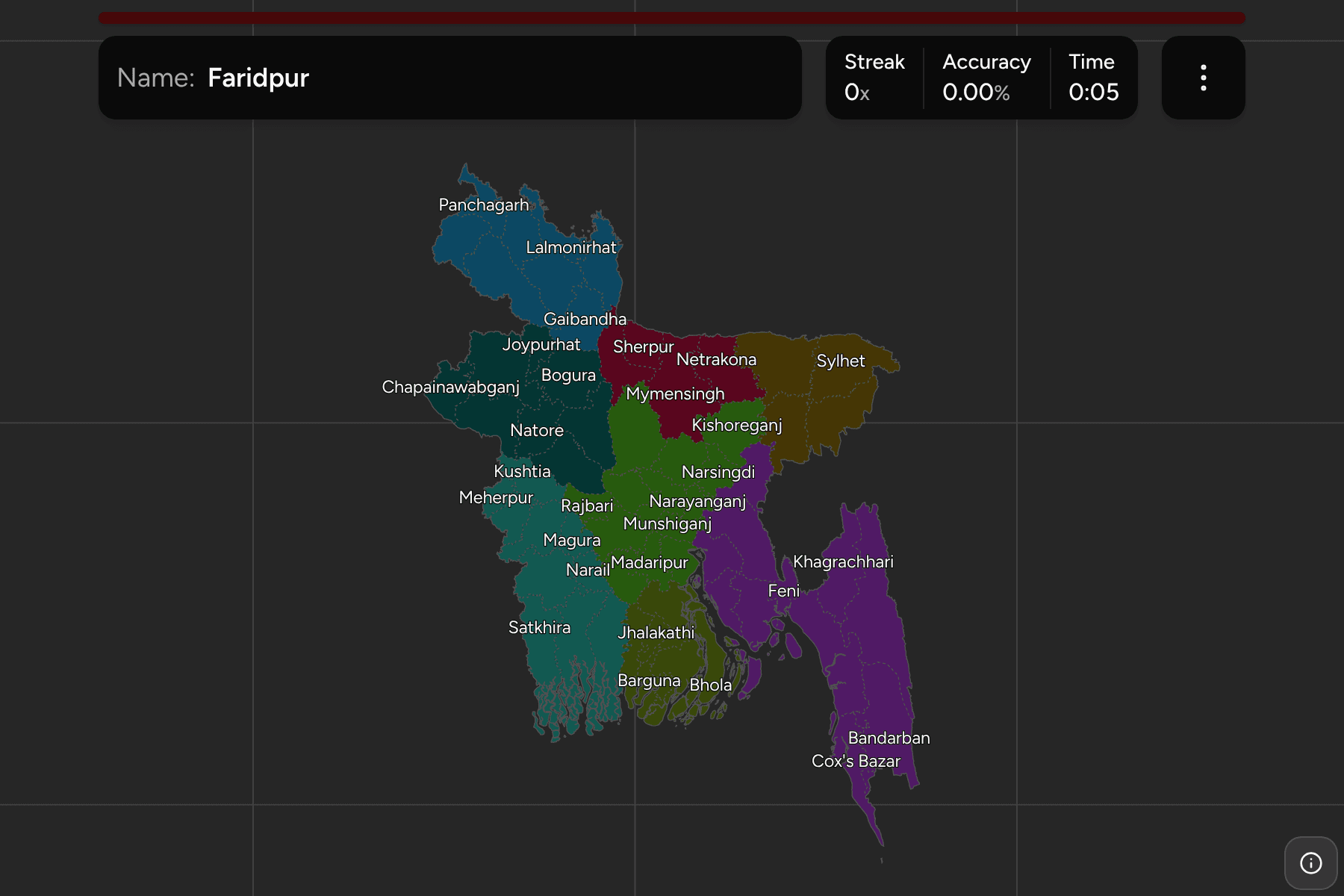
The districts of Bangladesh. Each is named for its main town, so the name that
heads a division is usually also a district: Dhaka, Chattogram, Khulna,
Rajshahi, Rangpur, Sylhet and Barishal each give their name to one of each.
Mymensingh does too, as the 2015 division and the older district.
Several names are spelled differently on older maps, because the government
changed the romanisation in 2018. The quiz uses the current ones: Barishal for
Barisal, Bogura for Bogra, Cumilla for Comilla, Chattogram for Chittagong,
Jashore for Jessore, Jhalakathi for Jhalokati and Chapainawabganj for
Nawabganj. Moulvibazar and Brahmanbaria are the other two that moved.
The districts are very uneven. In the centre, round Dhaka, Narayanganj,
Munshiganj, Gazipur and Manikganj are packed so tightly that the smallest have
a tap area wider than their outline, and zooming in is the way to reach them. In
the south east the opposite holds: Rangamati, Bandarban and Khagrachhari, the
three hill districts, are each far bigger than the ones around the capital.
Bhola, an island in the Meghna estuary, is the one district that is almost
entirely surrounded by water.
The groups are the divisions, so the game lets you drill them one at a time.
Each division answers under the same name in
Bangladesh Divisions.
How to place one
- Pick one division and learn it. Mymensingh and Sylhet have only four each
and are the quickest to finish; Dhaka has thirteen and Chattogram eleven.
- Start with the hills. Rangamati, Bandarban and Khagrachhari are the three
on the Myanmar and Indian border, and nothing else on the map is as large.
- Follow the rivers. The Jamuna runs north to south on the west of
Mymensingh and Dhaka; the districts either side of it fall into different
divisions.
- Read the south as a coast. Satkhira, Khulna and Bagerhat hold the
Sundarbans on the Indian border, Barguna, Patuakhali and Bhola face the Bay
of Bengal, and Noakhali, Feni, Chattogram and Cox's Bazar run down the east.
Every district, by division
- Dhaka13 districts
- Dhaka, Faridpur, Gazipur, Gopalganj, Kishoreganj, Madaripur, Manikganj, Munshiganj, Narayanganj, Narsingdi, Rajbari, Shariatpur, Tangail
- Chattogram11 districts
- Bandarban, Brahmanbaria, Chandpur, Chattogram, Cox's Bazar, Cumilla, Feni, Khagrachhari, Lakshmipur, Noakhali, Rangamati
- Rajshahi8 districts
- Bogura, Chapainawabganj, Joypurhat, Naogaon, Natore, Pabna, Rajshahi, Sirajganj
- Sylhet4 districts
- Habiganj, Moulvibazar, Sunamganj, Sylhet
- Khulna10 districts
- Bagerhat, Chuadanga, Jashore, Jhenaidah, Khulna, Kushtia, Magura, Meherpur, Narail, Satkhira
- Mymensingh4 districts
- Jamalpur, Mymensingh, Netrakona, Sherpur
- Rangpur8 districts
- Dinajpur, Gaibandha, Kurigram, Lalmonirhat, Nilphamari, Panchagarh, Rangpur, Thakurgaon
- Barishal6 districts
- Barguna, Barishal, Bhola, Jhalakathi, Patuakhali, Pirojpur
Worked examples
RangamatiThe biggest of themRangamati is the largest district in Bangladesh by a wide margin, in the hills
of the south east on the border with India and Myanmar. It holds Kaptai Lake,
the reservoir that drowned the old town.
NarayanganjThe small one by the capitalNarayanganj is one of the smallest districts, a river port on the Shitalakshya
just south east of Dhaka, and the centre of the country's jute and garment
trade. It is small enough to need a tap area on the map.
ChapainawabganjThe name that changedChapainawabganj is the district at the far west tip of the country, in
Rajshahi division, among the mango orchards by the Padma. Many maps still
call it just Nawabganj, so it is worth knowing both forms.
Frequently asked questions
How many districts does Bangladesh have?
64, spread over the eight divisions.
Why do some names look different from older maps?
The government changed the English spelling of several in 2018: Chittagong became Chattogram, Comilla became Cumilla, Jessore became Jashore and Barisal became Barishal, among others.
Which division is each district in?
The quiz groups them by division, so you can drill one division at a time. Each division is its own quiz as well.
The tier above this one is Bangladesh Divisions. For
another country at this level, see Guatemala Municipalities.
Sources