Bangladesh is a delta country: the Ganges, the Brahmaputra and the Meghna
join on the way to the Bay of Bengal, and almost the whole land is flat and
river-cut. The division is the unit that tells you which side of those rivers a
round is on, and there are only eight of them.
- The quiz
- Name to place, on the map
- Grouped by
- Four parts of the country, an unofficial cut
- In the game
- 8 divisions
What you are looking at
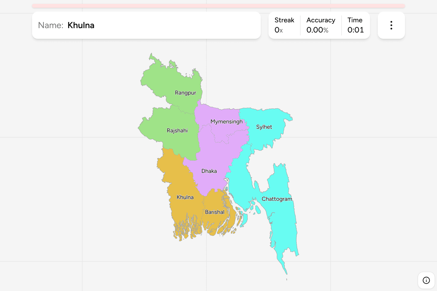
The divisions (bibhag) of Bangladesh, the first tier of the country. Seven are
named for their capital city, and the eighth, Mymensingh, was cut out of Dhaka
in 2015, which is why older maps show seven. Dhaka the division and Dhaka the
district are two different answers, and the same goes for Chattogram, Khulna,
Rajshahi, Rangpur, Sylhet and Barishal.
The map is lopsided in a useful way. Chattogram runs down the whole south east,
along the hills and the coast to the border with Myanmar. The Padma and the
Jamuna split the rest: Rajshahi and Rangpur lie west and north of the Jamuna,
Dhaka and Mymensingh sit at the centre, and Khulna and Barishal fill the tidal
south west, including the Sundarbans mangroves.
The groups are not an official classification. Bangladesh has no tier between
the division and the country, so the quiz cuts the eight into the north west,
the centre, the east and the south west to let you drill it a piece at a time.
The divisions are the Bangladesh Districts grouped, so
the borders of the two maps match exactly.
How to place one
- Start with Chattogram. It is the long division in the south east, the only
one with the Bay of Bengal on one side and the hills on the other.
- Find the capital. Dhaka is the middle of the country, with Mymensingh
north of it and Sylhet beyond that, in the north east corner.
- Split the west at the rivers. Rajshahi and Rangpur are the two northern
divisions, Rangpur on top. Khulna and Barishal are the two on the delta.
- Treat Barishal as the coast. It is the division on the Bay of Bengal
between Khulna and Chattogram.
Every division, by group
- North-west2 divisions
- Rajshahi, Rangpur
- Centre2 divisions
- Dhaka, Mymensingh
- East2 divisions
- Chattogram, Sylhet
- South-west2 divisions
- Barishal, Khulna
Worked examples
ChattogramThe biggest of themChattogram is the largest division, the whole south east of the country. It
holds the port city of Chattogram, the hill districts of Rangamati, Khagrachhari
and Bandarban, and Cox's Bazar with the longest beach in the country.
MymensinghThe newest of themMymensingh was made a division in 2015 from the northern districts of Dhaka:
Mymensingh, Jamalpur, Netrakona and Sherpur. A map from before that year draws
them inside Dhaka, so it is worth knowing where the old line ran.
Frequently asked questions
How many divisions does Bangladesh have?
Eight. Mymensingh became the eighth in 2015.
Why are the groups not official?
Bangladesh has no administrative tier between the divisions and the country, so the quiz groups the eight into four parts of the map by position.
What is below the division?
The districts, which number 64. They are their own quiz.
The tier below this one is Bangladesh Districts. For
another country at this level, see Guatemala Departments.
Sources