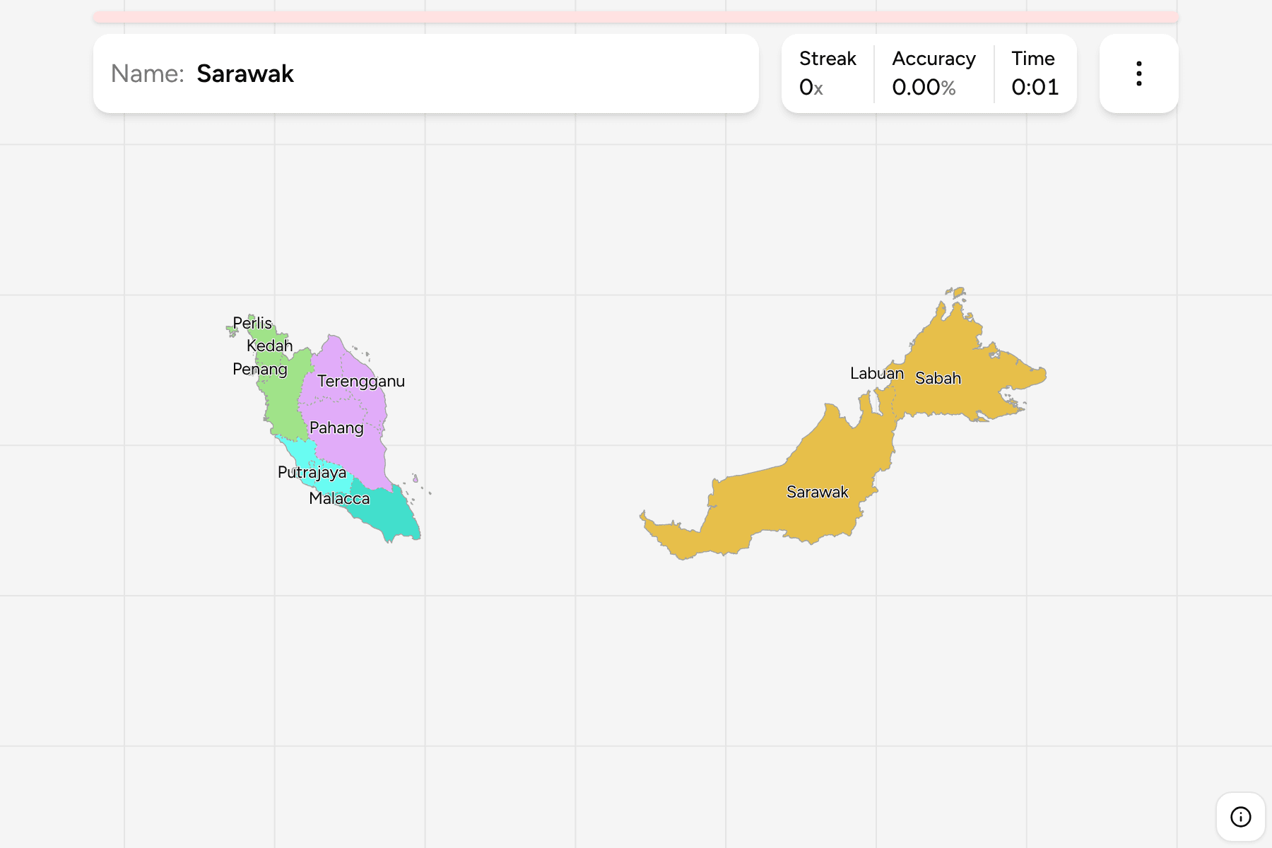
Malaysia is two landmasses under one flag, a peninsula running south from
Thailand and the northern third of Borneo, with six hundred kilometres of the
South China Sea between them. The first question about any place in the country
is which side of that water it is on, and the second is which of its sixteen
first-level divisions it belongs to.
- The quiz
- Name to place, on the map
- Grouped by
- Region: northern, central, southern, the east coast and East Malaysia
- In the game
- 16 state or federal territories
What you are looking at
Thirteen states and three federal territories. Nine of the peninsula's states
have hereditary rulers, which is why their borders are older and more irregular
than those of the two Bornean states, Sabah and Sarawak. The federal territories are administered directly by the central
government: Kuala Lumpur, the capital, Putrajaya, the administrative capital
built beside it, and Labuan, an island off the coast of Sabah.
Kuala Lumpur and Putrajaya are small and sit inside Selangor, so each has a tap
area wider than its shape. Perlis, Penang and Labuan are the other small
answers, and Penang is two pieces: the island and a strip of mainland opposite
it.
The groups are the regions the tourist board uses. The east coast is Kelantan,
Terengganu and Pahang, facing the South China Sea, and East Malaysia is Sabah,
Sarawak and Labuan. The states are the districts of
Malaysia Districts dissolved, so the borders of the two
maps match exactly.
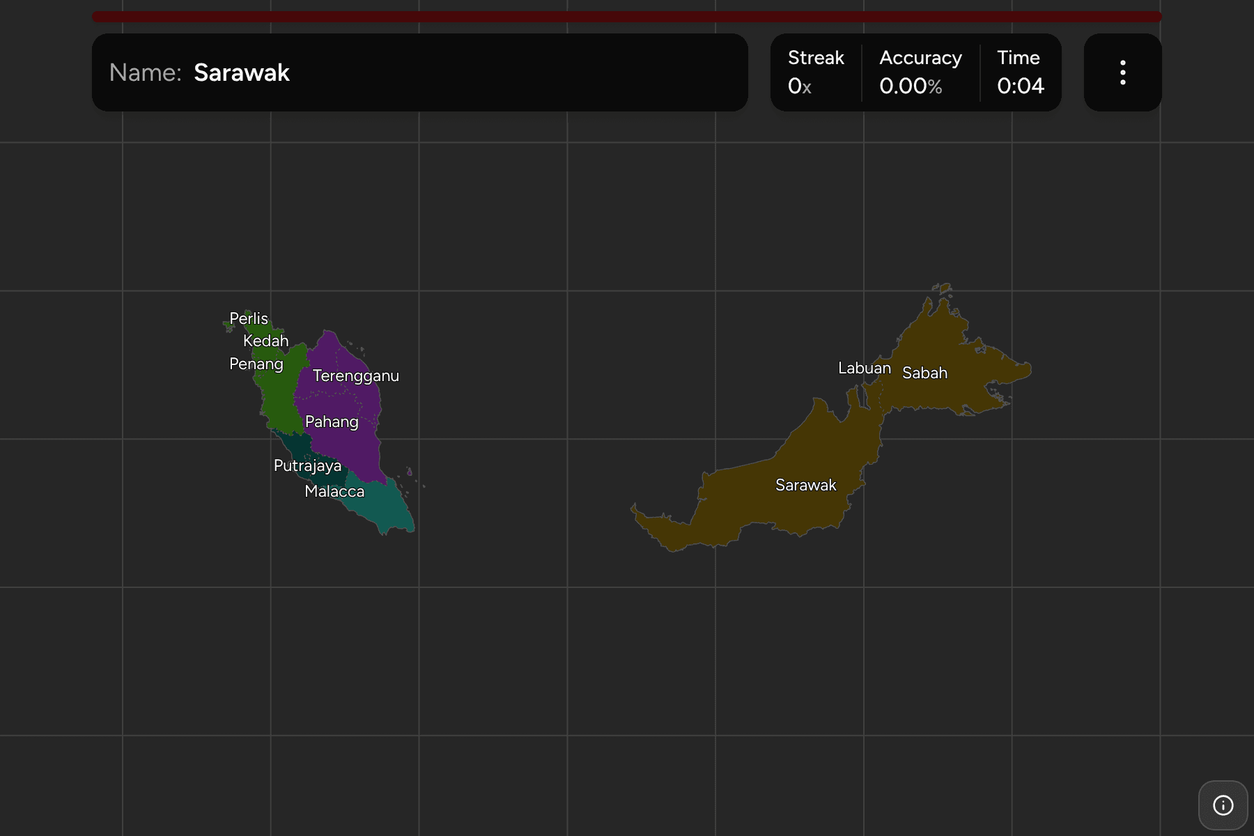
The map is drawn where the country is, so the frame is wide: the peninsula is on
the left and Borneo on the right, and the sea between them is empty.
How to place one
- Split the map in two. Everything left of the sea is the peninsula, and
Sabah, Sarawak and Labuan are everything to the right.
- Find the capital region. Kuala Lumpur is the small shape on the west coast
of the peninsula, inside Selangor, with Putrajaya just to its south.
- Learn the peninsula as a spine. Perak, Pahang and Johor are the big
states down the middle and the south, Kedah and Perlis sit at the Thai
border, and the east coast is Kelantan, Terengganu and Pahang.
- Find the small ones on the west coast. Penang, Malacca and Negeri Sembilan
are short stretches of coast between the larger states.
Every state, by region
- Northern4 state or federal territories
- Kedah, Penang, Perak, Perlis
- East Coast3 state or federal territories
- Kelantan, Pahang, Terengganu
- Central4 state or federal territories
- Kuala Lumpur, Negeri Sembilan, Putrajaya, Selangor
- East Malaysia3 state or federal territories
- Labuan, Sabah, Sarawak
- Southern2 state or federal territories
- Johor, Malacca
Worked examples
LabuanThe island off BorneoLabuan is a federal territory made of one island and a few islets in Brunei
Bay, just off the coast of Sabah. It is the smallest answer on the Bornean side
and the only one that is not part of Sabah or Sarawak.
Kuala LumpurThe capital inside another stateKuala Lumpur is not part of Selangor, although Selangor surrounds it and was
where the city began. It became a federal territory in 1974, and the state
capital moved to Shah Alam.
SarawakThe biggest oneSarawak is the largest state by a wide margin, nearly as large as the
whole peninsula, and it takes up the whole west of the Malaysian side of
Borneo.
Frequently asked questions
How many states does Malaysia have?
Thirteen states and three federal territories, sixteen first-level divisions in all. Eleven states and two of the territories are on the peninsula, and Sabah, Sarawak and Labuan are in Borneo.
What is a federal territory?
A division run by the central government rather than by a state. Kuala Lumpur, Putrajaya and Labuan are the three, and each is an answer here.
Why is the map so wide?
Because it is drawn where the country is. The peninsula and Borneo are about six hundred kilometres apart, and the frame has to hold both.
The tier below this one is Malaysia Districts, whose
states are the groups there. For another country at this level, see
Indonesia Provinces.
Sources