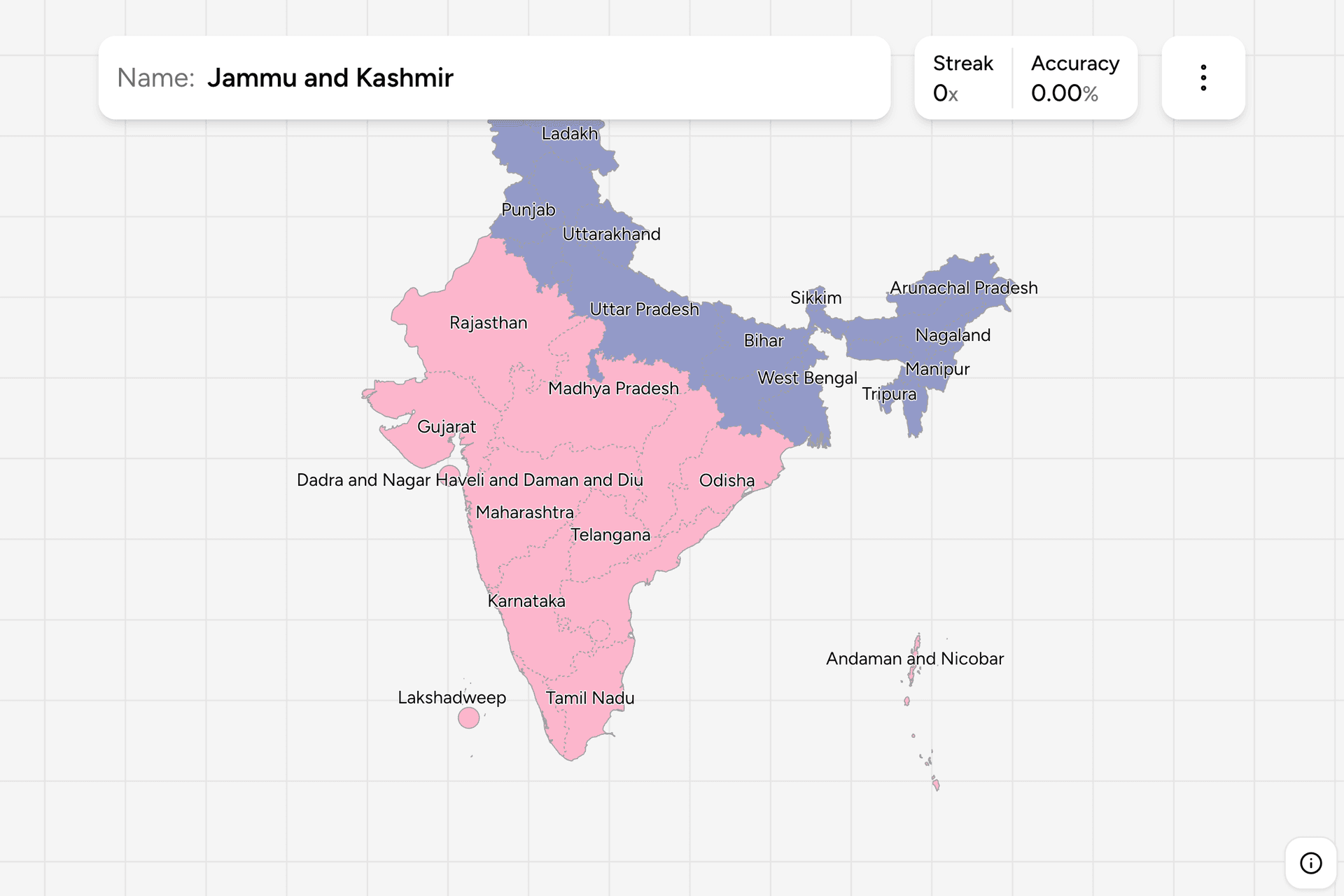
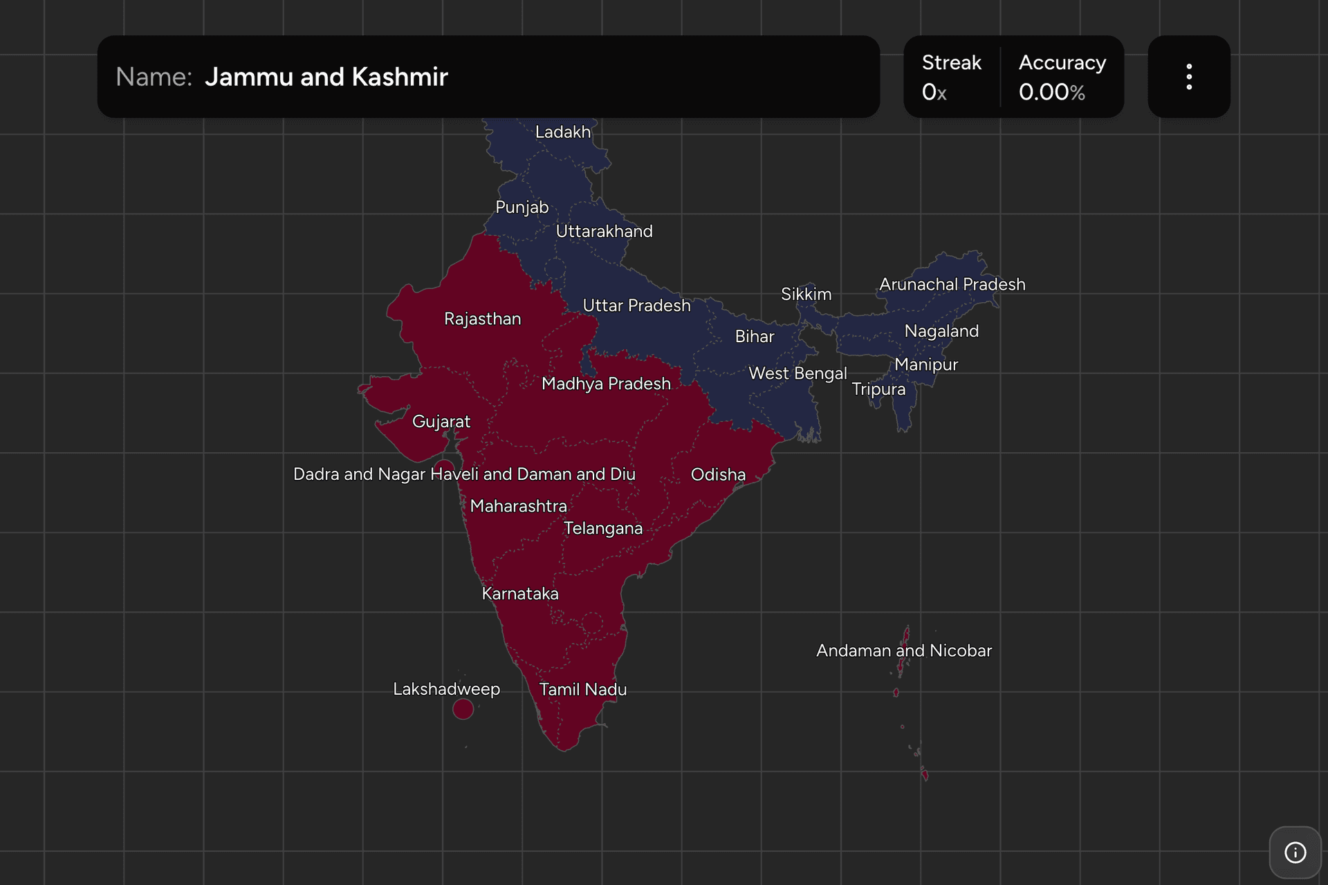
India is 28 states and 8 union territories, and the borders between them are
mostly language borders: the states were redrawn along linguistic lines in the
1950s and 60s, which is why a script on a road sign is very close to a state
name. This page is the whole map, and the game asks you to put each name where
it belongs, in the Latin alphabet or in the script the state actually writes
in.
- The quiz
- States and union territories
- Names
- Romanized or local script
- In the game
- 36 regions
What you are looking at
A state has its own elected government and its own official language or
languages. A union territory is administered from Delhi, although the larger
ones now have assemblies of their own, and they exist for reasons a map makes
obvious: they are islands (the Andamans, Lakshadweep), enclaves left over from
Portuguese and French rule (Goa was one until 1987, Puducherry and Daman still
are), the capital, or a border region under direct rule.
The list moves more than most countries'. Telangana was separated from Andhra
Pradesh in 2014. Jammu and Kashmir was reorganised in 2019, with Ladakh split
off as a territory of its own. Dadra and Nagar Haveli and Daman and Diu were
merged into one territory in 2020, which is why the name reads like a clerical
error and is not one. A map printed ten years ago is already out of date, and
this game follows the current arrangement.
The local name setting is the reason this game is worth playing twice. Turn
it on in the start dialog and each name appears in the script of its own
official language: தமிழ்நாடு for Tamil Nadu, കേരളം for Kerala, পশ্চিমবঙ্গ for
West Bengal, ਪੰਜਾਬ for Punjab. Arunachal Pradesh, Meghalaya, Mizoram and
Nagaland stay in the Latin alphabet, because that is what their official
languages are written in.
How to place one
- Start from the coast. The peninsula is the easy half. Down the west
side: Gujarat, Maharashtra, Goa, Karnataka, Kerala. Round the tip and back
up the east: Tamil Nadu, Andhra Pradesh, Odisha, West Bengal. Nine names in
one sweep, and they hem in everything else.
- Then fill the middle. Madhya Pradesh is the big one in the centre, with
Chhattisgarh east of it, Jharkhand east of that, and Telangana below.
Rajasthan is the big one in the northwest, against the Pakistani border.
- Then the north and the northeast. The Gangetic plain runs Punjab,
Haryana, Uttar Pradesh, Bihar, West Bengal from west to east, with the
Himalayan states above them. Everything beyond Bangladesh is the northeast:
Assam in the middle, with the smaller states wrapped around it.
The northeast is where rounds are lost, and it is worth a minute on its own.
Assam is the wide one along the Brahmaputra. Arunachal Pradesh is the large
one along the northern border. Meghalaya sits under Assam, Nagaland and
Manipur on the eastern edge with Nagaland above Manipur, Mizoram at the bottom
and Tripura poking into Bangladesh. Sikkim is not part of that cluster at all:
it is on the other side of Bhutan, a long way west.
The other easy points are the small ones. Delhi, Chandigarh, Puducherry, Goa
and the island territories are single clicks that people miss because they
scan for something bigger.
Every state and territory, by half of the map
- North20 regions
- Ladakh, Arunachal Pradesh, Sikkim, West Bengal, Assam, Uttarakhand, Nagaland, Manipur, Mizoram, Tripura, Meghalaya, Punjab, Himachal Pradesh, Jammu and Kashmir, Bihar, Uttar Pradesh, Jharkhand, Delhi, Chandigarh, Haryana
- South16 regions
- Rajasthan, Gujarat, Andhra Pradesh, Odisha, Maharashtra, Goa, Karnataka, Kerala, Puducherry, Tamil Nadu, Lakshadweep, Andaman and Nicobar, Madhya Pradesh, Chhattisgarh, Telangana, Dadra and Nagar Haveli and Daman and Diu
The two groups are halves of the map rather than the conventional idea of north
and south India: the split runs above Rajasthan and Madhya Pradesh, so those
two and Odisha belong to the southern group. Either half can be played on its
own from the game's start dialog, and half a map at a time is the right size
for a first pass.
Worked examples
KeralaThe narrow oneA strip of the southwest coast, between the Western Ghats and the Arabian
Sea, narrow enough that people click past it into Karnataka or Tamil Nadu.
In the local name setting it is കേരളം, in Malayalam, which is the fastest
way to recognise it from a sign.
SikkimNot in the northeastThe smallest state on the mainland, wedged between Nepal and Bhutan with West
Bengal below it. It is the one people put in the northeast cluster by mistake
even after they know where it is, because the eye groups small mountain
states together.
LadakhThe newest nameThe far north, high desert, and a union territory only since 2019, when Jammu
and Kashmir was reorganised. It is the newest name on this map and the one
most likely to be missing from a map you learned earlier.
LakshadweepWorth locating onceAn archipelago in the Arabian Sea, off the Kerala coast, and one of the
clicks this game will not let you guess your way into. Along with the Andaman
and Nicobar Islands out east, it is worth locating once deliberately rather
than hunting for it under time pressure.
Frequently asked questions
How many states does India have?
28 states and 8 union territories, which is 36 administrative units in total. States have their own elected governments; union territories are administered from Delhi, although Delhi, Puducherry and Jammu and Kashmir have assemblies of their own.
What is the difference between a state and a union territory?
A state is governed by an assembly it elects, with its own chief minister and its own official language. A union territory is administered by the central government through a lieutenant governor or administrator. Most union territories are small: islands, former colonial enclaves, the capital, or a border region held under direct rule.
Which Indian states are written in which script?
Broadly, the north and centre write Hindi or a related language in Devanagari, the south writes Tamil, Telugu, Kannada and Malayalam in scripts of their own, Bengali script covers West Bengal, Assam and Tripura, and Punjab writes Gurmukhi. The game can show every name in its own script, which is what makes a road sign readable rather than merely visible.
Which Indian states are newest?
Telangana, separated from Andhra Pradesh in 2014, is the newest state. Ladakh became a union territory in 2019 when Jammu and Kashmir was reorganised, and Dadra and Nagar Haveli and Daman and Diu were merged into a single territory in 2020. Before that came Chhattisgarh, Jharkhand and Uttarakhand, all in 2000.
Which Indian states are hardest to remember?
The northeastern ones, because there are eight of them in a small area and only Assam is large enough to be obvious. The trick is the order around Assam: Arunachal Pradesh along the northern border, Nagaland and Manipur down the eastern edge, Mizoram at the bottom, Tripura and Meghalaya to the southwest. Sikkim is not among them; it sits west of Bhutan.
More administrative maps in the region: Japan
Prefectures, Philippines
Provinces, Thailand
Provinces and Vietnam Provinces.
Sources