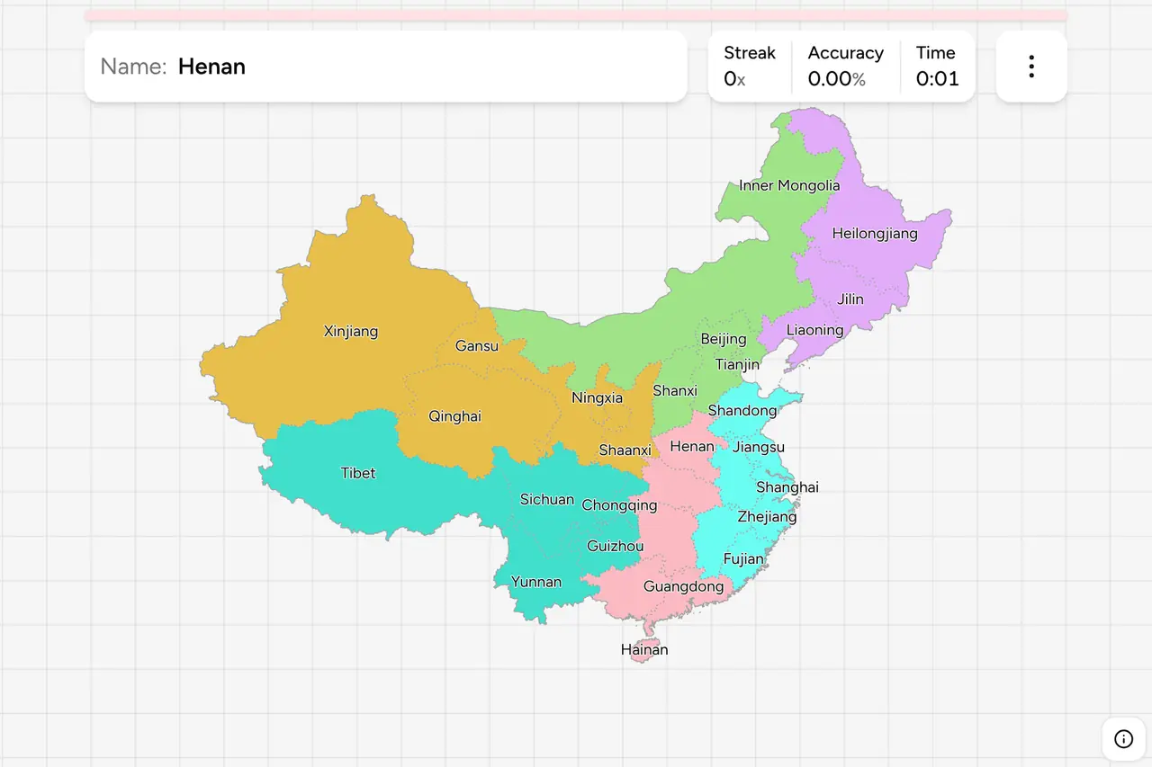
Mainland China is administered in 31 divisions at province level, and every
Chinese number plate starts by naming one of them. The first character on the
plate is the division's own one character abbreviation, and it is on the front
of every car, van and lorry on the road, so a single passing vehicle narrows a
photograph from a country of nine and a half million square kilometres to one
province. That only helps if you know where the province is. This page is the
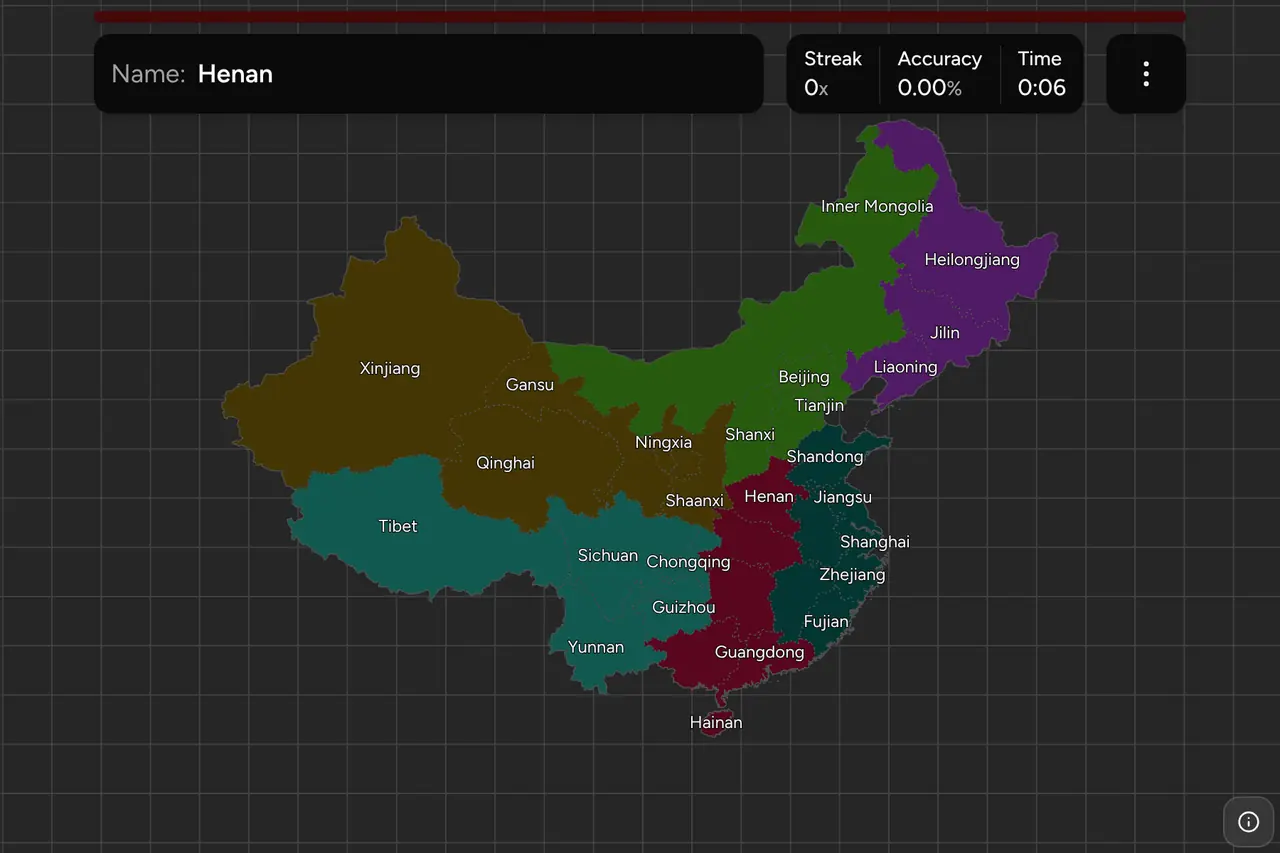
whole set, region by region, and the game asks you to put each name on the map.
- The quiz
- Name to place, on the map
- Names
- English or Chinese
- In the game
- 31 divisions
What you are looking at
Three kinds of division sit side by side on this map, all at the same level of
government. Most are provinces, 省 (shěng). Five are autonomous regions,
自治区 (zìzhìqū), each named for a minority nationality: Inner Mongolia,
Xinjiang, Tibet, Ningxia and Guangxi. Four are municipalities, 直辖市
(zhíxiáshì), cities reporting straight to the central government rather than to
a province around them. The three kinds differ in what they are called and in
some of how they are run, and in nothing you can see from the road. Hong Kong
and Macau are a fourth kind again, special administrative regions, and are not
in this game.
The abbreviations are the reason this set repays learning even if you never
touch an administrative map again. Some are simply the first character of the
name: 京 for Beijing, 云 for Yunnan, 新 for Xinjiang, 藏 for Tibet, 黑 for
Heilongjiang. Many are not, because they are the name of the ancient state that
once occupied the ground: 鲁 for Shandong, from
Lu, the state Confucius was born in. 豫 for Henan. 冀 for Hebei. 晋 for Shanxi,
from Jin. 粤 for Guangdong and 沪 for Shanghai, neither of which appears in the
modern name at all. After the character comes a Latin letter for the city
within the province, A usually being the capital, so 粤A is Guangzhou and 京A is
Beijing itself.
The names are the other half of it, and they are unusually literal. Chinese
province names are mostly directions attached to a landmark, and once you know
the landmark the pair sorts itself:
- 河北 and 河南, Hebei and Henan, are north and south of the He, the
Yellow River.
- 湖北 and 湖南, Hubei and Hunan, are north and south of the Hu, which
is Dongting Lake.
- 山东 and 山西, Shandong and Shanxi, are east and west of the
mountains, the Taihang range.
- 广东 and 广西, Guangdong and Guangxi, are the eastern and western
halves of what was once one Guang.
- 海南, Hainan, is south of the sea, and 青海, Qinghai, is named for
the blue lake sitting in it.
So 北 is north, 南 south, 东 east and 西 west, and five of the harder pairs on
this map are one character apart. The game will show either form: switch on the
local name in the start dialog and Sichuan becomes 四川省, Beijing becomes
北京市 and Tibet becomes 西藏自治区. If you are learning the names in order to
read them off a sign, the Chinese setting is the one to practise in.
One name is spelled oddly on purpose. Shaanxi and Shanxi are different
provinces whose names are both Shanxi in ordinary pinyin, separated only by
tone, so the convention is to double the a on 陕西 and leave 山西 alone. Shaanxi
is the western one with Xi'an in it; Shanxi is the eastern one against Hebei.
How to place one
- Take the empty west first. Xinjiang, Tibet, Qinghai, Inner Mongolia and
Gansu are five names covering more than half the country's area, and every
one of them has a shape you can recognise on its own: the two huge blocks in
the far west, the crescent across the whole north, and the corridor running
northwest between them. Learn those five and half the map is done in five
answers.
- Then split the paired names. Hebei and Henan, Hubei and Hunan, Shandong
and Shanxi, Guangdong and Guangxi are eight of the remaining twenty-six, and
each pair is one character of direction apart. The north one is always above
the south one and the east one always right of the west one, which sounds
too obvious to say until you meet Hubei and Hebei in the same run.
- Then run the coast, north to south. Liaoning, Hebei with Tianjin inside
it, Shandong on its peninsula, Jiangsu with Shanghai at its corner, Zhejiang,
Fujian facing Taiwan, Guangdong, Guangxi, and Hainan out on its own island.
That is a recital, and the coast is where most of the small provinces are.
- Then place the four municipalities. Beijing and Tianjin sit an hour apart
with Hebei wrapped around both, Shanghai is the speck at the mouth of the
Yangtze, and Chongqing is the odd one, a long way inland on the upper
Yangtze.
The pairs that catch people out are the ones that sound alike rather than the
ones that sit close. Hubei and Hebei are both "north of" something, and the
something is a lake in one case and a river in the other. Hunan and Henan are
the same trap upside down. Shanxi and Shaanxi are a spelling apart. Qinghai and
Hainan share the 海 that means sea and are two thousand kilometres apart.
Jilin, Jiangxi and Jiangsu begin alike and sit in the northeast, the southeast
and the east respectively.
The other thing worth knowing is that the map is heavily lopsided. The eastern
third holds most of the divisions and nearly all of the small ones, and the
western two thirds hold five. A guess in the wrong half of the country is
rarely the mistake; a guess one province along the coast is.
Every division, by region
- North China5 divisions
- Beijing, Hebei, Inner Mongolia, Shanxi, Tianjin
- Northeast China3 divisions
- Heilongjiang, Jilin, Liaoning
- East China7 divisions
- Anhui, Fujian, Jiangsu, Jiangxi, Shandong, Shanghai, Zhejiang
- Northwest China5 divisions
- Gansu, Ningxia, Qinghai, Shaanxi, Xinjiang
- Southwest China5 divisions
- Chongqing, Guizhou, Sichuan, Tibet, Yunnan
- South Central China6 divisions
- Guangdong, Guangxi, Henan, Hubei, Hainan, Hunan
Those are the six regions the country is conventionally divided into: 华北,
华东, 中南, 东北, 西南 and 西北. They carry no administrative power today, which
is worth saying out loud because they look like a tier of government. They were
one, briefly, as the greater administrative areas of the early 1950s, and they
survive in the names of railway bureaus, in weather bulletins, in sports leagues
and in the way the country is taught. Each region can be switched on and off on
its own in the game's start dialog, which makes the Northeast a three question
drill and East China a proper sitting.
Worked examples
ChongqingThe odd municipalityThree of the four municipalities are on the coast and this one is nowhere
near it. It was the eastern end of Sichuan until 1997, when it was split off
to run the resettlement of the Three Gorges Dam, which makes it the newest
province-level division on the map. Find Sichuan, look at its southeastern
corner, and the bite taken out of it is this.
ShaanxiThe doubled aThe one whose spelling exists to keep it apart from a neighbour. It is the
tall province in the middle of the country, with Xi'an and the terracotta army
at its southern end and the loess plateau over the rest of it. Its plate
character is 陕, and if you see one and cannot remember which Shanxi it is: the
doubled a is the western one.
HainanThe easy clickAn island province in the far south, tropical, and the only division on this
map you cannot get wrong by clicking a neighbour. It is also young: it was the
southern end of Guangdong until 1988. Anything in a photograph that looks like
the Caribbean and carries Chinese writing is here, and the plate says 琼.
Frequently asked questions
How many provinces does China have?
22 provinces on the mainland, which together with 5 autonomous regions and 4 municipalities makes 31 divisions at province level, and that is what this game covers. The People's Republic counts 23 provinces, the twenty-third being Taiwan, which it does not administer. Hong Kong and Macau are special administrative regions rather than provinces and are not in the game either.
What do the characters on Chinese licence plates mean?
The first character is the province, autonomous region or municipality the vehicle is registered in, written with that division's own one character abbreviation. The Latin letter after it is the city or prefecture inside it, with A usually the provincial capital. So a plate reading 粤A is Guangzhou in Guangdong and 京A is Beijing. Every plate carries it, which makes it the fastest way to place a Chinese photograph.
What is the difference between a province, an autonomous region and a municipality in China?
They sit at the same level of government and differ in what they are for. A province is the ordinary case. An autonomous region is named for a minority nationality and has some nominal powers over language and culture: Inner Mongolia, Xinjiang, Tibet, Ningxia and Guangxi. A municipality is a city governed directly by the central government instead of by a province: Beijing, Tianjin, Shanghai and Chongqing.
What is the difference between Shanxi and Shaanxi?
They are two different provinces whose names are both written Shanxi in ordinary pinyin and are told apart only by tone. The convention is to double the a on the western one, so Shaanxi is the province containing Xi'an and Shanxi is the province east of it, between the Yellow River and Hebei.
What are the six regions of China?
North China, Northeast China, East China, South Central China, Southwest China and Northwest China. They are how Chinese geography is taught and how a weather bulletin is read out, and they were a real tier of government for a few years in the early 1950s, but they are not one now: the province is the top administrative unit and the regions sit above it only in description.
Are Chinese provinces useful for GeoGuessr in China?
Yes, though China reaches GeoGuessr mostly through user photo spheres rather than official Street View coverage. Where it does appear, the plate on any vehicle names the province outright, road signs and expressway shields name it too, and the phone area code and the postcode both narrow to it. Every one of those is a lookup unless you know where the name goes, which is what this trainer drills.
More Asian administrative maps to learn: Japan
Prefectures, India States, Vietnam
Provinces and Thailand Provinces.
For the neighbours to the north and west, try Russia Federal
Subjects and Turkey Provinces.
Sources