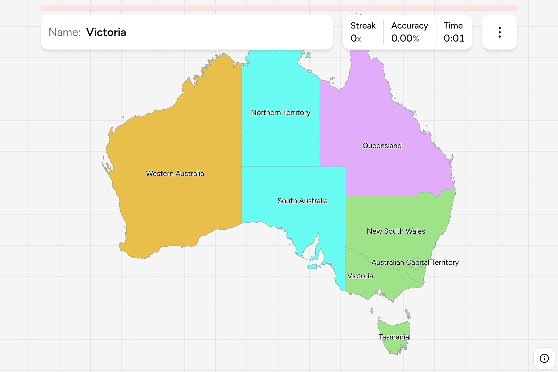
Australia is a continent cut into eight pieces, and the cut is easier to learn
than almost any other country's: three of the borders are dead straight lines of
longitude and latitude, and half the population lives in two of the eight. Every
address, every phone number and every number plate on the continent names one of
them, so a photograph almost always carries the answer somewhere in frame. This
page is the whole set, and the game asks you to put each name where it belongs.
- The quiz
- Name to place, on the map
- Best clue on the ground
- A postcode or a phone number, then the plate
- In the game
- 8 jurisdictions
What you are looking at
Six of the eight are states and two are territories, and the difference is where
the power comes from. The states were self-governing British colonies before
Australia existed: New South Wales from 1788, Tasmania split off as Van Diemen's
Land in 1825, Western Australia was founded in 1829, South Australia in 1836,
Victoria was separated from New South Wales in 1851 and Queensland in 1859. They
federated on 1 January 1901 and kept everything they had not handed to the
Commonwealth, which is why a state's powers are its own rather than Canberra's
to lend.
The two territories were carved out afterwards, both in 1911. South Australia
handed the top half of its holdings to the Commonwealth, which became the
Northern Territory, and New South Wales surrendered a patch of the Southern
Tablelands for a capital that was neither Sydney nor Melbourne, which became the
Australian Capital Territory. Both now have their own parliaments, the Northern
Territory since 1978 and the ACT since 1988, but those parliaments sit under
ordinary Commonwealth acts, and federal parliament has overridden territory law
more than once.
The borders themselves are the thing worth memorising, because most of them are
arithmetic rather than geography. The 129th meridian east is the entire western
border of the Northern Territory and South Australia, which is the long straight
line a third of the way across the continent. The 26th parallel south separates
the Northern Territory from South Australia. South Australia meets New South
Wales along 141 degrees east and Queensland along 138 degrees east. Only two
borders follow the land: the Murray River between New South Wales and Victoria,
and the rivers and ranges that carry part of the Queensland line.
Population is where the map misleads worst. Western Australia is a third of the
country by area and holds about one Australian in ten; the Northern Territory is
nearly a fifth of it and holds about one in a hundred. New South Wales and
Victoria together, which are a tenth of the land, hold well over half the people,
and nearly all of that is in the coastal strip. Street view coverage follows the
people, so the odds before you look at anything are strongly east coast.
How to place one
- Look for a postcode, because it settles the state outright. Every
Australian postcode is four digits and the first one or two name the state:
2 for New South Wales, 3 for Victoria, 4 for Queensland, 5 for South
Australia, 6 for Western Australia, 7 for Tasmania, and 08 for the Northern
Territory, which is the only one that takes two digits to read. The ACT is
the
exception that needs care, because Canberra sits in the 2600s, inside the New
South Wales range. Postcodes are printed on shopfronts, real estate boards,
council notices and the side of trucks.
- Then a phone number, which is coarser but everywhere. Australia has four
area codes and they group the states: 02 covers New South Wales and the ACT,
03 covers Victoria and Tasmania, 07 is Queensland alone, and 08 covers South
Australia, Western Australia and the Northern Territory. So a number narrows
eight answers to three at worst, and 07 settles it in one.
- Then the plate, which writes the name across it. Every state and
territory puts its own name or its abbreviation on the plate, usually with a
slogan, and the colours differ enough to read at a distance: maroon lettering
for Queensland, dark blue for Victoria, black for New South Wales and Western
Australia, and a distinctive red and ochre for the Northern Territory.
Canberra's plates name the city rather than the territory.
- Then the poles and the roadside, which work where there is nothing
written. South Australia is the giveaway here: the Stobie pole, two steel
joists with a slab of concrete between them, was invented in Adelaide in 1924
because the local timber would not last, and it is used across South Australia
and essentially nowhere else. Elsewhere the roadside is a matter of odds
rather than proof.
- Then the landscape, which is the last resort. Red soil, spinifex and
termite mounds are the Northern Territory first and the inland of Western
Australia and Queensland second. Sugarcane, tropical fruit and cyclone
shutters are the Queensland coast. Temperate rainforest, hills and cold
looking light are Tasmania. Wheat, sheep and Mediterranean scrub around a
gulf are South Australia. Anything green, cool and heavily farmed with a
sealed road grid is Victoria.
The failure modes are mostly about scale and about the two territories.
Canberra is not New South Wales even though its postcodes and its area code
say New South Wales, and it is completely surrounded by it, so the ACT has to be
placed from the map rather than from an address. Most of Western Australia
does not look like Perth: the state runs from the tropics to the Southern
Ocean and its interior is indistinguishable from South Australia's or the
Territory's. The Queensland and New South Wales border country looks the
same on both sides, which is what the plates and the postcodes are for. And
Tasmania is easy to forget entirely, which costs a whole answer on a quiz
with only eight of them.
Every state and territory, by region
- The southeast4 jurisdictions
- New South Wales, Australian Capital Territory, Victoria, Tasmania
- The northeast1 jurisdiction
- Queensland
- The centre2 jurisdictions
- South Australia, Northern Territory
- The west1 jurisdiction
- Western Australia
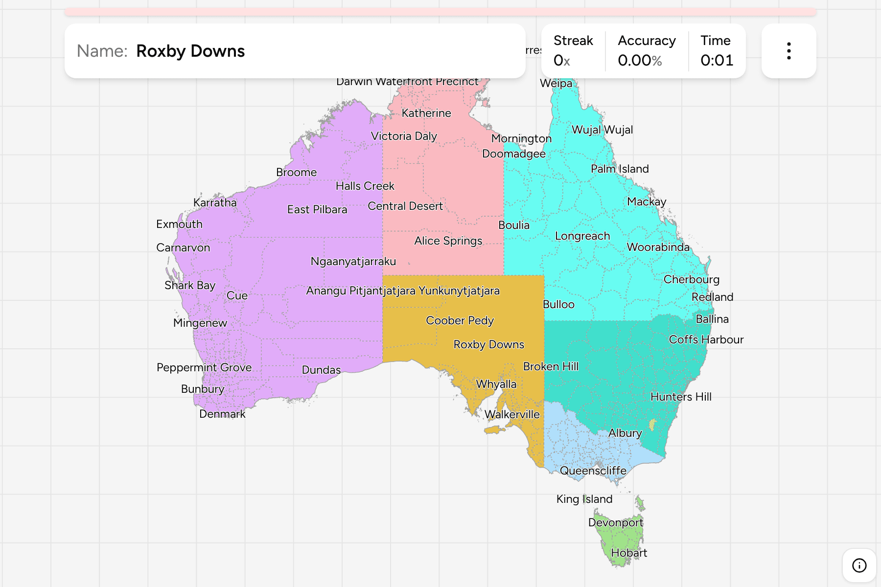
Those four groups are how the map in the game is coloured, so the bands are
visible while you play, and each can be played on its own from the start dialog.
The southeast is the one worth drilling first: it holds half the answers on the
map, the two smallest jurisdictions on the mainland, and almost all of the
country's coverage.
Worked examples
South AustraliaThe one with a pole you can nameThe Stobie pole is the cleanest single-object clue in Australia. Look for a
power pole made of two steel I-beams with a concrete slab poured between them,
grey and square rather than round and wooden. It is a South Australian
invention, it is still what the state builds with, and it barely crosses the
border in either direction. Failing that, this is the state of gulfs: two deep
inlets cut into the coast either side of Adelaide, which is a shape worth
knowing on the map as well as in a photograph.
Northern TerritoryThe one the red centre is inRed soil, spinifex, termite mounds and long unsealed roads put you here first,
but the inland of Western Australia and Queensland look much the same, so
confirm rather than assume. Two things confirm it. Postcodes start 08, so an
address here is written with a leading zero, and this is the only place in the
country where an open road is posted at 130 km/h. The
Territory is also the answer to the top of the map: it reaches the Arafura Sea
at Darwin and holds Uluru near its southern border.
Western AustraliaThe third of the country you cannot get wrong on the mapEverything west of the straight line at 129 degrees east is this one state.
There is no ambiguity about the border, and there is a great deal of state to
fill: about 2.5 million square kilometres, more than Greenland, with almost
everybody in it living in the southwestern corner around Perth. The other half
of that fact is what makes it hard on the ground rather than on the map, since
the wheatbelt and the Pilbara look like the rest of inland Australia and the
clue has to come from an address or a plate.
Australian Capital TerritoryThe one that is hard to click and easy to explainA rectangle of land the size of a large city, punched out of New South Wales
a hundred kilometres inland from the coast so that the new country's capital would
sit in neither Sydney nor Melbourne. On the ground it is Canberra and almost
nothing else: wide planned avenues, roundabouts, national institutions and
suburbs on a grid of curves. It is the smallest target in this game by a long
way, so the map gives it a slightly larger clickable area than its borders
cover.
Frequently asked questions
How many states does Australia have?
Six states and two internal territories, eight in total, which is what this game asks for. The states are New South Wales, Victoria, Queensland, South Australia, Western Australia and Tasmania; the territories are the Australian Capital Territory and the Northern Territory. Australia also administers external territories such as Norfolk Island, Christmas Island and the Cocos Islands, and a third internal one, the Jervis Bay Territory, which is 70 square kilometres on the New South Wales coast.
What is the difference between a state and a territory in Australia?
Where the authority comes from. The six states were self-governing colonies before Federation in 1901 and kept every power they did not hand to the Commonwealth, so their powers are their own. The two territories were created by the Commonwealth and govern themselves under ordinary federal law, which federal parliament can override. In daily life the difference is small, and both territories have had their own elected parliaments for decades.
What is the capital of Australia?
Canberra, which is in the Australian Capital Territory rather than in any state. It was built for the purpose after Federation, on land New South Wales surrendered in 1911, because Sydney and Melbourne could not agree that the other should have it. Sydney is the largest city in the country and Melbourne the second, and neither is the capital.
What is the largest state in Australia?
Western Australia, at about 2.53 million square kilometres, which is roughly a third of the continent and about four and a half times the size of France. Queensland is second at about 1.73 million and the Northern Territory third at about 1.35 million. The smallest state is Tasmania at about 68,000 square kilometres, and the smallest jurisdiction of all is the Australian Capital Territory at about 2,400.
Which Australian state has the most people?
New South Wales, with around eight million, followed by Victoria with around seven million and Queensland with around five and a half. Those three hold about four Australians in five. At the other end the Northern Territory has around 250,000 people, fewer than a single outer suburb of Sydney, spread over a fifth of the continent.
How can you tell which Australian state a photo is in?
Look for a postcode first, because the leading digit names the state: 2 New South Wales, 3 Victoria, 4 Queensland, 5 South Australia, 6 Western Australia, 7 Tasmania and 08 the Northern Territory, with Canberra an exception inside the 2600s. A phone number narrows it almost as fast, since 02 is New South Wales and the ACT, 03 is Victoria and Tasmania, 07 is Queensland and 08 is the three western and central jurisdictions. Number plates carry the name outright. Failing all of those, a Stobie pole means South Australia.
Why is the Northern Territory not a state?
It has never had the population to press the case successfully. The land was South Australia's until 1911, when it was handed to the Commonwealth, and it has governed itself since 1978. A referendum on becoming a state was held in 1998 and was defeated, largely over the proposed terms rather than the principle, and statehood has been revisited several times since without a vote. Its roughly 250,000 people would make it much the smallest state.
Why are Australia's state borders straight lines?
Because they were drawn in London and Adelaide before anyone had seen the country they crossed. The 129th meridian east, which is the western border of the Northern Territory and South Australia, and the 26th parallel south between those two, were surveyed onto a map rather than found on the ground. The exceptions are in the southeast, where the Murray River separates New South Wales from Victoria and rivers and ranges carry part of the Queensland line, and that is also the part of the country the colonies actually occupied at the time.
Does all of Australia use the same time zone?
No, there are three, and daylight saving splits them further. Eastern time covers Queensland, New South Wales, the ACT, Victoria and Tasmania; central time, half an hour behind, covers South Australia and the Northern Territory; western time, another hour and a half behind, covers Western Australia. Queensland, the Northern Territory and Western Australia do not observe daylight saving, so for part of the year the country runs on five different clocks.
More administrative maps in the same shape: Canada
Provinces, which is the other federation of a near empty
continent, Argentina Provinces, South Africa
Provinces and India States. If you
would rather learn a country by its phone numbers, US Dialing
Codes and Canada Dialing Codes ask
the same question a different way.
Sources