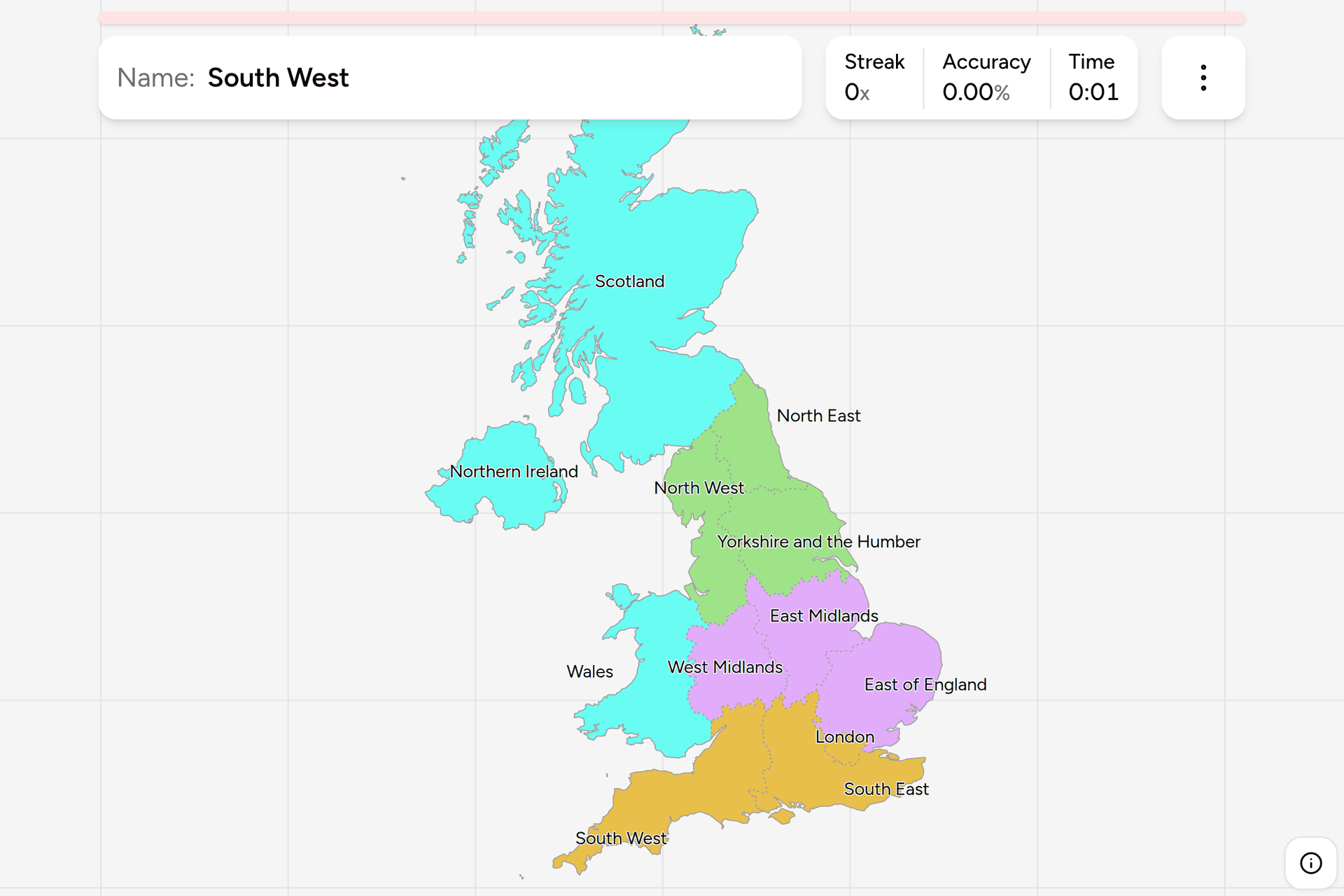
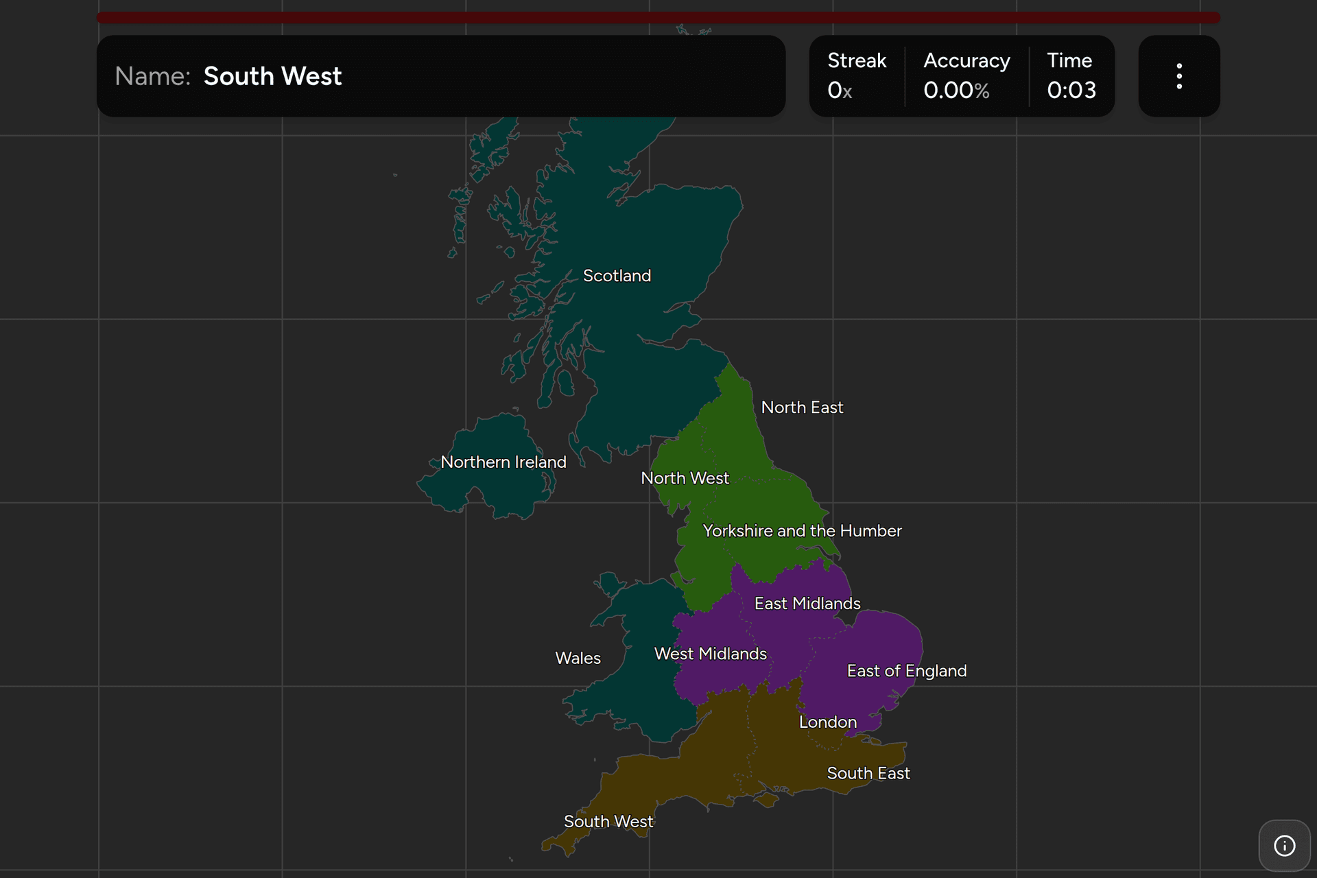
The United Kingdom is four countries that share a road network, and the tier
everything about it is counted in is the twelve you see here: England's nine
regions, plus Scotland, Wales and Northern Ireland. Three of the twelve announce
themselves on every sign they own, and the other nine have to be read off brick,
stone, hills and a number plate. This page is the twelve, the groups worth
learning them in, and what puts you inside one from a photograph.
- The quiz
- Name to place, on the map
- Where it helps
- Sign language, road numbers, plate memory tags, building stone
- In the game
- 12 regions
What you are looking at
The United Kingdom has no single administrative map. It has four countries, and
each of them is divided differently underneath: England into regions, counties
and districts, Scotland into 32 council areas, Wales into 22 principal areas and
Northern Ireland into 11 districts. The twelve here are the one layer that covers
all four and means the same thing everywhere, which is why every national figure
is published in them.
England's nine are statistical regions with almost no government of their
own. They were drawn as government office regions in 1994, briefly had
assemblies proposed for them, and today the boundaries are what the census, the
labour market survey, the house price index and the weather forecast are all
broken down by. London is the exception with a mayor and an assembly; the other
eight have no single body over them at all. That does not make them arbitrary.
Every one of them is built out of whole counties, and they follow the lines
anybody in the country would draw anyway.
The other three are countries with parliaments. Scotland, Wales and Northern
Ireland each have a devolved legislature with real powers over transport,
health, education and, crucially for anybody reading a photograph, road signs
and speed limits. This is why the border between England and Wales is the
sharpest administrative line in the country to spot and the border between the
North West and the West Midlands is nearly impossible.
The acronyms move and the map does not. These twelve were the UK's NUTS 1
regions while it was in the EU, and are now called ITL 1, for International
Territorial Levels. The codes changed from UKC through UKN to TLC through TLN.
The boundaries did not change at all, so an older map labelled NUTS 1 is the same
map.
How to place one
- Read the language on the sign, because it settles a third of the map in one
look. Every road sign in Wales is bilingual, Welsh and English, by law, and
plenty of the road markings are too: "Araf" painted on the tarmac is Welsh for
slow. Wales also runs a 20mph default in built-up areas, which no other part
of the UK does, so a 20 sign on an ordinary residential street is a strong
second vote. In Scotland, Gaelic appears beside English on signs across the
Highlands and Islands and on the trunk roads north and west of the central
belt, though not usually in the south or east.
- Then look at Northern Ireland's own tells, which are unlike anywhere else in
the UK. Its number plates are the old three letter, four digit style rather
than the mainland's AA00 AAA, and every Northern Irish combination contains an
I or a Z. The province has a road numbering scheme of its own that reuses
numbers Great Britain also has, and the road furniture, the signage details
and the field boundaries all read closer to Ireland than to England, which is
the point: if you are unsure whether you are in Northern Ireland or the
Republic, the distances are the answer, because the North is in miles and the
Republic is in kilometres.
- Then take the road number. Great Britain's A roads are numbered in zones
that fan out clockwise, one to six from London and seven to nine from
Edinburgh, and a road keeps the number of the zone it starts in. So an A
road beginning with a 7, an 8 or a 9, and a motorway numbered in the 70s, 80s
or 90s, is Scotland. An A1 or A6 is the eastern and northern side of England,
an A3 or A4 the south and west. It is a coarse instrument and it is free.
- Then read the memory tag on a number plate. A current British plate is
AA00 AAA, and the first two letters say which DVLA office issued it, which in
practice says where the car was sold. S is Scotland and C is Cymru, which
between them cover two of the twelve. In England, B is Birmingham and the West
Midlands, L is London, M is Manchester and Merseyside, Y is Yorkshire, N is
the north east, P is Preston and the north west, A is East Anglia, E is Essex,
G is Kent and Sussex, H is Hampshire and Dorset, and W is the west of England.
It is where the car was registered rather than where it is, so treat a single
plate as a hint and three plates agreeing as an answer.
- Then read what the buildings are made of, which is the only clue that works
everywhere in England. The Midlands, the North West and much of the south
east are red brick. The Cotswolds, in the South West, are honey limestone, and
so is the stone belt that runs up through the East Midlands into Lincolnshire.
The Pennine towns of Yorkshire and the north are dark gritstone with stone
roofs and drystone walls instead of hedges. East Anglia has flint, pargeting
and pantiles, and almost no stone of its own. Cornwall and Aberdeen are
granite. Scotland's tenements are sandstone, red in Glasgow and blond in
Edinburgh.
- Then narrow inside the group. The four groups below are the ones this game
offers as filters, and each is small enough to work through one at a time.
The traps are mostly about where the lines actually fall.
Yorkshire and the Humber is not Yorkshire. It takes in North and North East
Lincolnshire on the south bank of the Humber, which nobody in Lincolnshire calls
Yorkshire, and it leaves out the part of the old West Riding around Saddleworth
that is now in the North West. Lincolnshire proper, the county, is East Midlands.
The East of England reaches further south and west than it sounds. It is
Norfolk, Suffolk, Cambridgeshire, Essex, Hertfordshire, Bedfordshire and
Peterborough, so it comes right down to the edge of London and it includes places
most people file under the home counties.
The South East wraps around London on three sides and reaches from Milton
Keynes in the north to the Isle of Wight in the south, taking in Oxford, Reading,
Brighton, Dover and Southampton. It is the most populous region in the country
after London and the hardest one to picture as a shape.
The North East is small. It is Northumberland, Tyne and Wear, County Durham
and Teesside and nothing else; Cumbria, on the other side of the Pennines, is
North West. Carlisle is 90 miles from Newcastle and in a different region.
Every region, by group
- Northern England3 regions
- North East, North West, Yorkshire and the Humber
- Midlands and East3 regions
- East Midlands, East of England, West Midlands
- Scotland, Wales and Northern Ireland3 regions
- Northern Ireland, Scotland, Wales
- Southern England3 regions
- London, South East, South West
Those four groups are this game's own cut, and they are not an official
tier. The United Kingdom publishes exactly one grouping above these twelve, the
four countries, and it is useless as a filter here because three of the four
would hold a single region each. So England is split into the three bands it is
described in anyway, and the three countries that are not England make up the
fourth group. Each one can be switched on and off on its own in the game's start
dialog.
Northern England is the three regions above the Trent and the Mersey: the
North East, the North West and Yorkshire and the Humber. Midlands and East
is the belt across the middle, the two Midlands regions plus the East of England.
Southern England is London, the South East around it and the South West
running out to Land's End. Scotland, Wales and Northern Ireland is the rest
of the country, and it is three quarters of the land area with a sixth of the
people on it.
Worked examples
WalesThe one the signs tell youWales is the easiest answer on this map and it is worth knowing why, because the
same trick does not work anywhere else in Britain. Welsh is an official language
of Wales and every road sign carries both languages, usually with Welsh on top.
You do not have to read it: two lines of text where England would have one is
the whole clue. Confirm it with a plate beginning with C, for Cymru, or with a
20mph limit on a street that would be 30 anywhere else in the UK. The trap is
the border, which runs through farmland with no natural feature for most of its
length, so a bilingual sign is the only thing separating Monmouthshire from
Gloucestershire.
LondonThe small one everybody overshootsLondon is the smallest target in the game by a factor of forty, and it stops
well short of where most people think it does. The boundary is Greater London,
the 32 boroughs and the City, drawn in 1965: Watford, Dartford, Epsom,
Slough and the whole of the M25's outer side are not in it. Inside, the giveaway
is the transport system rather than the buildings. Red buses with route numbers,
the roundel on a station, red double yellow lines becoming red routes on main
roads, black cabs, and the only place in the country where a bus stop flag looks
like that. Anything more than about 20 miles from the centre is the South East
or the East of England instead.
East MidlandsThe one nobody can placeThe East Midlands is Derbyshire, Nottinghamshire, Leicestershire,
Northamptonshire, Rutland and Lincolnshire, and it is the region that loses the
most guesses on this map because it has no edge that announces itself. It is
bounded by the Peak District at the top left, the Wash at the bottom right and
farmland in between. Place it by elimination. If you are on flat arable land
east of the M1 and north of Cambridgeshire, with limestone or red brick villages
and a church spire on every horizon, you are in it. If the ground starts to rise
into gritstone and drystone walls, you have crossed into either Yorkshire or the
Peak, and the Peak is still East Midlands as far as Derbyshire goes.
Frequently asked questions
How many regions does the UK have?
Twelve at the top statistical level: the nine regions of England, plus Scotland, Wales and Northern Ireland. England's nine are the North East, the North West, Yorkshire and the Humber, the East Midlands, the West Midlands, the East of England, London, the South East and the South West. Scotland, Wales and Northern Ireland are countries rather than regions, which is why the tier is usually called nations and regions rather than just regions.
What are the nine regions of England?
The North East, the North West, Yorkshire and the Humber, the East Midlands, the West Midlands, the East of England, London, the South East and the South West. They were set up as government office regions in 1994 and are now the standard geography for English statistics. Only London has a government of its own, with an elected mayor and an assembly. The other eight are statistical and administrative rather than political, and every one of them is made up of whole ceremonial counties.
What is the difference between a country and a region in the UK?
England, Scotland, Wales and Northern Ireland are the four countries of the United Kingdom. Scotland, Wales and Northern Ireland each have a devolved parliament or assembly with power over things like health, education, transport and road signs; England has none and is governed directly by the UK Parliament. The nine English regions sit below that level and have no legislature at all. So the twelve in this quiz mix two kinds of thing, which is exactly how the UK counts itself.
What are ITL regions, and what happened to NUTS?
ITL stands for International Territorial Levels, the UK's own replacement for the EU's NUTS classification after Brexit. ITL 1 is these twelve nations and regions, ITL 2 divides them further into around 40 areas, and ITL 3 further again. The boundaries were carried over unchanged from NUTS, so the only thing that really changed was the codes: UKC to UKN became TLC to TLN. A map labelled NUTS 1 for the UK is the same map as one labelled ITL 1.
Is Yorkshire a region of England?
Not exactly. The region is called Yorkshire and the Humber, and it is not the same as the historic county of Yorkshire. It includes North and North East Lincolnshire on the south bank of the Humber, which were never in Yorkshire, and it excludes parts of the old West Riding that are now in the North West, including Saddleworth. The historic county survives as four ceremonial counties: North, South and West Yorkshire and the East Riding.
Which UK region is London in?
London is a region in its own right, and the only English region with its own elected government. It covers Greater London, which is the 32 London boroughs plus the City of London, and the boundary has been in its current shape since 1965. It is the smallest of the twelve by area by a very wide margin and the most populous of the nine English regions. Places just outside it, like Watford, Dartford and Slough, are in the East of England or the South East.
How can you tell which part of the UK a photo is in?
Start with the language on the signs: bilingual Welsh and English means Wales, and Gaelic beside English means the Scottish Highlands and Islands. Northern Ireland uses old style three letter number plates that always contain an I or a Z. In Great Britain, the first two letters of a modern number plate are a regional memory tag, with S for Scotland, C for Wales, B for Birmingham, L for London, M for Manchester and Y for Yorkshire. A roads numbered in the 7, 8 and 9 zones are Scottish. After that it comes down to building materials and landscape: red brick in the Midlands, limestone in the Cotswolds, gritstone and drystone walls in the Pennines, flint in East Anglia, granite in Cornwall and Aberdeen.
Which is the largest UK region, and which the smallest?
Scotland is much the largest by area, at roughly a third of the United Kingdom, followed by Wales and then the South West of England. London is the smallest by a long way: it is about a fiftieth the size of Scotland and smaller than several English counties. By population the order is almost reversed, with the South East the most populous of the twelve and Northern Ireland the least.
For other European administrative maps at this level, try France
Regions, Italy Regions, Germany
States and Poland Voivodeships. If you
want the harder version of the same problem, France
Departments and Germany Districts
are the tier below in their own countries.
Sources
- Regions of England, the nine, how they were drawn, and what is left of the government office era
- ITL and NUTS statistical regions of the UK, the twelve top-level territorial units, and the codes that replaced the NUTS ones
- Great Britain road numbering scheme, the zones that make a road number worth reading
- Vehicle registration plates of the United Kingdom, the memory tags, and why Northern Irish plates look nothing like the rest
- Welsh language road signs, why every sign in Wales is bilingual
- Natural Earth, the local authority boundaries this game's map is dissolved from