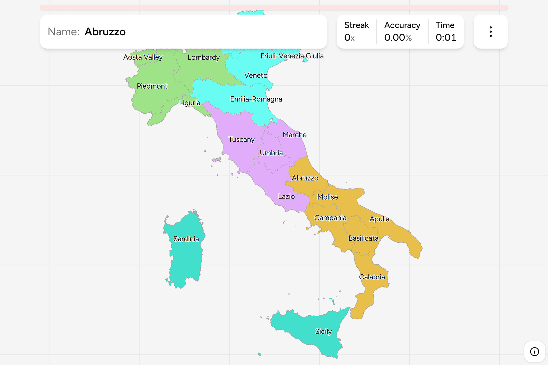
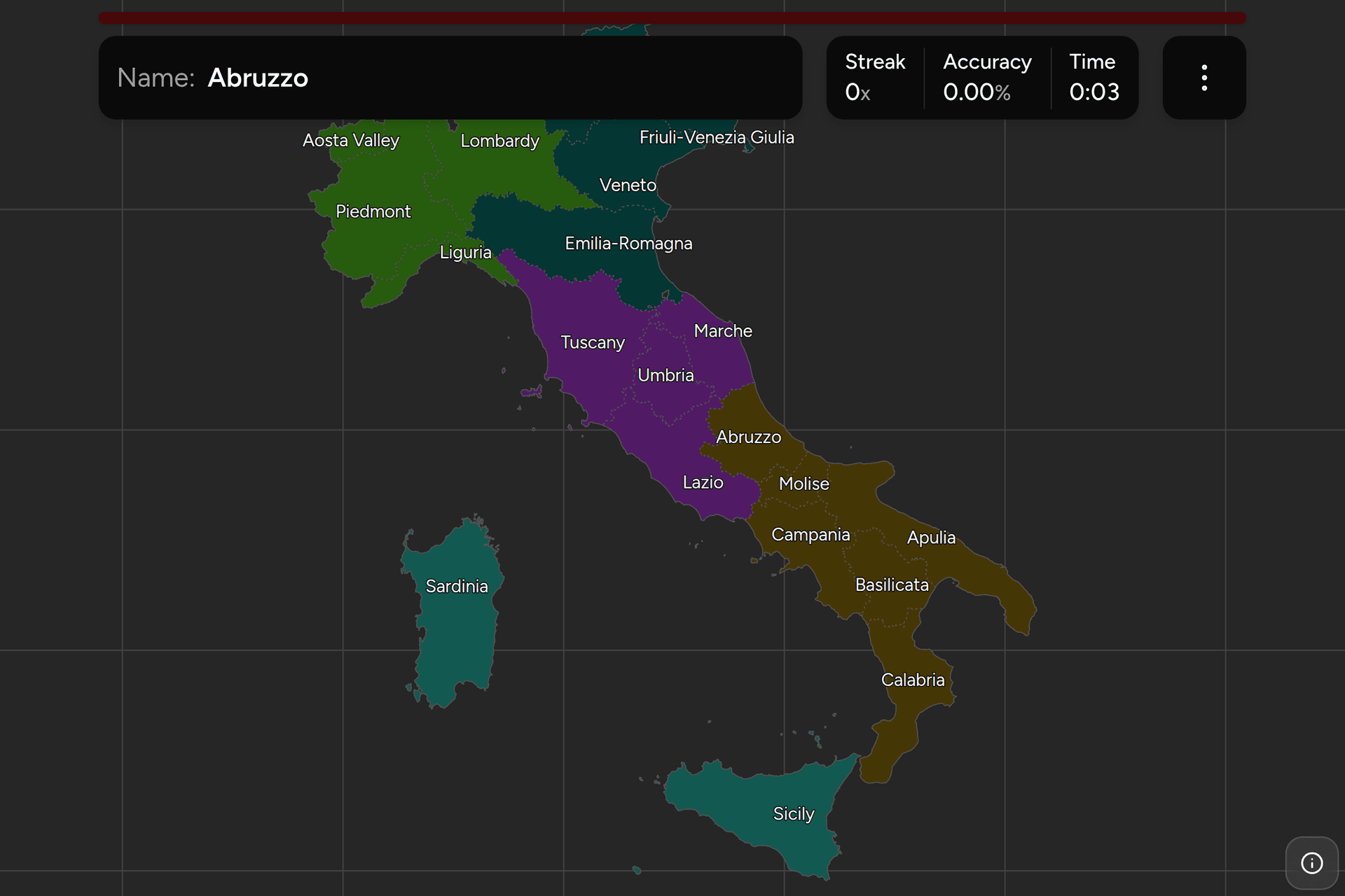
Italy is one of the easiest countries in the world to recognise and one of the
harder ones to pin, because almost everything that identifies it identifies the
whole of it. The regions are the tier that actually differs from place to place:
they run the roads, the hospitals and the local railways, five of them have a
second official language, and every one of them signs its own border. This page
is the twenty of them, the groups worth learning them in, and what puts you
inside one from a photograph.
- The quiz
- Name to place, on the map
- Where it helps
- Plate province codes, bilingual signs, road numbering, landscape
- In the game
- 20 regions
What you are looking at
Italy has been divided into twenty regions since the 1948 constitution, though
fifteen of them sat on paper until 1970, when the ordinary-statute regions
finally elected councils and took over powers the state had been running from
Rome. The other five were given their statutes immediately, between 1946 and
1963, and for a reason: each had a language, an island or a border problem that
the new republic did not want to argue about. Those five are Sicily, Sardinia,
Valle d'Aosta, Trentino-Alto Adige and Friuli-Venezia Giulia, and between them
they are why an Italian road sign is sometimes not in Italian.
Below a region sit the provinces and metropolitan cities, which is the tier a
number plate encodes, and below those the comuni, of which there are about eight
thousand. A region is the largest unit under the state and much the most
powerful: health, local transport, most planning and a large share of the roads
are regional, which is why the name and the coat of arms turn up on so much
roadside furniture.
Several of the names are two places joined with a hyphen, and that is the
useful part. Emilia-Romagna is the Via Emilia's plain plus the Byzantine
exarchate around Ravenna, Trentino-Alto Adige is an Italian-speaking valley
joined to a German-speaking one, and Friuli-Venezia Giulia is the Friulian
countryside joined to the strip Italy kept around Trieste. Where a region is
named for two halves, the halves are genuinely different on the ground, and
telling which half you are in is usually easier than naming the region.
Two of the names have moved. Calabria meant the Salento in antiquity, which
is the heel and is now the far end of Apulia, and it slid across the gulf to the
toe in the Byzantine period. Marche is not a place name at all: it is the plural
of "march", the frontier counties of the Holy Roman Empire, which is also why
nothing in it is called Marche.
How to place one
- Read the language on the sign first, because three regions give themselves
away. German beside Italian, on everything, is Alto Adige, the northern
half of Trentino-Alto Adige. French beside Italian is Valle d'Aosta. Slovene
beside Italian, around Trieste and Gorizia, is Friuli-Venezia Giulia, which
also signs in Friulian further inland. In the Ladin valleys you get three
languages on one sign. None of these happens anywhere else in the country.
- Then take the province code off a plate. An Italian plate is black on
white in the format AA 000 AA, with a blue band at each end. The right-hand
band carries two letters and a year, and those two letters are the province:
RM for Rome, MI for Milan, NA for Naples, TO for Turin, BO for Bologna, BA
for Bari, PA for Palermo, CA for Cagliari. It narrows you a long way and it
does not answer the question, because there are five times as many provinces
as regions and you still have to know which region holds which. Plates issued
between 1994 and 1999 carry no code at all, and a fair number of those are
still on the road.
- Then read the road number. A green sign is an autostrada and numbered A.
A blue one is out of town, and the prefix says who owns it: SS is a strada
statale and belongs to the state, SR is regionale and SP provinciale. The
handover that created most of the SR and SP numbers happened around 2001,
when thousands of kilometres of former SS were given to the regions, so a
road signed SR is a road a region is paying for.
- Then read the land. Italy is four bands and two islands. The Alps close
the north. Below them the Po plain is flat, hazy, poplar-lined and industrial,
with rice and maize on it and almost no relief for two hundred kilometres. The
Apennines run the length of the peninsula and decide which sea you are on. And
from roughly Naples south the Mezzogiorno is drier, barer and more limestone,
with olives, prickly pear and hill towns built for defence.
- Then narrow inside the group. The five groups below are ISTAT's and are
small enough to work through one at a time.
The traps are almost all cities.
A famous city is not a region, and the region is often not the one you would
guess. Venice is Veneto, Milan is Lombardy, Florence is Tuscany, Naples is
Campania, Turin is Piedmont, Genoa is Liguria and Bologna is Emilia-Romagna,
which are the easy ones. Rimini is Emilia-Romagna and not Marche. Matera and its
cave dwellings are Basilicata and not Apulia, which is the single most common
mistake on this map. Assisi is Umbria. Pompeii and the Amalfi coast are
Campania. The Cinque Terre are Liguria. Alberobello and its trulli are Apulia.
Lake Garda is three regions at once. The western shore is Lombardy, the
eastern is Veneto and the northern tip is Trentino-Alto Adige, so a photograph
of the lake settles nothing on its own.
Two states inside Italy are in no region. San Marino sits inside
Emilia-Romagna's border with Marche and the Vatican inside Rome, and neither is
Italian territory, so neither is an answer here.
Every region, by group
- North West4 regions
- Piedmont (Piemonte), Aosta Valley (Valle d'Aosta), Lombardy (Lombardia), Liguria
- Centre4 regions
- Tuscany (Toscana), Umbria, Marche, Lazio
- North East4 regions
- Trentino-Alto Adige, Veneto, Friuli-Venezia Giulia, Emilia-Romagna
- South6 regions
- Abruzzo, Molise, Campania, Apulia (Puglia), Basilicata, Calabria
- Islands2 regions
- Sicily (Sicilia), Sardinia (Sardegna)
Those five groups are Italy's own. They are the ripartizioni geografiche,
the cut ISTAT publishes every national figure in and the one a news bulletin
means by "il Nord" or "il Sud". Eurostat carries the same five as Italy's
top-level statistical regions, which is the reason this game can check its
grouping against a published map rather than against somebody's memory. Each one
can be switched on and off on its own in the game's start dialog.
North West is Piedmont and the Alpine corner beside it, plus Lombardy and
the Ligurian coast: the industrial triangle, the richest part of the country and
the most populous of the five. Centre is the four regions either side of the
Apennines from Tuscany down to Rome. North East is the Veneto plain, the
mountains above it and the Via Emilia running southeast to the Adriatic.
South is six regions and the whole peninsula below Rome. Islands is
Sicily and Sardinia, which between them are a sixth of the country and have
special statutes, their own languages and, in Sardinia's case, very little in
common with anywhere else on this map.
Worked examples
Trentino-Alto AdigeThe one that answers itselfTrentino-Alto Adige: two valleys stapled together, Italian-speaking Trentino in
the south and German-speaking Alto Adige, or Südtirol, in the north. It was
Austrian until 1919 and the northern half never stopped being German, so every
sign, every shop front and every place name up there comes in both languages.
If you are looking at an Italian road sign with German on it, there is nowhere
else in the country you can be. The architecture finishes the job: onion domes,
steep roofs, painted facades and apple orchards on terraces up the valley
sides.
ApuliaThe heel, and the one whose name movedApulia, or Puglia: the flattest and one of the driest parts of Italy, running
from the Gargano promontory down the Adriatic to the tip of the heel. Look for
olive groves that go to the horizon, dry stone walls, whitewashed towns and
reddish soil, with no mountains anywhere except the Gargano itself. The trap is
Basilicata, which is wedged into the instep and gets credited with Apulian
things constantly, Matera above all. The rule of thumb is relief: if the ground
is flat and the sea is on your left going south, you are in Apulia.
MoliseThe one nobody can placeMolise: the smallest region on the mainland, split off from Abruzzo as recently
as 1963, with two provinces, no famous city and a national joke about whether
it exists at all. It is the ankle of the boot, between Abruzzo and Apulia on
the Adriatic side, and it looks like both of them: Apennine hill country
inland, a short flat coast, hill towns and a lot of sheep pasture. Nothing in a
photograph will say Molise, so place it by elimination. If you are on the
Adriatic south of Abruzzo and well north of the Gargano, this is what is there.
Frequently asked questions
How many regions does Italy have?
20. Fifteen have an ordinary statute and five a special one: Sicily, Sardinia, Valle d'Aosta, Trentino-Alto Adige and Friuli-Venezia Giulia. The regions were created by the 1948 constitution, but only the five special ones were set up straight away; the other fifteen existed only on paper until the first regional elections in 1970. Below the regions are the provinces and metropolitan cities, and below those about eight thousand comuni.
Which Italian regions are autonomous, and why?
Sicily, Sardinia, Valle d'Aosta, Trentino-Alto Adige and Friuli-Venezia Giulia. Each was given a special statute for a reason of language, geography or border. Sicily had an active separatist movement in 1946 and got the first statute of all. Sardinia is an island with its own language. Valle d'Aosta is French speaking. Trentino-Alto Adige was Austrian until 1919 and its northern half is German speaking, which was the subject of a treaty with Austria. Friuli-Venezia Giulia sat on a disputed border with Yugoslavia and was the last of the five, in 1963. A special statute means more legislative power and, in most cases, a much larger share of the taxes raised locally.
Do Italian number plates show the region?
No, they show the province, which is the tier below. A current plate is black on white in the format AA 000 AA, with a blue EU band on the left and a second blue band on the right carrying two letters and a year. Those two letters are the province code: RM for Rome, MI for Milan, FI for Florence, BZ for Bolzano. Since there are more than a hundred provinces and only twenty regions, the code narrows you considerably but you still need to know which region the province sits in. Plates issued between 1994 and 1999 have no code on them at all.
What languages appear on Italian road signs?
Italian everywhere, and a second language in three regions. German appears beside Italian throughout the province of Bolzano, in Trentino-Alto Adige. French appears beside Italian in Valle d'Aosta. Slovene appears beside Italian around Trieste and Gorizia in Friuli-Venezia Giulia, which also signs in Friulian in the province of Udine. Ladin appears as a third language in a handful of Dolomite valleys, and Sardinian and other minority languages turn up on local signs elsewhere. Bilingual signage is the strongest single regional clue in Italy, because it happens in only a few places and it happens on everything.
What is the difference between an Italian region and a province?
A region is one of the twenty top-level divisions, with an elected council, a president and real legislative power over health, transport, planning and much of the road network. A province is the tier below, of which there are more than a hundred, including the metropolitan cities that replaced the provinces around the largest urban areas in 2015. Provinces have far less power than they used to and were nearly abolished in a referendum that failed in 2016. For anybody reading clues off a photograph the practical difference is that plates and older road signs encode provinces, while boundary signs, road ownership and public services show regions.
What are the five macro-regions of Italy?
Nord-Ovest, Nord-Est, Centro, Sud and Isole, which translate as North West, North East, Centre, South and Islands. They are ISTAT's ripartizioni geografiche, the standard grouping every Italian national statistic is broken down by, and Eurostat uses the same five as Italy's top-level statistical regions. They carry no administrative power of their own: there is no government between a region and the state. They are how Italians talk about the country, though, and the South in particular is more often called the Mezzogiorno.
Which Italian regions are easiest to confuse?
Apulia and Basilicata, because Basilicata is wedged into the instep of the boot and Matera, its best known place, is usually assumed to be Apulian. Marche, Umbria and Abruzzo, which are three medium sized regions stacked in the middle of the peninsula with no famous city between them. Molise and Abruzzo, since Molise was part of Abruzzo until 1963 and still looks like it. And Emilia-Romagna against Marche on the Adriatic, where Rimini is in the former and the border is further south than most people expect.
Which is the largest region of Italy, and which the smallest?
Sicily is the largest by area, a little ahead of Piedmont and Sardinia. The smallest is Valle d'Aosta, which is a single Alpine valley system with its tributaries and is about a hundredth the size of Sicily. By population the order is different again: Lombardy is much the most populous, with around a sixth of the country in it, and Valle d'Aosta the least, with fewer people than a mid sized town.
For other European administrative maps of a similar size, try France
Regions, Poland Voivodeships,
Netherlands Provinces and Germany
States. If you want the harder version of the same country's
problem, Spain Provinces and France
Departments are the next tier down in their own countries.
Sources
- Regions of Italy, the twenty regions, their statutes, and the powers that go with them
- Provinces of Italy, the tier below, which is what a plate's two-letter code points at
- Vehicle registration plates of Italy, the plate format, and when the province code came back
- Bilingualism in South Tyrol, why an Italian road sign is sometimes in German
- ISTAT statistical regions, the five ripartizioni this game groups the regions by
- geoBoundaries, the regional boundaries this game's map is built from, drawn from OpenStreetMap