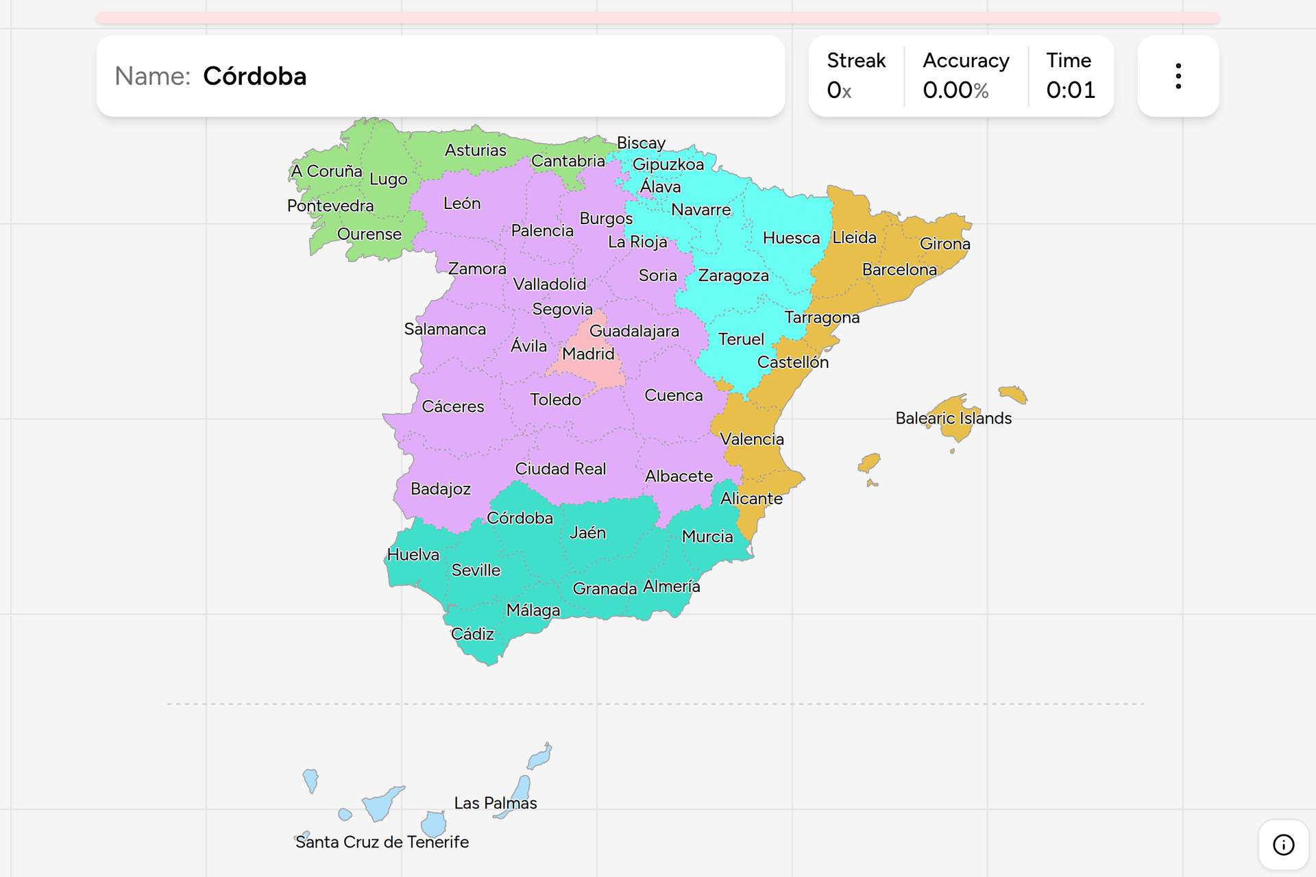
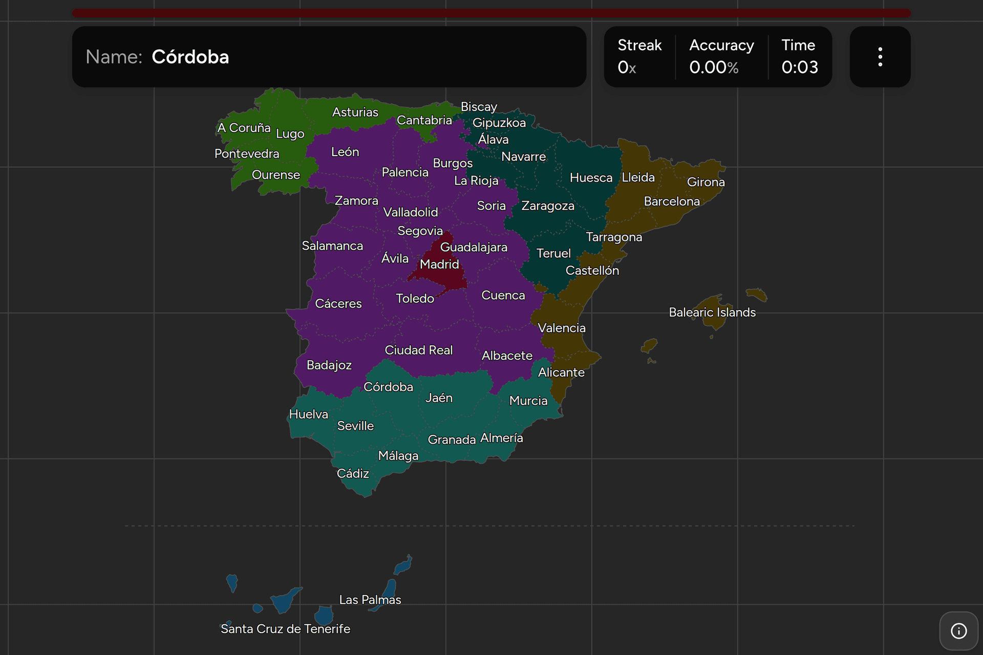
Spain is cut into provinces, and it has been cut the same way since 1833: one
set of lines that the post office, the phone network, the old number plates and
the statistics office all still use. Learn them and half the clues in the
country resolve to a place, because almost anything with a number on it in
Spain is numbered by province. This page is the whole set, and the game asks
you to put each name where it belongs, in English or the way it is written at
home.
- The quiz
- Name to place, on the map
- Names
- English or as written in Spain
- In the game
- 50 provinces
What you are looking at
A provincia is not a government. It is a division of the state, drawn up in
November 1833 by Javier de Burgos to give a centralising government something
regular to administer, and its borders have barely moved since: the same map
you learn here was being printed before photography. Forty-nine were drawn
then. The fiftieth arrived in 1927, when the single Canary province was split
between Las Palmas and Santa Cruz de Tenerife, and that is the last time this
map changed.
Above the provinces sit the seventeen autonomous communities, which are the
real tier of government: they run the hospitals, the schools and the police in
some cases, and they are what a Spaniard means by where they are from. The
communities were built out of provinces rather than across them, so every
province belongs to exactly one, and seven communities are a single province
wearing two hats. Ceuta and Melilla, on the African coast, are neither: they
are autonomous cities, a status nothing else in Spain holds, and they are not
in this game.
Most provinces are named after their capital, which makes the map easier than
it looks: find the city and you have the province. The exceptions are the ones
that were already something before 1833 and kept their own name, so their
capital is called something else entirely, and those are the eight that catch
people out.
The province is also the most legible thing on any Spanish street. A postcode
begins with its province number, counted alphabetically from 01 to 50. A
landline area code is provincial. A road numbered with letters and a dash
usually carries a provincial or community prefix. Number plates named the
province outright until 2000 and plenty of those cars are still on the road,
and the language on the signage narrows it further, since Galician, Basque,
Catalan and Valencian each belong to a handful of these.
How to place one
- Start with the seven that are a community on their own. Asturias,
Cantabria, La Rioja, Madrid, Murcia, Navarre and the Balearic Islands are
each one province and one autonomous community, so if you know the
community you already know the province. That is a seventh of the map for
free, and it is the fastest thing on this page to memorise.
- Run the north coast west to east. Galicia is the four in the corner, two
coastal and two inland. Then Asturias, then Cantabria, then the three Basque
provinces packed into the space one normal province would take, then Navarre
reaching down to the Ebro.
- Run the Mediterranean south to north. Up from Gibraltar the coast is
Andalusian as far as Almería, then Murcia, then the three of the Valencian
Community stacked in a strip, then Catalonia's four in the corner against
France. The Balearics sit off that strip and the Canaries are in the box
below the map.
- Fill in the two big interiors. North of Madrid is Castile and León,
nine provinces and the largest block on the map. South and east of it is
Castile-La Mancha with five, and west against Portugal is Extremadura with
two, which are the first and second largest provinces in the country.
- What is left is the middle and the valley. Madrid is the small one in
the centre with the recognisable shape, and the Ebro valley in the northeast
is Aragón, three provinces in a north to south column.
The Castilian nine are where runs go wrong, because none of them has a shape
worth remembering and the names give nothing away. The order that helps is the
ring: Valladolid in the middle with Palencia above it, then clockwise Burgos,
Soria, Segovia, Ávila, Salamanca, Zamora and León.
The other reliable traps are pairs. La Rioja is the small one on the Ebro and
it is not Basque, and Álava, which sits immediately north of it and looks much
the same, is. Cuenca and Guadalajara are both east of Madrid, and Guadalajara
is the northern of the two. Cáceres and Badajoz are the Extremaduran pair,
north and south. Castellón is a province on the coast and Castile is half the
country. And León is a province, a city and a kingdom that has not existed for
eight hundred years, none of which is the country in Central America.
Every province, by region
- Northwest6 provinces
- A Coruña, Lugo, Ourense, Pontevedra, Asturias, Cantabria
- Centre16 provinces
- Ávila, Burgos, León, Palencia, Salamanca, Segovia, Soria, Valladolid, Zamora, Albacete, Ciudad Real, Cuenca, Guadalajara, Toledo, Badajoz, Cáceres
- Northeast8 provinces
- Álava, Gipuzkoa, Biscay (Bizkaia), Navarre (Navarra), La Rioja, Huesca, Zaragoza, Teruel
- East8 provinces
- Barcelona, Girona, Lleida, Tarragona, Castellón, Valencia, Alicante, Balearic Islands (Illes Balears)
- South9 provinces
- Almería, Cádiz, Córdoba, Granada, Huelva, Jaén, Málaga, Seville (Sevilla), Murcia
- Madrid1 province
- Madrid
- Canary Islands2 provinces
- Las Palmas, Santa Cruz de Tenerife
These seven groups are the NUTS 1 regions, the top level of the statistical
division Spain and Eurostat publish in, and they are made of whole autonomous
communities, so no province is split between two of them. They are not a tier
of government and nobody uses them in conversation, but they are the grouping
the numbers come in, and they cut the fifty into pieces a person can learn one
at a time. Each group can be played on its own from the start dialog, so the
Canaries are a two question drill and the Centre is a real one.
The name in brackets is the province as it is written in Spain, which is the
form on the road signs, and what the game shows if you turn on the local name
in the start dialog. Most of the fifty are the same word either way. Where they
differ it is usually because the province is in a place with a second official
language, and the Galician, Basque or Catalan form is the legal one.
Worked examples
ÁlavaThe Basque threeThree provinces in the space most of this map gives to one, and the corner
where a run is most likely to lose a point. Two of them are on the coast,
Bizkaia around Bilbao and Gipuzkoa against the French border, and this is the
third, the inland one on the Ebro side of the hills. Its capital is
Vitoria-Gasteiz, which is also the seat of the whole Basque government, so
the province and the city share no name at all.
Santa Cruz de TenerifeThe islands in the boxThe western half of the Canaries: Tenerife, La Palma, La Gomera and El
Hierro, with La Graciosa and the eastern islands belonging to Las Palmas
instead. The archipelago is a thousand kilometres southwest of the mainland,
off the Sahara, so this map moves it up into the empty sea below Andalusia
and draws a line to say so. It was one province until 1927, and splitting it
in two settled an argument between the islands that had been running for a
century.
OurenseThe inland GalicianGalicia is four provinces, and three of them have a coast. This is the one
that does not: the southeastern corner against Portugal, in the valley of
the Miño, and the answer to the question of which Galician province is
landlocked. Its capital carries the same name and is built on hot springs that the
Romans bathed in, and probably takes its name from them.
BadajozThe biggest oneThe largest province in Spain by area, roughly the size of Slovenia, filling
the southern half of Extremadura along the Portuguese border, with Cáceres
above it as the second largest. Between them they are a tenth of the country
and two of its emptiest corners, which is why a photo taken in either one
tends to offer nothing but dehesa, holm oaks and pigs.
Frequently asked questions
How many provinces does Spain have?
50. Ceuta and Melilla are often counted alongside them, and the postcode and statistical systems give them numbers 51 and 52, but they are autonomous cities rather than provinces and this game asks about the 50.
What is the difference between a province and an autonomous community in Spain?
The community is the government and the province is the administrative division underneath it. There are 17 communities, each made of one or more whole provinces, and they hold real power over health, education and much else. The provinces are older, dating from 1833, and survive mostly as the unit everything is numbered by: postcodes, area codes, statistics and, until 2000, number plates. Seven communities consist of a single province: Asturias, Cantabria, La Rioja, Madrid, Murcia, Navarre and the Balearic Islands.
Why do the Canary Islands have two provinces?
Because Las Palmas de Gran Canaria and Santa Cruz de Tenerife spent the nineteenth century arguing about which of them was the capital of the islands. The single Canary province created in 1833 was divided in two in 1927, giving each city a province of its own: Santa Cruz de Tenerife takes the western islands and Las Palmas the eastern ones. The community still has two capitals, and its presidency alternates between the two cities.
What are Spain's provinces named after?
Their capital city, in 42 of the 50 cases, which is why finding the city places the province. The eight exceptions were territories with names of their own before the provinces were drawn: Álava, Asturias, the Balearic Islands, Bizkaia, Cantabria, Gipuzkoa, La Rioja and Navarre. Their capitals are Vitoria-Gasteiz, Oviedo, Palma, Bilbao, Santander, San Sebastián, Logroño and Pamplona.
How can you tell which Spanish province a photo is in?
Look for a number. A postcode on a shopfront or a van begins with the province number, counted alphabetically from 01 for Álava to 50 for Zaragoza, and a landline number beginning 9 carries a provincial area code. A car registered before September 2000 has the province's letters on the plate, and there are still plenty about. After that, the language on the signs narrows it to a region, the road numbering prefix names the community or the province that maintains the road, and the landscape does the rest.
Which is the largest province in Spain, and which the smallest?
Badajoz is the largest by area at about 21,800 square kilometres, with Cáceres second, so Extremadura's two provinces are the biggest in the country. Gipuzkoa is the smallest at under 2,000. By population Madrid is far ahead of everything else with around seven million people, and Soria is the emptiest, with fewer than a hundred thousand in a province larger than Madrid.
When were Spain's provinces created?
In November 1833, by a decree drafted by Javier de Burgos, which replaced the old kingdoms and lordships with 49 provinces of roughly comparable size, each named after its capital except where an older name stuck. The only change since was the division of the Canaries into two provinces in 1927. The 1833 borders were themselves a redraw of a French-inspired attempt from the Napoleonic period, and they were deliberately drawn so that no provincial capital was more than a day's travel from anywhere in its province.
The same fifty provinces answer a different question in Spain Dialing
Codes, which is worth playing straight after this one.
More European maps in this shape: Germany States, Germany
Districts and Poland
Voivodeships. Further afield, Argentina
Provinces and Japan Prefectures
ask exactly the same thing of two other countries.
Sources