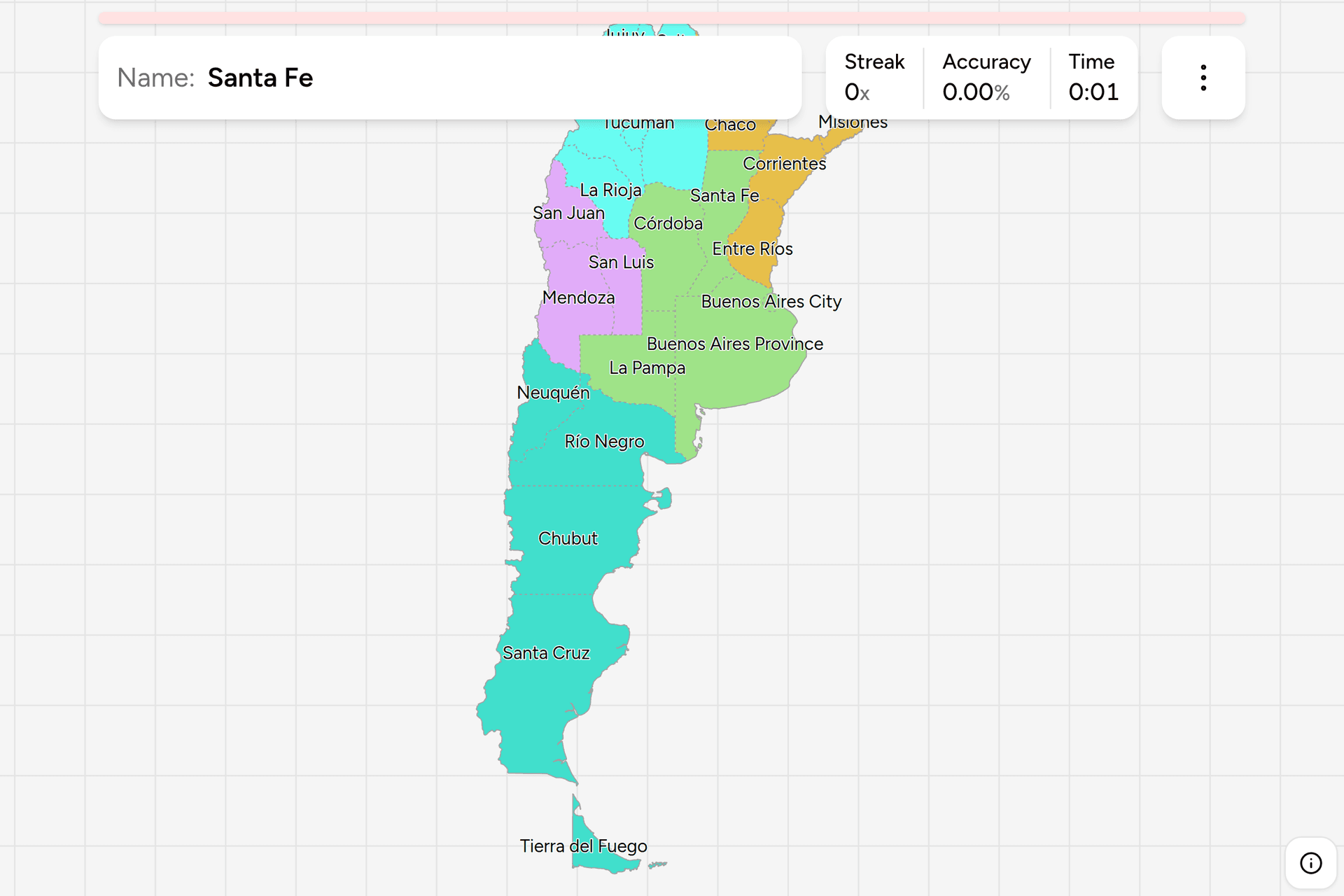
Argentina is a federation of 23 provinces and one autonomous city, and the map
they make is the longest in the Americas: three and a half thousand kilometres
from the Bolivian altiplano to the Beagle Channel, with the Andes down one side
the whole way. Most of it is easier than it looks, because the provinces line
up with landscapes you can already name. This page is the whole set, and the
game asks you to put each name where it belongs.
- The quiz
- Name to place, on the map
- Names
- Spanish, as they are written
- In the game
- 24 jurisdictions
What you are looking at
A provincia is a state of the Argentine federation, and the constitution is
unusually blunt about the direction the power flows: the provinces existed
first and delegated what the nation has, keeping everything they did not hand
over. Each one writes its own constitution, elects its own governor and
legislature, and runs its own police force and its own courts. Twenty-three of
them cover the country between them.
The twenty-fourth is not a province. Buenos Aires was cut out of the province
around it in 1880 to be the federal capital, and it was run for the next
century by a mayor the president appointed. The 1994 reform gave it a
constitution and an elected head of government of its own, so today the
Autonomous City of Buenos Aires sits alongside the provinces rather than under
any of them, which is why Argentine statistics count 24 jurisdictions and not
23. That is also the one thing on this map you have to get right twice: Buenos
Aires is both the city and the far bigger province wrapped around it, and they
are separate answers here.
Half the country arrived at provincehood late. The fourteen historic provinces
are nineteenth century, but the Chaco and Patagonia were national territories,
governed from Buenos Aires with no vote and no governor of their own, until a
run of laws in the 1950s converted them: Chaco and La Pampa in 1951, Misiones
in 1953, then Formosa and the four mainland Patagonian territories in 1955.
Tierra del Fuego waited until 1990, which makes the youngest province on this
map younger than most of the people playing for it.
Names to expect trouble from, because they are attached to more than one thing:
five provinces begin with San or Santa and two more with La, Córdoba and
Santiago del Estero are both cities you have heard of before they are
provinces, and Río Negro, Santa Cruz and Chubut are all rivers first.
How to place one
- Anchor on Buenos Aires. The province is the huge one around the
estuary, fanning out from the Río de la Plata to the Atlantic, and it is the
largest on the map by area and by population. The city is the speck on its
northeastern edge where the estuary starts. Get those two apart and a third
of the country is placed.
- Run down Patagonia. Everything below the Río Colorado is four long
provinces stacked in order, Neuquén, Río Negro, Chubut and Santa Cruz, plus
the island at the end. Neuquén is the small triangle in the northwest corner
of the region against Chile, and the other three run coast to Andes across
the full width.
- Take the Andean strip. Going up the Chilean border from Neuquén:
Mendoza, San Juan, La Rioja, Catamarca, Salta, Jujuy. That is the entire
western edge in one sweep, and it ends at the Bolivian border.
- Then the rivers in the northeast. Misiones is the finger pointing into
Brazil, Corrientes is below it, Entre Ríos below that, and the three of them
together are Mesopotamia, the land between the Paraná and the Uruguay. West
of the Paraná and north of Santa Fe are Chaco and, above it against
Paraguay, Formosa.
- What is left is the middle. Córdoba in the centre with the sierras,
Santa Fe as the tall thin one on the Paraná above Buenos Aires, San Luis
east of Mendoza, La Pampa square in the middle south, Santiago del Estero
landlocked between Córdoba and the northwest, and Tucumán, the smallest
province of all, tucked in beside it.
The mistakes are nearly all in the northwest, where six provinces share a
corner and not one of them has a shape worth remembering. La Rioja is the
Andean one above San Juan and it is not in Cuyo, though the grouping called
Nuevo Cuyo does count it there. Catamarca is above La Rioja, not below it.
Santiago del Estero is the one people put in the mountains: it is the flat,
hot, landlocked province east of the Andean strip, sharing a border with
Córdoba.
The second trap is La Pampa against La Rioja, which are a thousand kilometres
apart. La Pampa is the tidy rectangle in the middle south, in the grassland its
name describes. La Rioja is the dry Andean one in the northwest, named after
the Spanish region by settlers who came from there.
Every province, by region
- Pampas5 jurisdictions
- Buenos Aires Province, Buenos Aires City, Santa Fe, Córdoba, La Pampa
- Cuyo3 jurisdictions
- San Juan, Mendoza, San Luis
- Northwest6 jurisdictions
- Jujuy, Salta, Tucumán, Catamarca, La Rioja, Santiago del Estero
- Northeast5 jurisdictions
- Formosa, Chaco, Corrientes, Misiones, Entre Ríos
- Patagonia5 jurisdictions
- Neuquén, Río Negro, Chubut, Santa Cruz, Tierra del Fuego
These are the five regions Argentine geography is taught in, and the words a
weather forecast, a wine label and a tourist board all use. They are
conventions rather than a tier of government, and the edges are argued over:
La Rioja is put in Cuyo as often as in the Northwest, Entre Ríos belongs to the
Litoral and to the Pampas depending on who is drawing, and the political
Patagonia takes La Pampa in with it. Each group can be played on its own from
the start dialog, and Cuyo is a three question drill while the Northwest is a
real one.
Worked examples
Buenos Aires CityThe one that is not a provinceTwo hundred square kilometres on a map that runs to Cape Horn, and the
smallest target here by a factor of a hundred. It is federal territory rather
than part of the province around it, which is the whole reason it answers
separately, and the province it sits against is governed from La Plata, sixty
kilometres down the coast and built from nothing in 1882 to replace the
capital it had just lost.
Santiago del EsteroNot in the mountainsThe landlocked one in the northwest that is not Andean at all: flat, hot
thorn forest between Córdoba and the mountain provinces, with no border on
anything foreign. Its capital is the oldest Spanish town still standing in
Argentina, founded in 1553 and known as the Mother of Cities because the
expeditions that founded Córdoba, Salta and Tucumán all set out from it.
La PampaPampas, not PatagoniaThe neat rectangle below Córdoba and Buenos Aires, and the province that gets
dragged too far south. Its name is the grassland, its east is farmland
continuous with the pampas around it, and only the dry west looks Patagonian.
It is grouped with Patagonia politically, which is where the confusion comes
from, and it became a province in 1951 in the same law as Chaco.
Tierra del FuegoThe island at the endThe Argentine half of the island, split with Chile down a straight line, plus
Isla de los Estados off its eastern tip. It is the newest province, the
smallest by population and the only one you cannot drive to without leaving
the country, and its capital Ushuaia is the southernmost city of any size in
the world. The province's full legal name lays claim to a great deal more
than the map shows.
Frequently asked questions
How many provinces does Argentina have?
23, plus the Autonomous City of Buenos Aires, which is not a province but sits at the same level: it has its own constitution, its own elected head of government and its own ISO code. Argentine statistics therefore count 24 jurisdictions, and this game asks about all 24.
Is Buenos Aires a city or a province?
Both, and they are different places. The Autonomous City of Buenos Aires is the federal capital, about 200 square kilometres, and was separated from the province in 1880. Buenos Aires Province is the territory wrapped around it, the largest in the country by area and by population, and it is governed from La Plata rather than from the capital. Nearly half of all Argentines live in one or the other.
What are the five regions of Argentina?
The Northwest, the Northeast or Litoral, Cuyo in the west, the Pampas in the centre and east, and Patagonia in the south. They are teaching and marketing regions rather than a level of government, so the edges move: La Rioja is counted in Cuyo about as often as in the Northwest, and the political grouping called Patagonia includes La Pampa, which is geographically pampas.
Which is the largest province in Argentina?
Buenos Aires on both counts, with roughly a third of a million square kilometres and around two Argentines in five. Santa Cruz is second by area and one of the emptiest places in the country. Tucumán is the smallest province by area and the most densely populated, and Tierra del Fuego has the fewest people.
How can you tell which Argentine province a photo is in?
Landscape first, because the provinces follow it closely: red laterite soil and rainforest means Misiones, thorn scrub means the Chaco, vineyards under a wall of Andes means Cuyo, flat fenced grassland means the Pampas, and treeless windswept steppe means Patagonia. After that, look for a provincial route marker, since each province designs its own and the shape and colour change at the border, and for a telephone area code painted on a shopfront, which is geographic. The number plate will not help: Argentina issues them in a national sequence with no provincial code on them.
When did Argentina's provinces get their current borders?
The fourteen historic provinces date from the nineteenth century, and the rest were national territories run directly from Buenos Aires until the 1950s. Chaco and La Pampa became provinces in 1951, Misiones in 1953, and Formosa, Neuquén, Río Negro, Chubut and Santa Cruz in 1955. Tierra del Fuego was the last, in 1990, which is why the current map of 23 provinces is younger than it looks.
The other South American map here is Brazil Dialing
Codes, and the rest of the Americas is covered by
Mexico Dialing Codes, US Dialing
Codes, Canada Dialing Codes and
US License Plates. Maps in exactly this shape elsewhere:
Germany States, Poland
Voivodeships, India States and Japan
Prefectures.
Sources