Canada is the second largest country on earth and it is divided into thirteen
pieces, which is fewer than most countries a tenth of its size. That is what
makes the set worth learning: thirteen names cover nine and a half million
square kilometres, and almost everything you can read off a Canadian roadside,
the language on the signs, the shield on the route marker, the slogan on the
plate, points at one of them. This page is the whole set, and the game asks you
to put each name where it belongs.
- The quiz
- Name to place, on the map
- Best clue on the ground
- Signage language, then the plate
- In the game
- 13 jurisdictions
What you are looking at
Ten of the thirteen are provinces and three are territories, and the difference
is constitutional rather than geographic. A province holds its powers in its own
right: section 92 of the Constitution Act hands it education, health, natural
resources, property and civil rights, and Ottawa cannot take them back without
amending the constitution. A territory holds the powers Parliament has delegated
to it, under an ordinary federal act that Parliament could in principle rewrite.
In practice the three territories run themselves much as a province does, with
an elected legislature and a premier, and the gap has narrowed with every
devolution agreement since the 1980s. It still shows in the money, since
territorial budgets come overwhelmingly from federal transfers, and in the land,
since most of it remains under federal or Indigenous title rather than
territorial.
The country was assembled over eighty-two years and the order it arrived in is
still visible. Four joined at Confederation in 1867, the west and the island
provinces followed over the next decade, the two prairie provinces were cut out
of the North-West Territories in 1905, and Newfoundland held out as a separate
British dominion until 1949. The last change was recent enough that a lot of
printed maps are wrong: Nunavut was separated from the Northwest Territories on
1 April 1999, taking the eastern two thirds with it.
Population is where the map misleads worst. Ontario and Quebec between them hold
about three fifths of Canadians, almost all of it in a strip along the American
border, while the three territories together hold fewer people than a mid-sized
town. Nearly everything you will ever be dropped into sits in the bottom few
degrees of a map that runs to the pole.
How to place one
- Read the language first, because it settles the hardest question on the
map. French alone on the road signs, and a stop sign reading
ARRÊT with
no English under it, is Quebec, which legislates French as its only official
language. Road signage in both languages as a matter of course is New
Brunswick, the one officially bilingual province. Inuktitut syllabics
alongside English put you in Nunavut. Everywhere else works in English, with
bilingual signs only where the federal government is paying for them, which
is why a national park or a border post is no evidence at all.
- Then the plate, which names the province outright. Every jurisdiction
writes its name across the top and most add a slogan under it:
Yours to Discover, Je me souviens, Wild Rose Country, Land of Living Skies,
Friendly Manitoba, Beautiful British Columbia, Canada's Ocean Playground. Two of them do not need reading at all, because the Northwest
Territories and Nunavut both issue a plate cut into the shape of a polar
bear, which is recognisable at any distance and narrows you to two.
- Then the route marker, which is on more roads than plates are. Each
province draws its own: Ontario's King's Highway numbers sit in a shield
under a crown, Quebec's provincial routes sit in a shield with a fleur-de-lis
above the number, and the western provinces each use a shape of their own.
A green and white Trans-Canada Highway maple leaf tells you only that you are
in Canada, which you already knew.
- Then the landscape, which is what is left. Mountains meeting the sea, or
temperate rainforest, is British Columbia. Mountains on the western horizon
over open grassland is Alberta. Flat farmland with grain elevators and a road
grid running dead straight to the horizon is Saskatchewan first and Manitoba
second. Bare pink rock, lakes and black spruce is the Canadian Shield, which
runs from northern Saskatchewan across to Labrador and is the least useful
landscape on the continent. Ocean on one side and forest on the other is
Atlantic Canada, and the tiebreaks there are soil colour and treeline rather
than terrain.
The failure modes are mostly a matter of scale. Ontario is not southern
Ontario: the province reaches west past the top of Minnesota, and its
northwestern corner is shield and lakes that look exactly like Manitoba, which
is the single most common wrong answer on this map. The prairie provinces are
not distinguishable by landscape alone anywhere near their shared borders, so
if all you have is a wheat field, you need the plate or the shield. French
does not stop at the Quebec line: eastern Ontario, northern New Brunswick and
pockets of Manitoba have long-standing francophone communities, so a French
church or a French place name is a hint and not a verdict, while French on the
official signage is a verdict. And Labrador is not Quebec, though it looks
like the north shore next to it and is reached by road through it.
Every province and territory, by region
- The West Coast1 jurisdiction
- British Columbia
- The Prairies3 jurisdictions
- Alberta, Saskatchewan, Manitoba
- Central Canada2 jurisdictions
- Ontario, Quebec
- Atlantic Canada4 jurisdictions
- New Brunswick, Newfoundland and Labrador, Nova Scotia, Prince Edward Island
- The North3 jurisdictions
- Northwest Territories, Nunavut, Yukon
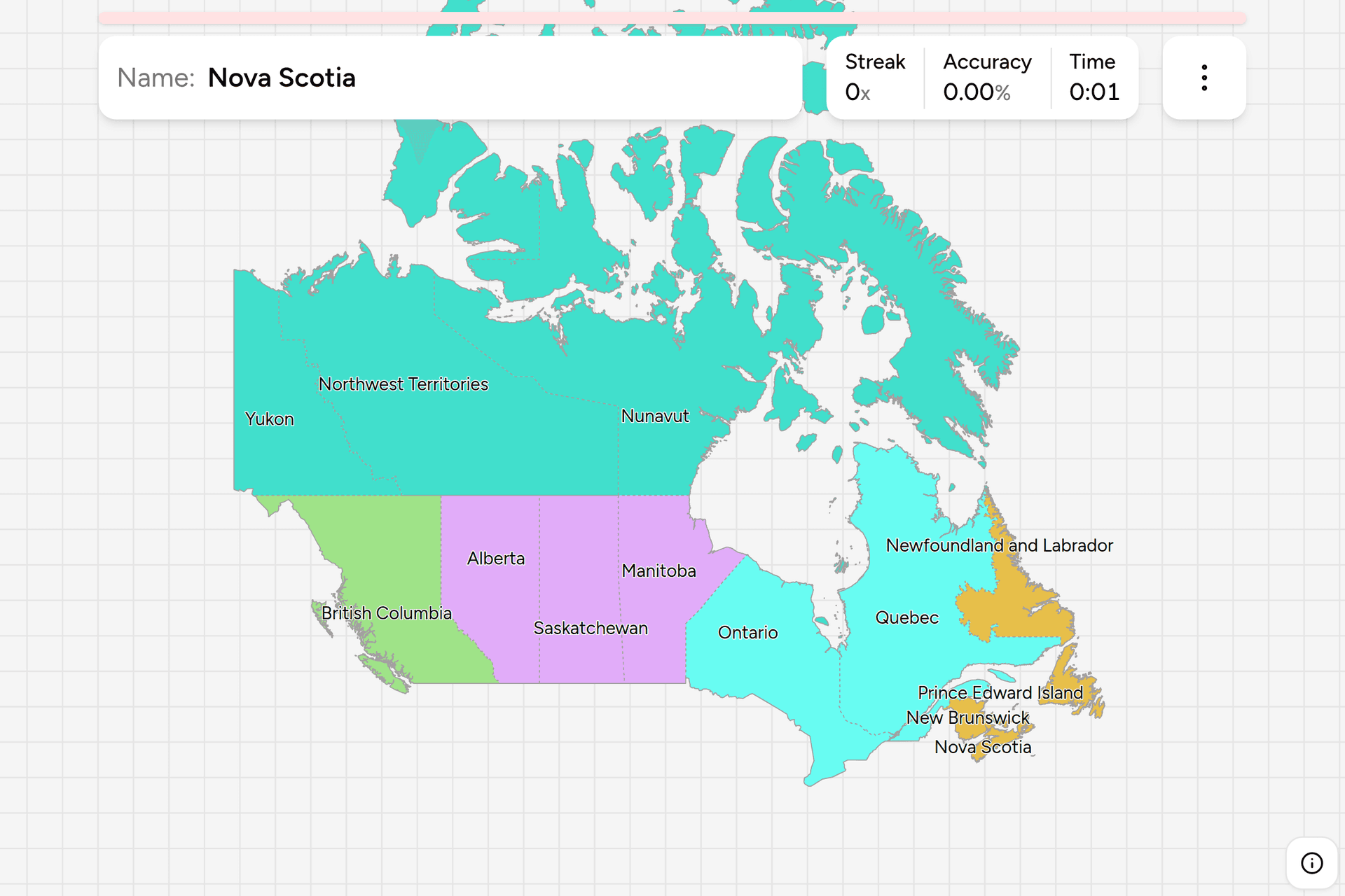
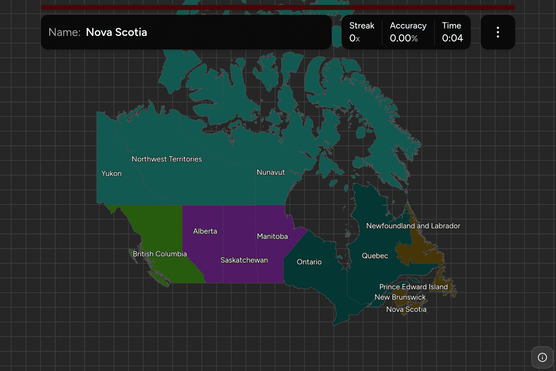
Those five are the regions Canada is habitually divided into, and they are the
groups the map in the game is coloured by, so the bands are visible while you
play. Each can also be played on its own from the start dialog. The Prairies and
Atlantic Canada are the two worth drilling first, because between them they hold
seven of the thirteen answers and they are the two groups whose members are
hardest to tell apart from inside.
Worked examples
QuebecThe one you can call from a single signThe only jurisdiction in North America that runs its public signage in French
alone, which makes it the easiest answer on this map and worth checking for
before anything else. Look for ARRÊT on the stop sign, Arrêt interdit and
Cédez on the regulatory signs, and speed posted as maximum. The second
giveaway is the land itself along the St. Lawrence, cut into long narrow strips
running back from the river, which is the seigneurial rang system still
written on the fields three centuries later.
OntarioThe one you will land in mostRoughly two in five Canadians live here, and the coverage follows them, so this
is the odds-on answer for anywhere that looks suburban, industrial or simply
busy. It is also the province people place too far east: the northwest reaches
to the Manitoba border and looks nothing like the farmland and lakes of the
south. The crown above the number on a King's Highway shield is the giveaway,
and it is on more roads here than any other provincial marker is anywhere.
SaskatchewanThe default guess for flatThe most nearly rectangular jurisdiction in the country and the flattest ground
in it, which is exactly the problem: a grain field with a grid road through it
is this province, Alberta or Manitoba, and nothing in the field will say which.
Two things tip it. Alberta shows mountains on the western horizon from a
surprising distance out, and Manitoba turns to lakes and shield within a couple
of hours of Winnipeg. A wheat field with a clean horizon in every direction is
this one, and the survey grid here is the tightest and most regular of the
three.
NunavutThe one with no roads into itA fifth of Canada by area, about forty thousand people, and not one kilometre
of road connecting it to the rest of the country or its communities to each
other. So it turns up as isolated coverage inside a settlement and essentially
nowhere else: gravel streets, buildings on piles above the permafrost, no
trees, and Inuktitut syllabics on the signs. Those syllabics are the fastest
separation from the other two territories, both of which sign in the Latin
alphabet.
Frequently asked questions
How many provinces and territories does Canada have?
Ten provinces and three territories, thirteen in total. The count has been the same since 1 April 1999, when Nunavut was separated from the Northwest Territories, and before that it was ten and two from 1949, when Newfoundland joined as the tenth province.
What is the difference between a province and a territory in Canada?
Where the powers come from. A province holds its authority directly under the Constitution Act, and Ottawa cannot remove it without a constitutional amendment. A territory holds authority delegated by Parliament under an ordinary federal statute. In daily practice the three territories are governed much like provinces, with elected legislatures and premiers, but their budgets are overwhelmingly federal transfers and most of the land in them is not territorial.
What is the largest province in Canada?
Quebec, at about 1.54 million square kilometres, which is roughly three times the size of France. Nunavut is larger still at about 2.09 million, so it is the largest subdivision in the country, but it is a territory rather than a province. The smallest by a wide margin is Prince Edward Island, at around 5,700 square kilometres.
Which Canadian provinces speak French?
Quebec is the only province with French as its sole official language, and it is where the large majority of Canadian francophones live. New Brunswick is the only officially bilingual province, with a French-speaking Acadian population of about a third. Everywhere else is English-speaking at the provincial level, though francophone communities exist across the country, notably in eastern and northern Ontario and in Manitoba.
How can you tell which Canadian province a photo is in?
Signage language first, because French-only signs mean Quebec and routinely bilingual signs mean New Brunswick. Then the licence plate, which carries the name and usually a slogan, and which in the Northwest Territories and Nunavut is cut into the shape of a polar bear. Then the provincial route marker, since each province designs its own shield. Landscape comes last, because the prairie provinces and the Canadian Shield look the same across enormous distances.
Which Canadian provinces are easiest to confuse?
Alberta, Saskatchewan and Manitoba, which share a landscape as well as a pair of borders, and Manitoba against northwestern Ontario, which are the same shield and lake country on either side of a line. In the east the pairing is New Brunswick against Nova Scotia. The territories are easier than they look, because Nunavut signs in Inuktitut syllabics and the other two do not.
When did each Canadian province join Confederation?
Ontario, Quebec, Nova Scotia and New Brunswick founded the country in 1867. Manitoba and the North-West Territories followed in 1870, British Columbia in 1871 and Prince Edward Island in 1873. Yukon was separated in 1898, Alberta and Saskatchewan were created in 1905, Newfoundland joined in 1949 after governing itself as a separate dominion, and Nunavut was created in 1999.
Why is Newfoundland half an hour off the rest of Canada?
Newfoundland Standard Time is three and a half hours behind Greenwich, a half-hour offset it kept from before it joined Canada, when it set its clocks by the sun over St. John's rather than by a zone drawn from the mainland. Labrador, on the mainland, mostly uses Atlantic time instead, so the province spans two zones half an hour apart.
The other Canadian map is built on the same thirteen: Canada Dialing
Codes, which asks for the area code instead of the name
and merges the Maritimes and the territories where they share one. Across the
border, US Dialing Codes and US License
Plates cover the other half of the continent. More
administrative maps in the same shape: Argentina
Provinces, Germany States and South
Africa Provinces.
Sources