Peru is three countries stacked side by side: a desert coast, the Andes, and the
Amazon basin that fills more than half the area. Knowing you are in it says
little about where, and the region is the unit that fixes it. Each has been run
by an elected regional government since 2002, and most Peruvians can place the
coastal ones and the Andean south, then lose the rest somewhere in the jungle.
- The quiz
- Name to place, on the map
- Grouped by
- Macroregion: Norte, Centro, Sur, Oriente
- In the game
- 26 regions
What you are looking at
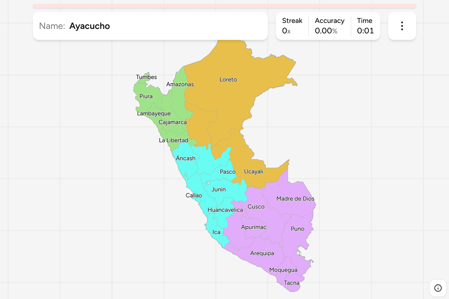
The map has the 24 departments, which Peru calls regions, and two more units at
the same level: Callao, a constitutional province with a regional government of
its own, and Lima Province, which is the capital itself. Lima Province is not
part of the Lima Region that surrounds it. It is run by the metropolitan
municipality, so the region drawn around it has the same name and a different
capital, and both are answers here.
Callao and Lima Province are far too small to tap at the scale of the whole
country, so both take a tap area wider than their shape.
The groups above the regions have no government. The Norte is the northern
coast and the Andes behind it, the Centro holds the capital and the central
highlands, the Sur is the high Andes down to the Chilean border together
with Madre de Dios, and the Oriente is the Amazon, which is Loreto, San
Martín and Ucayali.
How to place one
- Get the macroregion first. Four groups instead of 26, and the game lets
you drill them one at a time.
- Count down the coast. Tumbes, Piura, Lambayeque, La Libertad and Áncash
run south from the Ecuadorian border before the capital, and Ica, Arequipa,
Moquegua and Tacna follow it down to Chile.
- Find Lima and Callao together. Callao is the sliver at the water, and Lima
Province sits just inside it, with Lima Region around both.
- Everything big and east is jungle. Loreto alone is more than a quarter of
the country. Ucayali and Madre de Dios sit below it, and San Martín is the
smaller one at the western edge of the basin.
Every region, by macroregion
- Norte6 regions
- Amazonas, Cajamarca, La Libertad, Lambayeque, Piura, Tumbes
- Sur8 regions
- Apurímac, Arequipa, Ayacucho, Cusco, Madre de Dios, Moquegua, Puno, Tacna
- Centro9 regions
- Áncash, Callao, Huancavelica, Huánuco, Ica, Junín, Lima Region, Lima Province, Pasco
- Oriente3 regions
- Loreto, San Martín, Ucayali
Worked examples
Lima ProvinceThe capital, inside another regionLima Province is the city and its surroundings, and it is not part of the Lima
Region, which is drawn around it. It is the one to find first when you are
lost on the central coast, and the reason the map holds two answers called
Lima.
CallaoThe smallest oneCallao is Peru's main port and the airport the capital uses, and it is the
only constitutional province that is also a region. On the map it is a sliver
against Lima Province, which it touches along the coast.
LoretoThe big oneLoreto is the largest region by a wide margin and takes in the northeast
corner of the country, bordering Ecuador, Colombia and Brazil. It has the
river port of Iquitos, which has no road to the rest of Peru.
Frequently asked questions
How many regions does Peru have?
25 regional governments: the 24 departments, which have been called regions since 2002, and the Constitutional Province of Callao. Lima Province is a 26th unit at the same level but has no regional government, so this game counts 26 answers.
Is Lima Province part of the Lima Region?
No. The city is administered by the Metropolitan Municipality of Lima and is separate from the Lima Region around it, whose capital is Huacho. Here they are two answers.
Why are the regions in the east so large?
They cover the Amazon basin, where few people live. The population is on the coast and in the Andes, which is why the regions there are smaller.
What are the Norte, Centro and Sur?
The macroregions planners and the statistics office use for the country. They are not administrative divisions, and they are the groups this game is cut by.
What about the provinces?
Peru has 196 of them, and they are the next tier down. See Peru Provinces for that map.
The tier below this one is Peru Provinces, and the 26 answers
here are the 26 groups there, so it is the place to go once the regions come
easily. For another Andean country at this level, see
Colombia Departments.
Sources