Chile is divided into 16 regions, and below them into 56 provinces: the tier
a presidential delegate heads each one, and Chileans use its name for the
stretch of country around a city. The communes under them, 346 in all,
are what the elected mayors run, and a province is mostly a group of them. This
page is the whole list of provinces, grouped by region the way the game groups
it.
- The quiz
- Name to place, on the map
- Grouped by
- Region
- In the game
- 56 provinces
What you are looking at
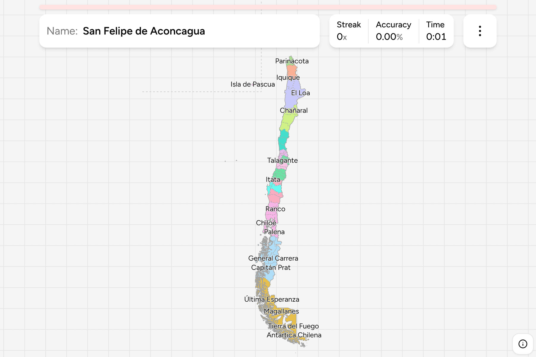
The map has the provinces as they stood after Ñuble was made a region in 2018,
which is when its three provinces (Diguillín, Itata and Punilla) were drawn. Most
regions have between two and four, and the exceptions are the Región
Metropolitana with six and Valparaíso with eight. A handful, like Santiago and
Valparaíso, share their name with their region's capital.
Scale varies enormously. The provinces of the far south are each the size of a
small European country, while those around Santiago and Valparaíso are a few
kilometres across. Easter Island is a province in its own right, 3,500 km out in
the Pacific: it is moved into the empty sea off the north coast and fenced with a
dashed line, rather than letting it more than double the width of the map. The
Juan Fernández and Desventuradas islands belong to the Valparaíso province and
are drawn where they are, as is the stretch of the southern fjords.
How to place one
- Get the region first. 16 answers instead of 56, and the game lets you
drill them one at a time.
- Read the name. Many are a landscape or a place: Última Esperanza is the
far end of Magallanes, Tamarugal the inland desert of Tarapacá and Antártica
Chilena the southern islands.
- Watch the pairs. Arica and Parinacota, Ranco and Valdivia, and Choapa and
Limarí are neighbours that share a region and a similar shape.
- Then use the coast. Most provinces north of the capital are strips from
the sea to the Andes, while those in the south are islands and fjords.
Every province, by region
- Arica y Parinacota2 provinces
- Arica, Parinacota
- Valparaíso8 provinces
- Isla de Pascua, Los Andes, Marga Marga, Petorca, Quillota, San Antonio, San Felipe de Aconcagua, Valparaíso
- Biobío3 provinces
- Arauco, Biobío, Concepción
- Magallanes4 provinces
- Antártica Chilena, Magallanes, Tierra del Fuego, Última Esperanza
- Coquimbo3 provinces
- Choapa, Elqui, Limarí
- Ñuble3 provinces
- Diguillín, Itata, Punilla
- Aysén4 provinces
- Aysén, Capitán Prat, Coyhaique, General Carrera
- Atacama3 provinces
- Chañaral, Copiapó, Huasco
- Maule4 provinces
- Cauquenes, Curicó, Linares, Talca
- Los Lagos4 provinces
- Chiloé, Llanquihue, Osorno, Palena
- Antofagasta3 provinces
- Antofagasta, El Loa, Tocopilla
- O'Higgins3 provinces
- Cachapoal, Cardenal Caro, Colchagua
- Los Ríos2 provinces
- Ranco, Valdivia
- Tarapacá2 provinces
- Iquique, Tamarugal
- Región Metropolitana6 provinces
- Chacabuco, Cordillera, Maipo, Melipilla, Santiago, Talagante
- La Araucanía2 provinces
- Cautín, Malleco
Each region can be switched on and off in the start dialog, which is the only
sane way through a list this long. Arica y Parinacota is two questions, Valparaíso
is eight.
Worked examples
SantiagoThe capitalSantiago province is the heart of the capital region and about a seventh of
the area of the Región Metropolitana. The other five provinces ring it: Cordillera to
the east, Maipo to the south, Talagante and Melipilla to the west and
Chacabuco to the north.
Isla de PascuaThe one that is movedEaster Island, or Rapa Nui, is a province of Valparaíso with a single commune.
In reality it is 3,500 km from the coast. The game draws it off Tarapacá, in a
corner fenced by a dashed line.
Antártica ChilenaThe bottom of the mapAntártica Chilena covers the islands south of the Beagle Channel, including
Cape Horn and Puerto Williams, which is the southernmost town in the world.
Its Antarctic claim is not drawn.
Frequently asked questions
How many provinces does Chile have?
56, since the three provinces of Ñuble were created in 2018. Before that there were 54.
What does a province do in Chile?
It is headed by a delegate appointed by the president, and groups several communes. It is the middle of three tiers: region, province and commune.
Why does the map differ from older ones?
Ñuble became a region in 2018 and was split off the Biobío, taking its provinces with it, and one province became three in the process.
Is Easter Island a province?
Yes. Isla de Pascua is one of the eight provinces of Valparaíso, and in this game it is drawn off the north coast so the map stays a usable shape.
What is a commune?
The tier below the province, run by an elected mayor and council. There are 346, and they are what a Chilean address is in.
The tier above this one is Chile Regions, and the 16 groups here
are its 16 answers, so it is the place to start. For another country at this
level, see Spain Provinces.
Sources