France's regions are the youngest map in Europe that everybody is expected to
know: seven of them were merged into existence on 1 January 2016, and several
still had a working title on their first road sign. Thirteen of them cover
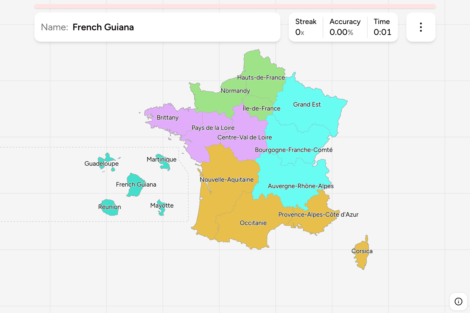
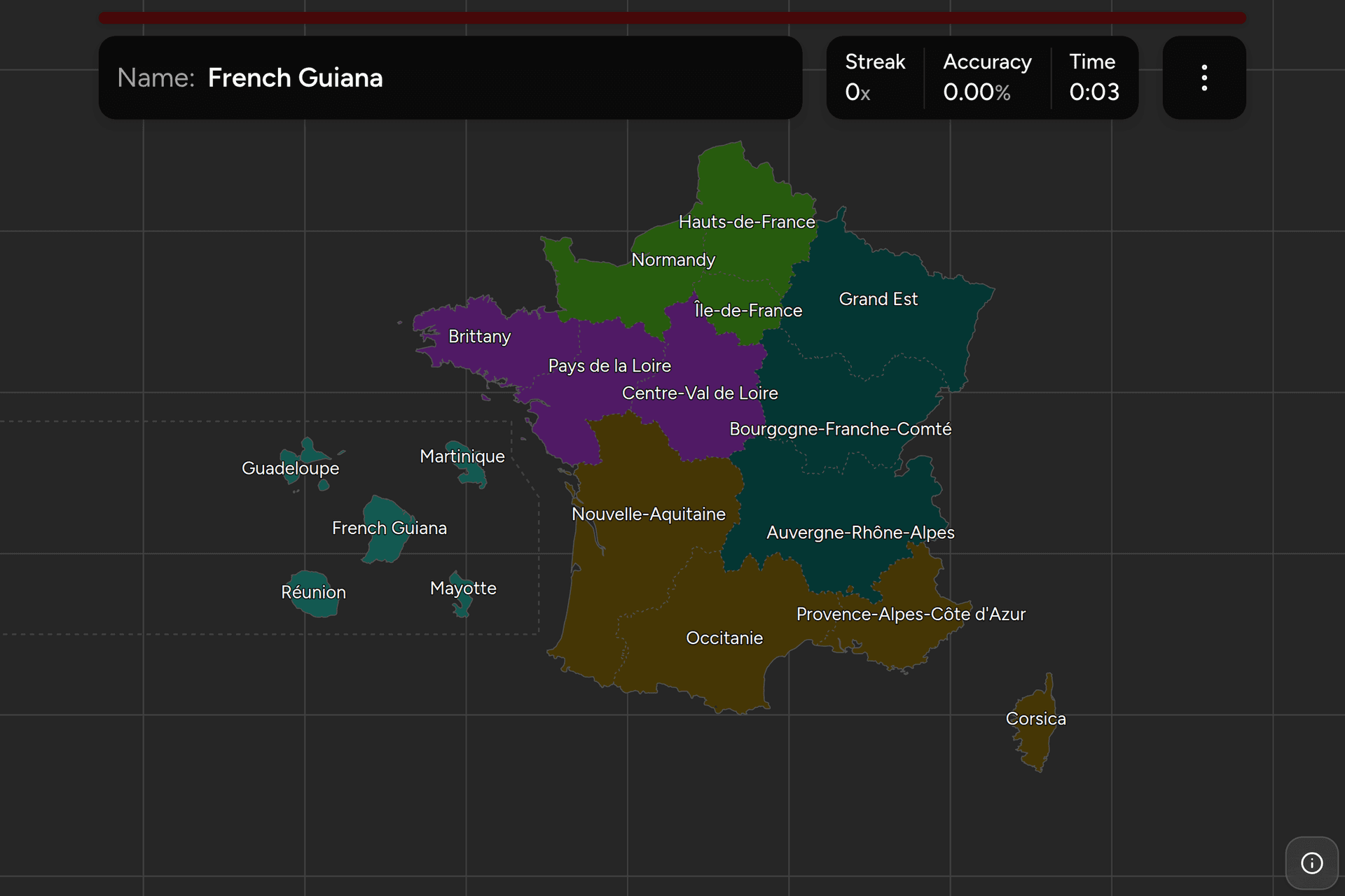
Europe and five are an ocean away, on this map moved into the Atlantic so they
can be clicked. This page is the whole set, and the game asks you to put each
name where it belongs, in English or the way it is written in French.
- The quiz
- Name to place, on the map
- Names
- English or French
- In the game
- 18 regions
What you are looking at
A région is the top tier of French local government, sitting above the 101
departments and a long way below a German state in what it is allowed to do.
France is not a federation: the region has no laws of its own, and its council
runs the things a national ministry handed down in the 1980s and after, which
are the lycées, the regional trains, and economic development. The state is
still present in every one of them in the person of a prefect appointed from
Paris, seated in the regional capital.
The current map is only a decade old. A law passed in January 2015 merged the 22
metropolitan regions into 13 from the first day of 2016, and it did the merging
by hyphen: Bourgogne-Franche-Comté and Auvergne-Rhône-Alpes are exactly the two
and two regions they say they are. Four of the new ones were named in a hurry
and renamed a few months later, which is the reason the biggest region in the
country spent 2016 being called Aquitaine-Limousin-Poitou-Charentes before it
settled on Nouvelle-Aquitaine, and why Grand Est, Hauts-de-France and Occitanie
are invented names rather than old ones. Six regions were left alone, and they
are the six with the oldest names on the map.
The five overseas regions are each a single department as well as a region, and
no two of them are put together quite the same way: some have one council doing
both jobs and some have two. What matters here is that they are regions in the
same sense the European thirteen are, sending the same deputies to the same
parliament and using the same euro, which is why a map of France that stops at
the Mediterranean is missing five of its eighteen pieces.
For actually reading a region off a photograph, France is harder than Germany or
Poland, because the signs, the markings and the plates are national. Three
things do vary:
- Bilingual signs. Breton under French in Brittany, Corsican in Corsica
(usually with the French half shot at or sprayed over), Basque in the
southwest corner, Occitan and Catalan along the Mediterranean, and German
place name spellings in Alsace. Each one is a region, or a corner of one.
- The regional logo. Town entry signs, the sides of TER trains and the
livery on public buildings and buses all carry the council's own mark and
often the region's name in full.
- The blue band on a number plate. It shows a department number and a
regional logo, and since 2009 the owner picks whichever they like, so it is a
hint about somebody's origins rather than about where the car is standing.
How to place one
- Start with the outline. Five regions are shapes before they are names:
the peninsula pointing at Cornwall is Brittany, the island is Corsica, the
tip at the Belgian border is Hauts-de-France, the eastern block on the German
and Swiss frontier is Grand Est, and the southeast corner with the Riviera in
it is Provence-Alpes-Côte d'Azur.
- Then the two big southern blocks. The whole Atlantic southwest, from the
Loire estuary to the Pyrenees, is one region: Nouvelle-Aquitaine, the largest
in the country. East of it, along the Mediterranean and up to the Massif
Central, is Occitanie. The pair between them and the Alps is
Auvergne-Rhône-Alpes, which reaches from Lyon to Mont Blanc.
- Then Paris. Île-de-France is the small ring around the capital in the
north centre, and it is much smaller than people expect. Normandy is
northwest of it on the Channel, and Centre-Val de Loire is directly below it.
- Two are left, and they fill the gaps. Pays de la Loire is the Atlantic
coast between Brittany and Nouvelle-Aquitaine, with Nantes in it.
Bourgogne-Franche-Comté is the inland one east of centre, running to the Jura
and the Swiss border.
Most mistakes here are made on names rather than shapes. Île-de-France is not an
island and never was: the name is older than the region and describes the land
between the Seine, the Marne and the Oise. Two regions have the Loire in their
name and neither owns much of the river, since the upper Loire rises in the
southeast and only the estuary is in Pays de la Loire. And the three invented
names are compass directions in disguise, which helps until you notice that
Grand Est is the east, Hauts-de-France is the north, and Occitanie is the south
by way of a language rather than a direction.
The other trap is the region that is still spoken about as though 2016 never
happened. Alsace, Picardie, Aquitaine, Limousin, Poitou-Charentes, Languedoc,
Auvergne and Lorraine are all live words in France for places that no longer
have a council, and several of them appear on the brown tourist signs beside a
motorway. A name on a sign is not evidence of a region any more.
Every region, by part of the country
- North3 regions
- Hauts-de-France, Normandy (Normandie), Île-de-France
- West3 regions
- Brittany (Bretagne), Pays de la Loire, Centre-Val de Loire
- East3 regions
- Grand Est, Bourgogne-Franche-Comté, Auvergne-Rhône-Alpes
- South4 regions
- Nouvelle-Aquitaine, Occitanie, Provence-Alpes-Côte d'Azur, Corsica (Corse)
- Overseas5 regions
- Guadeloupe, Martinique, French Guiana (Guyane), Réunion (La Réunion), Mayotte
The name in brackets is the French one, and it appears for the five where the
two forms differ. That is what the game shows if you turn on the local name in
the start dialog, and it is what a boundary sign says. Each group can be played
on its own from the start dialog, and the overseas five are the group worth
drilling first, because they are the ones nobody meets by accident.
Worked examples
Nouvelle-AquitaineThree regions in a coatThe largest region in the country and larger than Austria, covering the
Atlantic coast from below the Loire estuary to the Spanish border and inland
as far as the Massif Central. It was made in 2016 out of Aquitaine around
Bordeaux, Poitou-Charentes above it and Limousin inland, three regions that
had little in common beyond adjacency, and it is the one people undersize
because they are still placing Aquitaine.
Île-de-FranceNot an islandThe smallest of the thirteen in Europe and by a distance the most populous:
Paris and the ring of suburbs and countryside around it, about two per cent of
the country holding nearly a fifth of its people. The name is medieval and
describes land between rivers rather than water, and the region is small
enough on this map that it is often the click people miss.
BrittanyThe missing cornerThe peninsula, and the region with the most obvious identity on the ground:
bilingual signs in Breton, its own flag on everything, and a boundary you can
hear. The catch is the southeast corner of it. Nantes and the Loire estuary
were historically Breton and are not in this region, having been left in Pays
de la Loire when the regions were drawn, which is a live argument locally and
a trap on a map.
MayotteThe newest oneAn island in the Mozambique Channel, closer to Madagascar than to any other
part of France, and the most recent addition: it voted to become a department
in 2009 and was one from 2011. It is the smallest of the eighteen by area and
the poorest by a wide margin. On this map it has been moved into the Atlantic
with the other four and scaled up to something clickable.
Frequently asked questions
How many regions does France have?
18: 13 in Europe and 5 overseas. The European count was 22 until the end of 2015, when a merger reduced it to 13 from 1 January 2016. Corsica is usually counted among the 18 and is drawn as one here, though since 2018 its legal form is a single territorial collectivity rather than a region and a department side by side.
Why did France go from 22 regions to 13?
A law of 16 January 2015 merged them, with effect from 1 January 2016, on the argument that French regions were too small and too poor to matter next to a German state or a Spanish autonomous community. The merger was done on paper by joining whole regions, so no department changed hands and no border moved: seven groups became seven regions and six regions were left as they were.
What is the difference between a region and a department?
Age and job. The departments were drawn in 1790, there are 101 of them, and they are what a French address, a phone number and a plate registration have historically referred to. The regions were built on top in the 1950s and given elected councils in 1982, and they handle lycées, regional trains and economic development. A department is the middle tier between the region and the commune.
Are the overseas regions really regions?
Yes. Guadeloupe, Martinique, French Guiana, Reunion and Mayotte are each simultaneously a region and a single department, fully part of France and of the European Union, using the euro and voting in the same elections. The internal arrangements differ: some have one assembly doing both jobs and some have two. French Polynesia, New Caledonia and the other overseas collectivities are a different category and are not regions, which is why they are not in this game.
How can you tell which French region a photo is in?
Language first. Breton, Corsican, Basque, Catalan, Occitan and German spellings under the French on a sign each pin one region or a corner of one. After that it is the regional logo on town entry signs, buses and TER trains, and then the ordinary geographical evidence: roof tiles, vegetation, the shape of the hills. The blue band on a number plate shows a department number and a regional logo, but the driver chooses it, so it is weak evidence at best.
Which French region is the largest, and which the smallest?
Nouvelle-Aquitaine is the largest by area, at about 84,000 square kilometres, which is bigger than Austria. Ile-de-France has by far the most people, around a fifth of the country, while being the smallest of the thirteen European regions by area. Mayotte is the smallest of all eighteen at under 400 square kilometres.
Do the old region names still mean anything?
Socially yes, administratively no. Alsace, Picardy, Aquitaine, Limousin, Auvergne and Languedoc are all names people still use for where they live, and they turn up on tourist signs, on food labels and in the names of wines and cheeses. None of them has had a regional council since the end of 2015, and several of them are now a corner of a region named after something else.
More European maps in the same shape: Germany States, Poland
Voivodeships and Germany
Districts. The same country cut a different way, along the
department lines the regions ignore, is France Dialing
Codes.
Sources