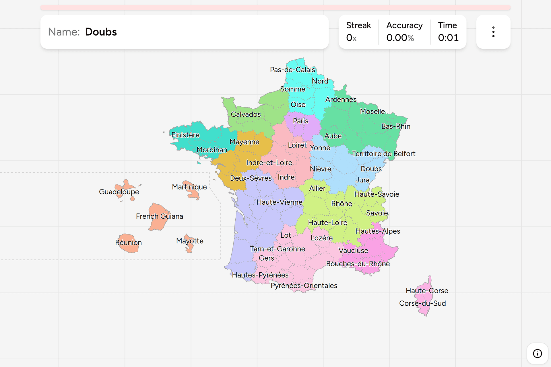
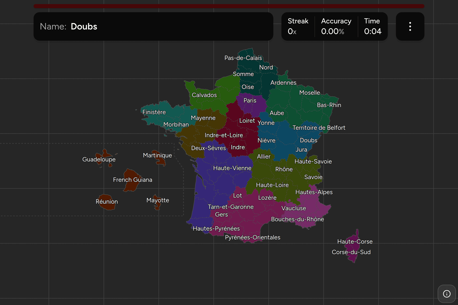
The department is the tier France actually runs on. It was drawn in 1790, it
has outlived every regime since, and its number is the first two digits of
every postcode, the middle of every administrative form and the thing on the
blue band of a number plate. There are 101 of them, 96 in Europe and five an
ocean away, and this page is the whole list, grouped by region the way the game
groups it.
- The quiz
- Name to place, on the map
- Grouped by
- Region
- In the game
- 101 departments
What you are looking at
A département is the middle tier of French local government: below the
region, above the commune, and older than both. The Constituent Assembly
created 83 of them at the end of 1789 to replace the provinces of the kingdom,
deliberately drawn so that anybody could ride to the chef-lieu and back in a
day, and deliberately named after rivers, mountains and coasts rather than
after the old provinces they cut up. That is why the map is full of Aube, Marne,
Oise, Somme, Rhône and Var, and why Brittany, Normandy and Burgundy are nowhere
on it: erasing those names was the point.
Each one has a préfecture, which is both the town and the prefect sitting in
it, appointed from Paris and representing the state. Beside the prefect is an
elected conseil départemental, which pays for the collèges, the D roads and
most of the country's social spending. The two together are why the department
survived the regions being invented on top of it in the 1950s, and survived the
periodic proposals to abolish it since.
The number is the part worth learning, because it is written everywhere:
- Postcodes. A five digit French postcode almost always opens with the
department: 75008 is Paris, 33000 is Gironde, 06400 is Alpes-Maritimes. The
two Corsican departments share 20, and the overseas five use all three digits
of theirs.
- Number plates. Until 2009 a French plate ended in the department it was
registered in, so an older car parked in a French street is telling you where
it came from. Plates issued since carry a blue band on the right with a
department number and a regional logo that the owner picks and keeps for the
life of the car, which makes it a hint about somebody rather than about the
road you are standing on.
- Roads. Departmental roads are numbered by the council that owns them, so
a D number stops at the boundary and starts again as something else on the
other side. When the state handed most of its N roads to the departments in
2006, many of them renumbered by adding a thousand, so a D1006 is the old N6
and tells you the road used to be a national one.
The boundary itself is signposted, usually with the name and the council's
logo, and it is one of the few administrative lines in France you can actually
see from a car.
How to place one
- Get the region first. Fourteen groups instead of a hundred and one, and
each can be played on its own from the start dialog. A department belongs to
exactly one region, so being in the right region is most of the way to the
right click.
- Read the name as geography. Most of these are rivers, and the river is
usually still there: Loire, Rhône, Garonne, Somme, Marne, Aisne, Isère, Var.
Mountains do the same job in the south and east, coasts in the west.
Côtes-d'Armor is Breton for the sea coast, Finistère is the end of the
earth, and Pas-de-Calais is the strait.
- Use Haute and Basse as a compass along the water. A pair of departments
named for one river splits it upstream and downstream, and upstream is the
Haute one, which is nearly always the one further from the sea and higher
up: Haute-Loire is not north of Loire, it is above it. Bas-Rhin and Haut-Rhin
are the pair that catch people out, because the Rhine runs north here, so the
Bas is the northern one.
- Then use the numbers. They are alphabetical, so once you know that 01 is
in the east and 89 is in Burgundy you can bracket anything: a low number is
early in the alphabet, not early on the map. What breaks the run is the
additions, which sit at the end rather than in place. Territoire de Belfort
took 90 in 1922, the ring around Paris took 91 to 95 when it was cut up in
1968, Corsica went from 20 to 2A and 2B in 1976 and nothing has been 20
since, and the overseas five are numbered in the 970s.
- Zoom for Paris. The centre of the map is eight departments inside a
circle fifty kilometres across, and four of them are a couple of pixels
wide with the whole country in view, so zoom in before you answer rather
than aim. Paris is the dot in the middle, and the three around it are
Hauts-de-Seine to the west, Seine-Saint-Denis to the northeast and
Val-de-Marne to the southeast.
The traps are the names that repeat. Loire is a department, Haute-Loire is
another, Loire-Atlantique is a third at the estuary, Loiret is a fourth on a
tributary, and Maine-et-Loire is a fifth: five different answers, one river.
Charente and Charente-Maritime, Savoie and Haute-Savoie, and the three
Pyrenean departments work the same way. And a few names have moved: what is
now Loire-Atlantique was Loire-Inférieure until 1957, Côtes-d'Armor was
Côtes-du-Nord until 1990, and older maps and older people still use both.
Every department, by region
- Normandy5 departments
- Calvados, Eure, Manche, Orne, Seine-Maritime
- Île-de-France8 departments
- Paris, Seine-et-Marne, Yvelines, Essonne, Hauts-de-Seine, Seine-Saint-Denis, Val-de-Marne, Val-d'Oise
- Hauts-de-France5 departments
- Aisne, Nord, Oise, Pas-de-Calais, Somme
- Pays de la Loire5 departments
- Loire-Atlantique, Maine-et-Loire, Mayenne, Sarthe, Vendée
- Brittany4 departments
- Côtes-d'Armor, Finistère, Ille-et-Vilaine, Morbihan
- Centre-Val de Loire6 departments
- Cher, Eure-et-Loir, Indre, Indre-et-Loire, Loir-et-Cher, Loiret
- Bourgogne-Franche-Comté8 departments
- Côte-d'Or, Doubs, Jura, Nièvre, Haute-Saône, Saône-et-Loire, Yonne, Territoire de Belfort
- Auvergne-Rhône-Alpes12 departments
- Ain, Allier, Ardèche, Cantal, Drôme, Isère, Loire, Haute-Loire, Puy-de-Dôme, Rhône, Savoie, Haute-Savoie
- Grand Est10 departments
- Ardennes, Aube, Marne, Haute-Marne, Meurthe-et-Moselle, Meuse, Moselle, Bas-Rhin, Haut-Rhin, Vosges
- Corsica2 departments
- Corse-du-Sud, Haute-Corse
- Nouvelle-Aquitaine12 departments
- Charente, Charente-Maritime, Corrèze, Creuse, Dordogne, Gironde, Landes, Lot-et-Garonne, Pyrénées-Atlantiques, Deux-Sèvres, Vienne, Haute-Vienne
- Occitanie13 departments
- Ariège, Aude, Aveyron, Gard, Haute-Garonne, Gers, Hérault, Lot, Lozère, Hautes-Pyrénées, Pyrénées-Orientales, Tarn, Tarn-et-Garonne
- Provence-Alpes-Côte d'Azur6 departments
- Alpes-de-Haute-Provence, Hautes-Alpes, Alpes-Maritimes, Bouches-du-Rhône, Var, Vaucluse
- Overseas5 departments
- Guadeloupe, Martinique, French Guiana, Réunion, Mayotte
The groups are the regions, which is how anybody in France places a department
they cannot picture. Brittany and Corsica are the shortest, so they are the
places to start; Occitanie, Auvergne-Rhône-Alpes and Nouvelle-Aquitaine are a
dozen or more each and are worth a sitting on their own. The overseas five are
grouped together because each of them is a region and a department at the same
time, so a group per region would be five groups of one.
Worked examples
ParisThe smallest oneParis is a commune and a department at once: about a hundred square
kilometres, the smallest by a distance, and on a map of the whole country it
is a dot you can lose behind the label. It has no departmental council of its
own any more, since the city and the department were merged into one body in
2019, and it is still 75 on every postcode and every form. It is drawn at its
real size here rather than given a clickable blob, because a blob big enough
to help would cover the three departments wrapped around it, so this is one
to zoom into.
Territoire de BelfortWhat a war left behindThe odd one out on the eastern border, and the smallest in metropolitan
France after Paris. When Germany annexed Alsace in 1871, the strip of
Haut-Rhin that France kept was too small to be a department and was
administered separately; it was made one in 1922 and kept the name it had
been given as a leftover. It is the reason the numbering runs to 90 before
the Paris ring gets a number at all.
French GuianaThe biggest by farFrench Guiana is a department and a region on the northeast shoulder of South
America, and it is larger than the eight largest metropolitan departments put
together, most of it rainforest with no road in it. On this map it has been
shrunk and moved into the Atlantic with the other four overseas departments,
inside a bracket, because drawn where it belongs it would be four thousand
kilometres off the left hand edge.
Haute-CorseThe number that vanishedCorsica was department 20 until 1976, when it was split into Corse-du-Sud in
the southwest and Haute-Corse in the northeast, taking the letters 2A and 2B
rather than two new numbers. The postcodes there still start with 20, no
department has been numbered 20 since, and since 2018 both councils have been
merged into a single collectivity for the island while the two departments
carry on as administrative divisions of the state. Haute-Corse is the larger
and holds Bastia; the boundary runs across the middle of the island, not down
it.
Frequently asked questions
How many departments does France have?
101: 96 in metropolitan France and five overseas, which are Guadeloupe, Martinique, French Guiana, Reunion and Mayotte. The count was 100 until 2011, when Mayotte became one after voting for it two years earlier. Saint-Pierre-et-Miquelon, Saint-Barthelemy, Saint-Martin, French Polynesia, New Caledonia and Wallis-et-Futuna are overseas collectivities rather than departments, which is why they are not in this game.
What are the French department numbers, and where do they come from?
They are alphabetical. When the list of departments was written out and numbered, it was in alphabetical order of the names of the time, so 01 is Ain and the numbers climb through the alphabet rather than across the map. Everything created later was added at the end instead: Territoire de Belfort as 90 in 1922, the five departments of the Paris region as 91 to 95 in 1968, and the overseas ones in the 970s. Corsica was 20 until 1976 and is 2A and 2B now.
What is the difference between a department and a region?
Age, size and job. The departments were drawn in 1790 and there are 101 of them; the regions were built on top in the twentieth century, given elected councils in 1982 and merged down to 18 in 2016. A department runs the colleges, the departmental roads and most social spending; a region runs the lycees, the regional trains and economic development. Every department is inside exactly one region, which is how this game groups them.
Can you tell the department from a French postcode?
Almost always. The first two digits of a five digit postcode are the department number, so 59000 is Nord and 13001 is Bouches-du-Rhone. The exceptions are Corsica, whose two departments share the 20 prefix, and the overseas departments, whose codes use all three digits of theirs, such as 97400 for Reunion. A handful of communes near a boundary are delivered from a sorting office on the other side of it and carry that department's prefix instead.
Is the department number still on French number plates?
Not as an assignment. Plates issued before 2009 end in the number of the department the car was registered in, and there are still plenty of them about. The system that replaced it gives a car one number for life and puts a department number and a regional logo in a blue band at the right hand end, chosen by the owner. People usually pick where they are from, so it is evidence about a driver rather than about a place.
Which is the largest French department, and which the smallest?
French Guiana is the largest at about 83,500 square kilometres, which is roughly the size of Austria. Gironde is the largest in Europe at around 10,000. Paris is the smallest at about 105 square kilometres, and Territoire de Belfort is the smallest after it at around 600.
Are the French departments being abolished?
They are being worked around rather than abolished. Corsica merged its two departmental councils into a single island collectivity in 2018, Alsace merged its two into the Collectivite europeenne d'Alsace in 2021, Lyon and its suburbs have been governed by the Metropole de Lyon since 2015, and Paris merged its city and departmental councils in 2019. In each case the numbers, the postcodes, the prefectures and the boundaries carried on, which is why the map here still shows a department in every one of those places.
How do you spot a French department boundary from the road?
The sign, and then the road number. A boundary is normally marked with the name of the department you are entering and the council's logo, and departmental roads are renumbered at that line, so a D road changes number as you cross. The style of the signs, the design of the kilometre markers and even the colour of the road furniture can change with the council that buys them, which is the sort of difference worth noticing once you have the country down to a region.
The tier above this one is France Regions, whose thirteen
European answers are thirteen of the groups here, the overseas five making up
the fourteenth. France Dialing Codes
is the same country cut a third way, into five telephone zones whose borders
run along these department lines. For the same level of government elsewhere,
try Spain Provinces or Germany
Districts.
Sources