Panama is a narrow, S-shaped country that joins two continents and two oceans,
with Costa Rica at one end and Colombia at the other. Its first tier is ten
provinces and three comarcas indígenas, indigenous territories that rank
alongside the provinces, and together they cover the country without a gap.
Anyone who drives the Pan-American Highway, or follows a ship through the canal,
passes through most of them.
- The quiz
- Name to place, on the map
- Grouped by
- The west, the central provinces, the canal, and the east
- In the game
- 13 province or comarcas
What you are looking at
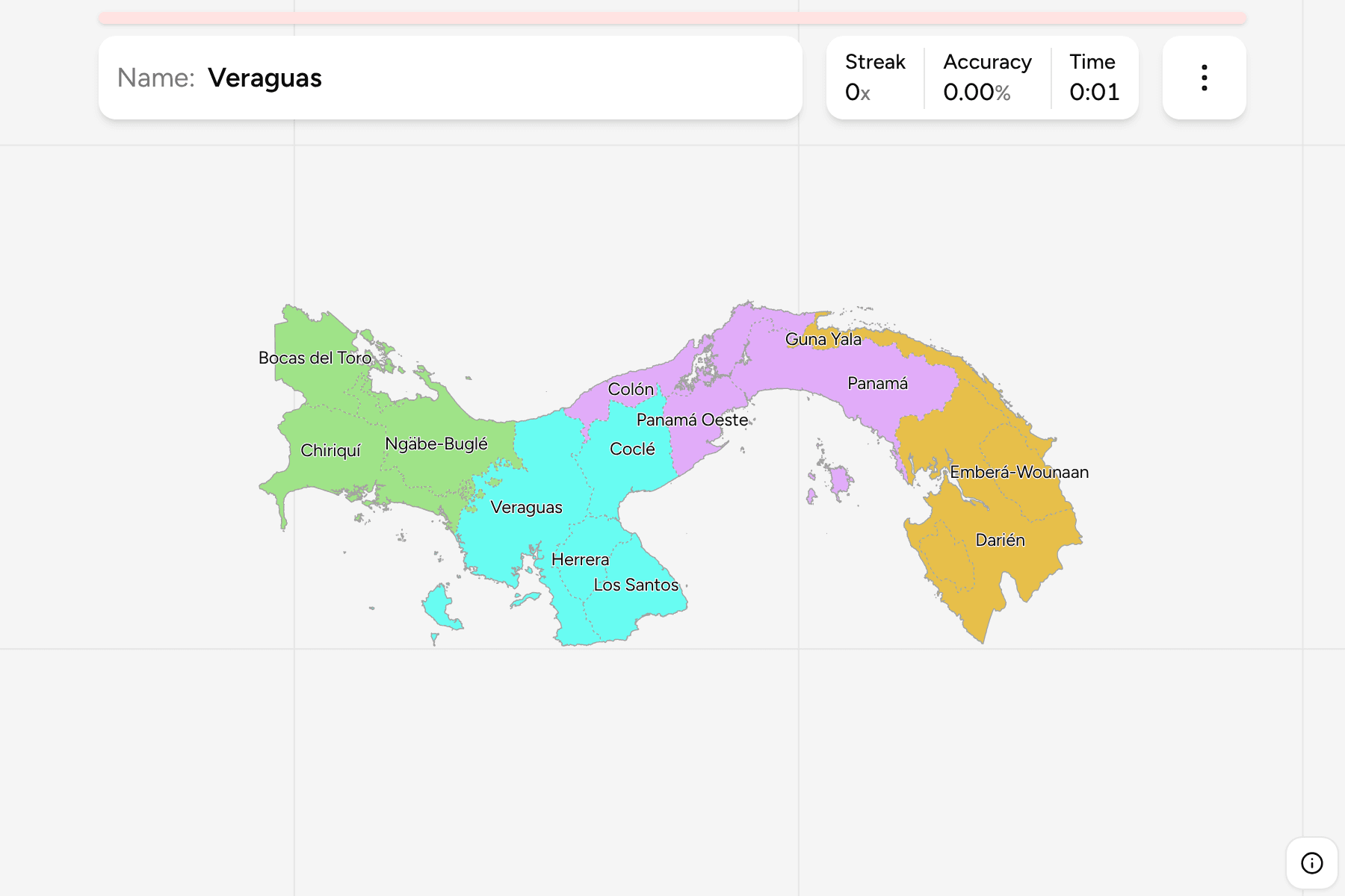
The provinces and the three provincial comarcas of today, named in Spanish. The
map includes Panamá Oeste, which was split off Panamá in 2014 and is missing from
older maps. The comarcas (Guna Yala on the Caribbean coast, Emberá-Wounaan inside
Darién, and Ngäbe-Buglé in the west) are answers like any other, and they are
the ones most often skipped by people who learned the map from an old atlas.
The groups are not an official classification, because Panama publishes none.
They are the four parts the country is usually described in: the west on the
Costa Rican border, the central provinces of the Azuero side, the canal zone
around the capital, and the east towards Colombia. They are a way to learn the
map a piece at a time.
How to place one
- Start with the canal. Colón on the Caribbean and Panamá on the Pacific
face each other across the narrowest part of the country, with Panamá Oeste
on the western bank.
- Find the Azuero peninsula. Herrera and Los Santos fill the rounded bulge
on the Pacific side, with Coclé and Veraguas above and beside it.
- Walk west. Ngäbe-Buglé sits between Veraguas and Chiriquí, and Bocas del
Toro is the Caribbean side of the same mountains.
- Finish in the east. Guna Yala is the long strip along the Caribbean, and
Darién, the largest province, takes up the rest to the Colombian border, with
Emberá-Wounaan inside it.
Every province and comarca, by group
- West3 province or comarcas
- Bocas del Toro, Chiriquí, Ngäbe-Buglé
- Canal3 province or comarcas
- Colón, Panamá, Panamá Oeste
- Central4 province or comarcas
- Coclé, Herrera, Los Santos, Veraguas
- East3 province or comarcas
- Darién, Emberá-Wounaan, Guna Yala
Worked examples
PanamáThe capital's provincePanamá holds the capital on the Pacific mouth of the canal, and stretches east
along the coast towards Darién, which makes it one of the larger provinces.
HerreraThe smallestHerrera is the smallest province, on the eastern side of the Azuero peninsula,
with Los Santos to its south and Coclé to the north.
Guna YalaThe comarca on the CaribbeanGuna Yala is a thin strip of mainland and the San Blas islands along the
Caribbean coast, east of Colón and north of Panamá.
Frequently asked questions
How many provinces does Panama have?
Ten, and three more comarcas with provincial rank, so 13 divisions in the first tier. Panamá Oeste has been the tenth province since 2014.
What is a comarca?
An indigenous territory with its own regional government. Guna Yala, Emberá-Wounaan and Ngäbe-Buglé have the rank of a province, and appear in the game as answers.
Why no districts game?
Panama has created several districts since the national boundary files were drawn, so no source we can use draws the current ones yet.
Sources