Ireland is a country where the county is an identity before it is an
administrative unit. It is what the GAA pitches, the number plates and the
football rivalries are drawn around, and people will tell you what county they
are from before they tell you the town. A round here is a question of which of
the state's counties you are standing in.
- The quiz
- Name to place, on the map
- Grouped by
- Province: the four historic provinces of Ireland
- In the game
- 26 counties
What you are looking at
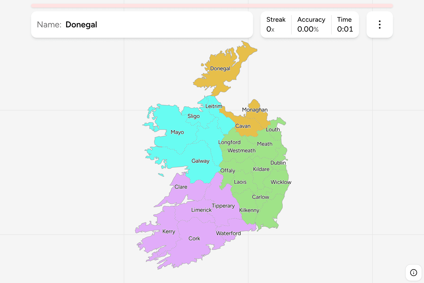
The map is the Republic of Ireland. It leaves out the six counties of Northern
Ireland, which are part of the United Kingdom and are drawn in the UK's games, so
Ulster appears here with only the three counties of it that are in the state.
Dublin is one county on this map, although for local government it has been
four authorities since 1994: Dublin City, Fingal, South Dublin and Dún
Laoghaire-Rathdown. Tipperary is one as well (it was two councils until 2014),
and so are Cork, Galway, Limerick and Waterford, where a city council sits
beside the county council. They are drawn as the counties people mean when they
say the name, so the 26 here are the traditional counties of the state and not
the 31 local authorities.
Cork is the largest by area and Louth the smallest. The local name is a switch
in the start dialog: Cork is Corcaigh, Galway is Gaillimh and Donegal is Dún na
nGall.
How to place one
- Start with the coast. Donegal in the far north, Kerry and Cork in the
southwest, Wexford in the southeast and Dublin on the east coast each tell
you where you are before you have found the county.
- Follow the Shannon. It runs from Leitrim down through Roscommon,
Longford, Offaly, Clare and Limerick, and the counties on either bank are the
spine of the middle of the country.
- Use the provinces. Leinster is the east, Munster the south and southwest,
Connacht the west, and the three Ulster counties are the northern edge.
- Leave the midlands for last. Longford, Westmeath, Offaly, Laois and
Kildare are alike in shape and size, and are easier from the counties
around them.
Every county, by province
- Leinster12 counties
- Carlow, Dublin, Kildare, Kilkenny, Longford, Louth, Laois, Meath, Offaly, Westmeath, Wicklow, Wexford
- Munster6 counties
- Clare, Cork, Kerry, Limerick, Tipperary, Waterford
- Connacht5 counties
- Galway, Leitrim, Mayo, Roscommon, Sligo
- Ulster3 counties
- Cavan, Donegal, Monaghan
Worked examples
CorkThe rebel countyCork is the largest county, filling the south of the island. It reaches from
the Kerry border in the west nearly to Waterford in the east, and Cork city is
the second city of the state.
LongfordA midlands countyLongford is small and landlocked, between the Shannon and the Westmeath and
Cavan borders. It is one of the counties that most often goes wrong in the
midlands, which is why the Shannon is the way in.
Frequently asked questions
How many counties does Ireland have?
Twenty-six in the Republic, and thirty-two on the island once the six of Northern Ireland are counted. This quiz uses the 26 of the state.
Why is Dublin one county here when it has several councils?
Dublin county has been four local authorities since 1994. The quiz asks for the county, which is the unit people mean by Dublin and is the one on the number plates.
Why are there not 31 counties?
Thirty-one is the number of local authorities, which counts the city councils of Cork, Galway, Limerick and Waterford and the three Dublin authorities separately. The county boundaries underneath did not move.
For another country at this level, see Switzerland Cantons
or Belgium Provinces.
Sources