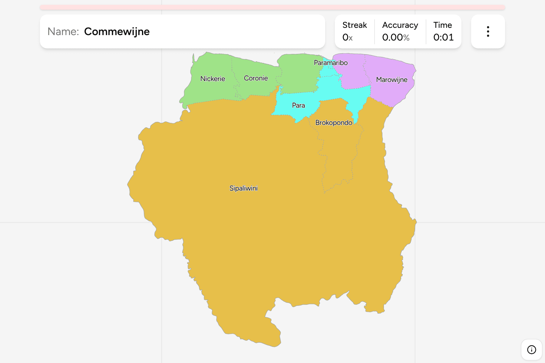
Suriname is the smallest independent country in South America and the only one
where Dutch is the official language, and its districts are the first tier of
the map. There are ten of them, nine along a short coastal strip and one that
fills the whole of the interior.
- The quiz
- Name to place, on the map
- Grouped by
- The west, the Paramaribo area, the east and the interior, an unofficial cut
- In the game
- 10 districts
What you are looking at
The districts (districten) of Suriname, which are also the electoral districts
and the level the country is governed from. Each is divided into resorts, the
second tier, and the districts here are those resorts joined together, so the
borders match Suriname Resorts exactly.
The map is lopsided to an extreme. Sipaliwini takes up more than three quarters
of the country, a block of rainforest and savannah that runs from the Brazilian
border to the Guyanese one and is home to few people. The other nine districts
share a strip along the Atlantic coast that is nowhere much more than a hundred
kilometres deep, and most of the people live in the two smallest of them:
Paramaribo and Wanica.
The groups are not an official classification. Suriname has no tier between the
district and the country, so the quiz cuts the ten into the west coast, the
Paramaribo area, the east and the interior to let you drill the map a piece at a
time.
How to place one
- Start with the big one. Sipaliwini is the whole south and the interior,
and the thing to learn first is that every other district is on the coast or
a short way inland from it.
- Follow the coast from the west. Nickerie borders Guyana along the Corantijn
river, then comes Coronie, then Saramacca, and then the crowded middle.
- Find the capital. Paramaribo is the small district on the Suriname river,
with Wanica wrapped around its south and Para behind them, and Commewijne
across the river to the east.
- Finish in the east. Marowijne runs along the Marowijne river on the border
with French Guiana, and Brokopondo, around the great reservoir, sits inland
between the coast and Sipaliwini.
Every district, by group
- West3 districts
- Coronie, Nickerie, Saramacca
- East2 districts
- Commewijne, Marowijne
- Centre3 districts
- Para, Paramaribo, Wanica
- Interior2 districts
- Brokopondo, Sipaliwini
Worked examples
SipaliwiniMost of the countrySipaliwini is the rainforest interior, and it is larger than the other nine
districts put together several times over. It borders Brazil to the south, and
has the Kabalebo, Tapanahony and Coeroenie rivers draining it.
ParamariboThe capital is a districtParamaribo is the capital and by a long way the smallest district, a few
kilometres across on the Suriname river. Its old centre is a UNESCO World Heritage
site, and it is the one you will most often reach for with a tap area.
BrokopondoThe one around the lakeBrokopondo is named for its reservoir, one of the largest man-made lakes in the
world, made in the 1960s by damming the Suriname river. It is the district just
inland of Para and Saramacca, and the first stop on the way into the interior.
Frequently asked questions
How many districts does Suriname have?
Ten: nine along the coast, and Sipaliwini, which makes up the interior.
Is Paramaribo a district or a city?
Both. The district is the capital and its surroundings, and it is the smallest on the map. The city sits on the Suriname river inside it.
Why are the groups not official?
Suriname has nothing between the districts and the country, so the west, the Paramaribo area, the east and the interior are a way to drill the map, not a classification.
The tier below this one is Suriname Resorts. For another
country in South America, see Bolivia Departments.
Sources