Cyprus is an island in the eastern Mediterranean, south of Turkey and west of
Syria and Lebanon, and a member of the European Union. It is worth knowing on its
own terms: the island is small enough to hold in your head, its six districts are
each named for their main town, and they are the tier that addresses, courts and
election results are organised by.
- The quiz
- Name to place, on the map
- Grouped by
- The west, the centre and north coast, and the east
- In the game
- 6 districts
What you are looking at
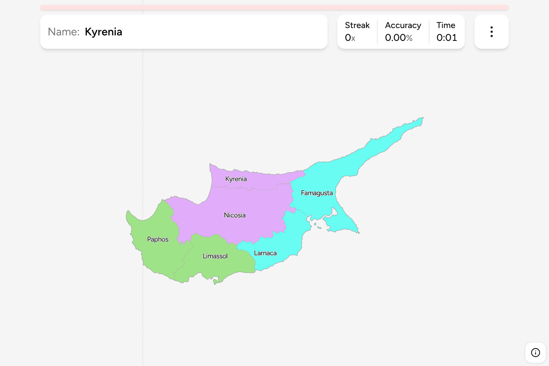
The six districts as the Republic of Cyprus defines them, which together cover the
whole island. The map draws them that way on purpose, so Kyrenia and most of
Famagusta are shown whole even though the Republic has not administered them since
1974. The British Sovereign Base Areas and the United Nations buffer zone are not
cut out of the districts around them.
Nicosia, the capital, sits in the middle of the island and is the largest district.
Paphos holds the west, Limassol the south coast, and Larnaca the south east. The
long finger pointing north east at the end of the island, the Karpas peninsula, is
part of Famagusta.
The groups are not an official classification. They are three pairs that sit
together on the island, and a way to learn the map a piece at a time.
How to place one
- Start with the middle. Nicosia is the broad district across the centre of
the island, and Kyrenia is the narrow strip along the north coast just above it.
- Take the west and south. Paphos is the western end, and Limassol is the
district along the southern coast to its east.
- Finish in the east. Larnaca sits on the south east coast, and Famagusta is
the large district beyond it that runs out to the Karpas peninsula.
Every district, by group
- West2 districts
- Limassol, Paphos
- Centre and north coast2 districts
- Kyrenia, Nicosia
- East2 districts
- Famagusta, Larnaca
Worked examples
NicosiaThe capitalNicosia is the largest district and fills the middle of the island, with Kyrenia
to its north and Larnaca, Limassol and Paphos around its southern and western
edges.
FamagustaThe peninsulaFamagusta is the district that takes in the Karpas peninsula, the long finger at
the north east tip of the island, and its coast faces Syria and Lebanon.
KyreniaThe north coastKyrenia is the narrow strip along the north coast, squeezed between the sea and
the northern edge of Nicosia.
Frequently asked questions
How many districts does Cyprus have?
Six: Nicosia, Limassol, Larnaca, Paphos, Famagusta and Kyrenia. Municipalities and communities divide them further, and this game does not.
Why are Kyrenia and Famagusta drawn in full?
The game draws the districts as the Republic of Cyprus defines them, which cover the whole island. That is a statement about the map and not about who administers which part of it.
Does Cyprus group its districts into regions?
No. The groups here are three pairs of districts that sit together on the island, and they will not match every list you find.
Sources