Fiji is an archipelago of more than three hundred islands, and nearly all of its
people live on two of them: Viti Levu and Vanua Levu. Its fourteen provinces are
the units the country's chiefly system and its administration are organised
around, and the map also has to find Rotuma, a small island dependency with its
own council that lies far to the north of everything else.
- The quiz
- Name to place, on the map
- Grouped by
- The four divisions: Central, Eastern, Northern and Western
- In the game
- 15 provinces
What you are looking at
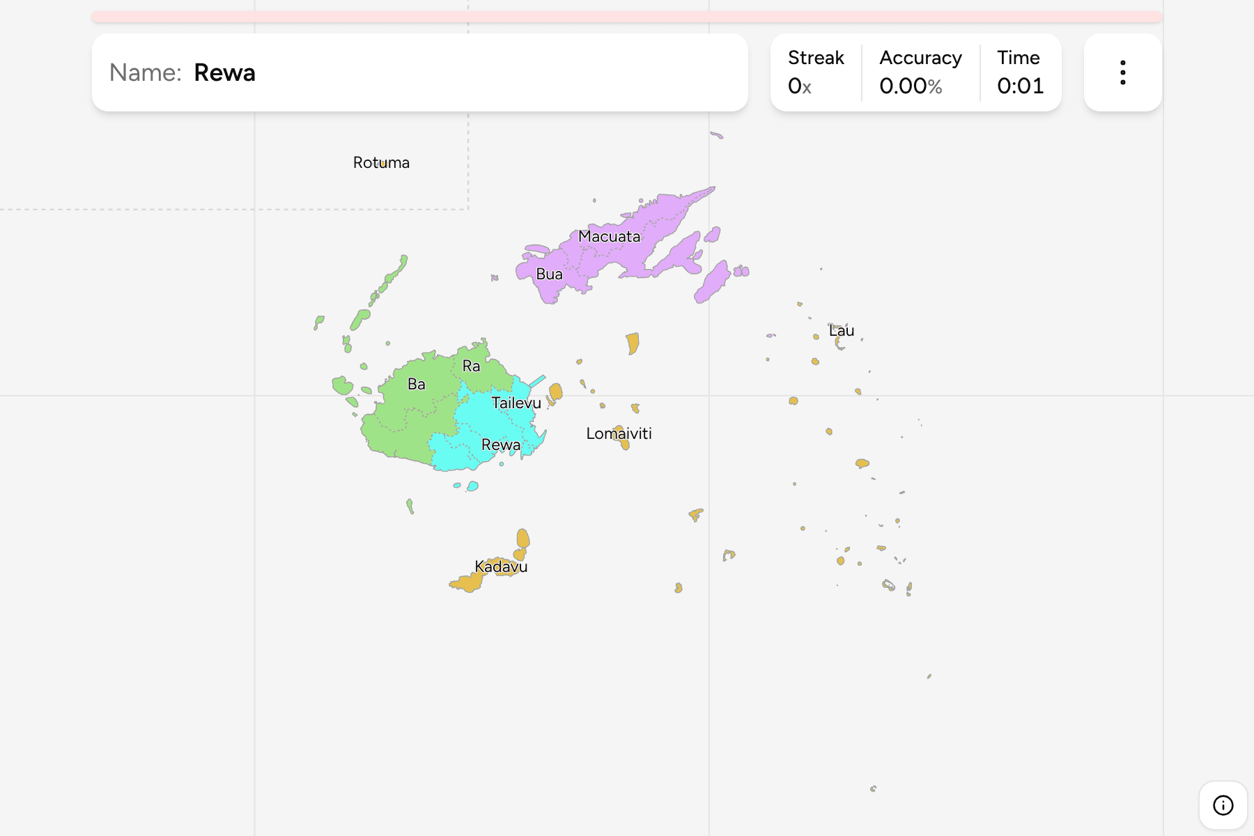
Fiji is governed in four divisions, each a group of provinces. The Western
Division holds the dry side of Viti Levu, the largest island: Ba, Ra and
Nadroga-Navosa. The Central Division is the south-east of Viti Levu around the
capital Suva, which is in Rewa, with Naitasiri, Namosi, Serua and Tailevu. The
Northern Division is Vanua Levu, the second island, split between Bua,
Cakaudrove and Macuata, and Cakaudrove also reaches over to Taveuni. The Eastern
Division is the scattered one: Lomaiviti in the middle of the group, Kadavu to
the south, Lau in the far east and Rotuma away in the north.
Rotuma is not a province. It is a dependency with its own council and a distinct
culture, and the map treats it as the fifteenth area to learn. It lies about
400 kilometres north of Vanua Levu, so the map moves it south into the empty sea
north-west of Vanua Levu and draws a dashed line around it, rather than leaving
most of the frame empty.
Fiji lies across the 180th meridian, so the date line runs through the
province of Cakaudrove and the Lau islands. The map draws them whole, as one
shape, on the eastern side of the world.
How to place one
- Start with Viti Levu. Ba is the north-west, Nadroga-Navosa the south-west
and Ra the north-east of the island. The Central provinces fill the south-east.
- Then Vanua Levu. Bua is the western tip, Macuata the long northern coast
and Cakaudrove the east, with Taveuni beyond it.
- Finish with the islands. Kadavu sits alone to the south, Lomaiviti is the
cluster between the two big islands, Lau is the chain stretching east and
south-east, and Rotuma is the speck inside the dashed line.
Every province, by division
- Western3 provinces
- Ba, Nadroga-Navosa, Ra
- Northern3 provinces
- Bua, Cakaudrove, Macuata
- Central5 provinces
- Naitasiri, Namosi, Rewa, Serua, Tailevu
- Eastern4 provinces
- Kadavu, Lau, Lomaiviti, Rotuma
Worked examples
RewaThe capitalRewa is a small province in the south-east of Viti Levu, and it holds Suva,
the capital and the largest city in the Pacific islands outside Papua New
Guinea.
LauThe far eastLau is dozens of small islands strung out to the east and south-east, a few
across the date line. It has almost no land, so it is a province you place by
the empty sea it takes up.
RotumaThe outlierRotuma is about 400 kilometres north of Vanua Levu, a volcanic island a few
kilometres across. On the map it sits alone inside the dashed line at the top
left, well away from where it is in the real world.
Frequently asked questions
How many provinces does Fiji have?
Fourteen, in four divisions. Rotuma, a dependency with its own council, is not a province but is on the map as well, which is why the game has fifteen areas.
Which province is the capital in?
Suva, the capital, is in the province of Rewa, in the Central Division on the south-east coast of Viti Levu.
Why does the map reach past 180 degrees?
Fiji is on both sides of the antimeridian. The provinces of Cakaudrove, Macuata and Lau cross it, so the map draws the part that falls west of it again on the far side, where it joins the rest.
Sources