Palau is an island country in the western Pacific, about 800 kilometres east of
the Philippines. Sixteen states divide it, and the quiz is less about borders
than about which island a name belongs to: ten states share one big island,
three more cover the islands to its south, and the rest are specks far from
anywhere.
- The quiz
- Name to place, on the map
- Grouped by
- Babeldaob, the southern islands, and the outlying islands
- In the game
- 16 states
What you are looking at
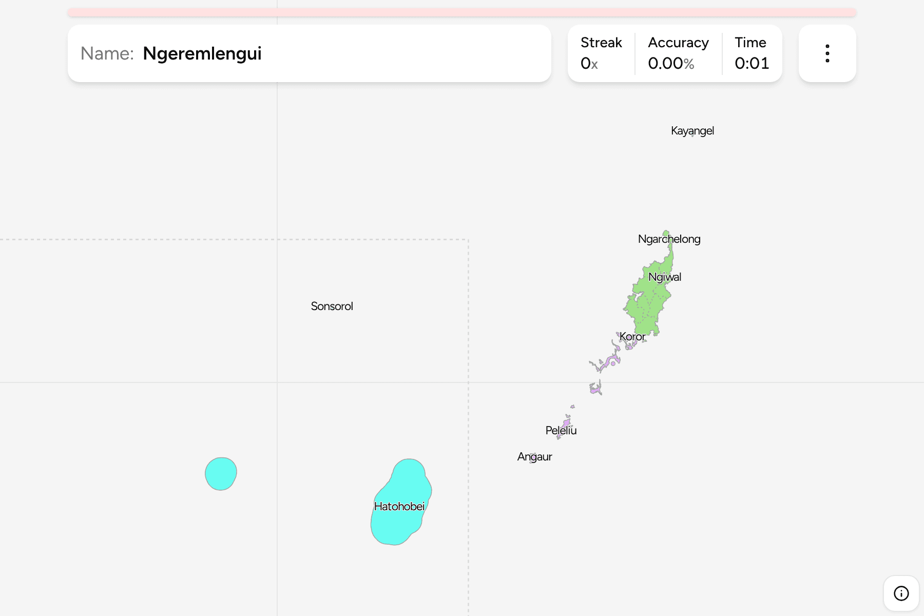
Palau's 16 states. Most of the land is Babeldaob, the largest island, which the
states cut into slices running from the northern tip to the airport in the
south. Koror, the former capital and the biggest town, lies on a cluster of
islands just south of it. Further south are the battlefield island of Peleliu
and the single island of Angaur. Kayangel is a small atoll at the very north.
Two states, Sonsorol and Hatohobei, are the Southwest Islands, which really lie
hundreds of kilometres from the rest, close to Indonesia. So the map can stay
readable, they are drawn in the empty sea west of Peleliu and Angaur, with a
line round them. Their sizes are true, their positions are not.
The groups are not an official classification. They are the ones the geography
makes, and a way to learn the map a piece at a time.
How to place one
- Start with Babeldaob. It is the one large island, and its states are
long slices side by side, so learn them from north to south.
- Find Koror next. It is the cluster of islands just south of Babeldaob.
- Then the southern islands. Peleliu and Angaur sit well apart from
Koror, Peleliu first.
- Leave the specks until last. Kayangel is on the northern edge, and the
Southwest Islands are in the inset.
Every state, by group
- Babeldaob10 states
- Aimeliik, Airai, Melekeok, Ngaraard, Ngarchelong, Ngardmau, Ngatpang, Ngchesar, Ngeremlengui, Ngiwal
- Koror, Peleliu and Angaur3 states
- Angaur, Koror, Peleliu
- Kayangel and the Southwest Islands3 states
- Hatohobei, Kayangel, Sonsorol
Worked examples
KororThe big townKoror is a cluster of islands rather than part of Babeldaob. It is the
commercial centre, and the state that most visitors to Palau stay in.
AngaurThe southern islandAngaur is a single small island at the southern end of the main group, with
no neighbour for kilometres around it.
HatohobeiThe far south westHatohobei is the most remote state, a scatter of reefs and islets near
Indonesia. The map draws it in the inset to the west of the main group.
Frequently asked questions
How many states does Palau have?
Sixteen: ten on Babeldaob, then Koror, Peleliu, Angaur, Kayangel, Sonsorol and Hatohobei.
Why are two states drawn in the sea next to the others?
Sonsorol and Hatohobei lie far to the south west. They are moved beside the other states so that the rest of the country can be shown at a useful size.
Does Palau group its states?
Not in a way this game uses. The groups are Babeldaob, the southern islands and the outlying islands, and they will not match every list you find.
Sources