Lesotho is a mountain kingdom completely surrounded by South Africa, and the
only country in the world whose lowest point is above 1,000 metres. Its ten
districts cover the country without a gap, and nearly all of the people live in
the lowlands along the western border, which is where the smaller districts and
the capital, Maseru, are packed.
- The quiz
- Name to place, on the map
- Grouped by
- The north, the centre and the south
- In the game
- 10 districts
What you are looking at
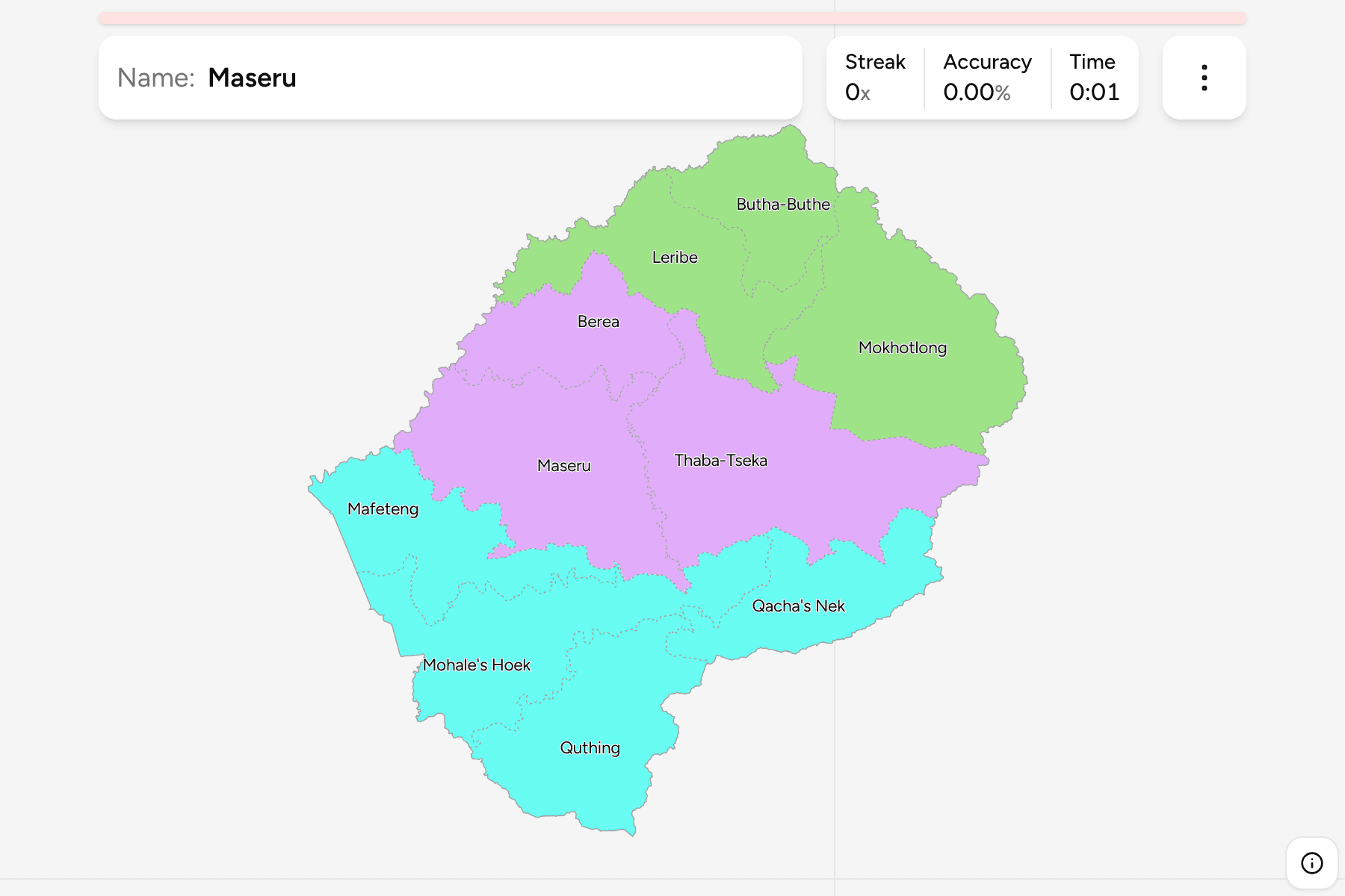
The ten districts of today, named the way Lesotho writes them. The lowland
districts of Maseru, Berea, Leribe and Mafeteng run in a line down the western
edge beside the Free State, while the high districts of Mokhotlong and
Thaba-Tseka fill the Maloti mountains in the east, and are the largest on the
map.
The groups are not an official classification. They are the north, the centre and
the south, a way to learn the map a piece at a time.
How to place one
- Start with the capital. Maseru is the district on the western border,
roughly halfway down.
- Go north along the border. Berea, Leribe and Butha-Buthe follow each
other up the west, with Butha-Buthe in the top corner.
- Find the mountains. Thaba-Tseka and Mokhotlong are the two big eastern
districts, with Mokhotlong in the north east.
- Finish in the south. Mafeteng, Mohale's Hoek and Quthing run down the
border, and Qacha's Nek is the district at the south eastern end.
Every district, by group
- North3 districts
- Butha-Buthe, Leribe, Mokhotlong
- Centre3 districts
- Berea, Maseru, Thaba-Tseka
- South4 districts
- Mafeteng, Mohale's Hoek, Qacha's Nek, Quthing
Worked examples
MaseruThe capitalMaseru sits on the western border, with Berea to its north and Mafeteng to its
south, and holds the capital and the largest share of the population.
Thaba-TsekaThe largestThaba-Tseka is the largest district, a block of high country in the middle of
the country that reaches from the Maloti towards the Drakensberg border.
Qacha's NekThe south eastern cornerQacha's Nek fills the south eastern corner, between Thaba-Tseka above it and
Quthing to its west.
Frequently asked questions
How many districts does Lesotho have?
Ten, and all of them cover land: the game has no territory outside them.
Does Lesotho group its districts into regions?
Not in a way this game relies on. The groups here are the north, the centre and the south, and they will not match every list you find.
Why do the district names look different elsewhere?
Some sources write Mohale's Hoek as Mohales Hoek and Qacha's Nek as Qachas Nek. The game keeps the apostrophe.
Sources