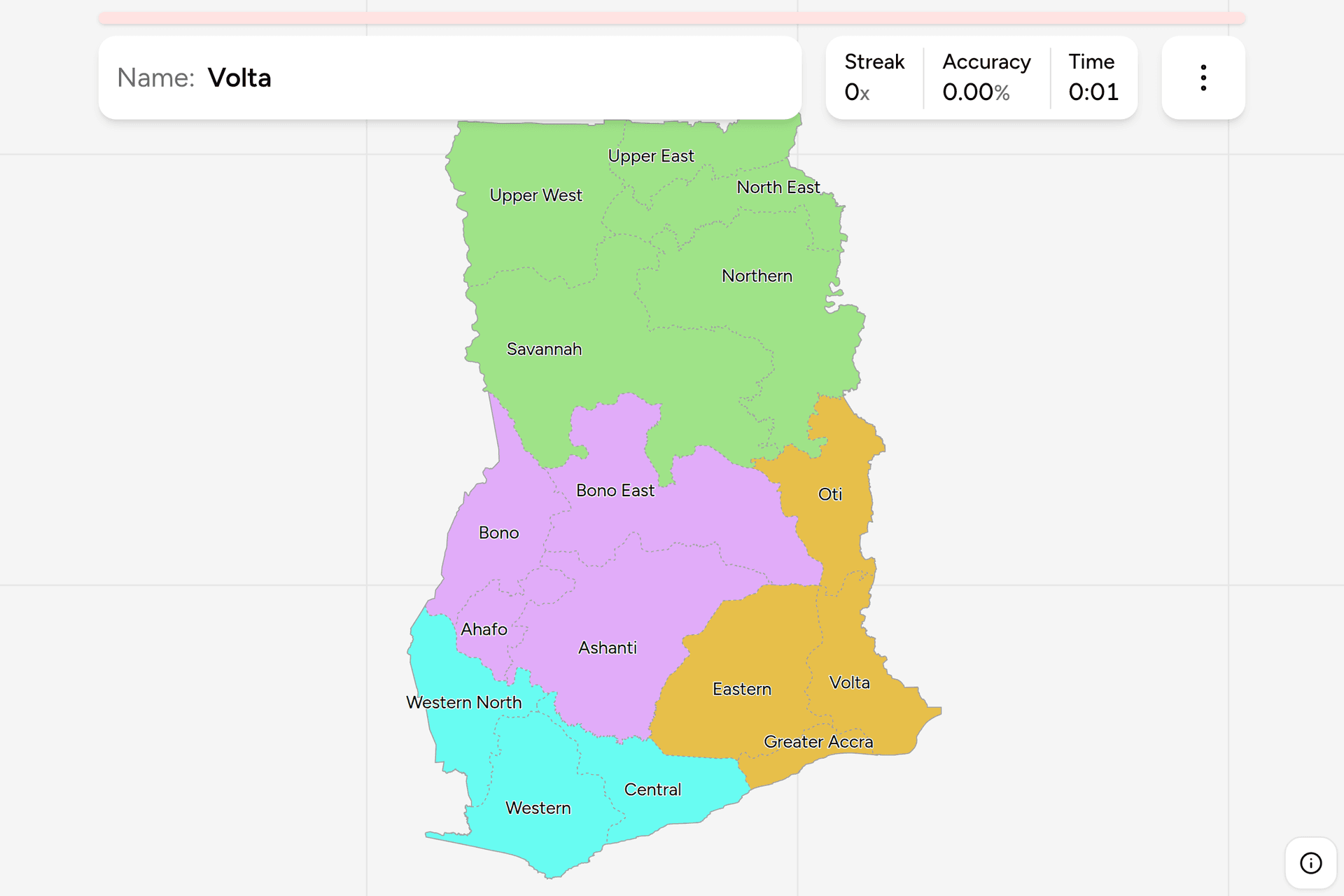
Ghana has 16 regions, and most maps of it still show 10. The country split four
of its regions in 2019, which is recent enough that a great deal of what is
printed, taught and drawn is the old map, and the new names are built out of the
old ones in a way that makes them easy to mix up: Western and Western North,
Northern and North East, Bono and Bono East. This page is all sixteen, the
groups worth learning them in, and what tells you which one you are standing in.
- The quiz
- Name to place, on the map
- Where it helps
- Plate codes, forest versus savannah, coast versus interior
- In the game
- 16 regions
What you are looking at
The region is the top tier of Ghana's administration. Each has a regional
minister appointed by the president and a regional capital, and below it sit the
districts, municipalities and metropolitan areas that actually run local
services. Unlike Tunisia's governorates, only one region, Greater Accra, is
named after its capital: the rest are named for a direction, a river or the
people who live there, so knowing where Tamale is does not tell you that it is
the capital of Northern.
The number that matters is 16. From 1987 until 2019 Ghana had ten regions.
Referendums held in December 2018 approved six new ones, created in February
2019, all by splitting an existing region:
- Northern gave up its west as Savannah and its north east corner as
North East.
- Brong-Ahafo became three: Bono, Bono East and Ahafo. The name
Brong-Ahafo no longer belongs to any region.
- Volta gave up its long northern half as Oti.
- Western gave up its inland north as Western North.
Ashanti, Central, Eastern, Greater Accra, Upper East and Upper West were not
touched. A map with Brong-Ahafo on it, or with Northern running all the way to
the Ivorian border, is a map from before 2019.
A Ghanaian plate names a region. A standard plate opens with a two-letter
code for the region that registered the vehicle, followed by a number and the
last two digits of the year: GR and its variants for Greater Accra, AS for
Ashanti, and so on. The codes were handed out for the ten old regions and a plate
keeps its code for life, so an older car can carry a code for a region that no
longer exists, and BA on a plate says Brong-Ahafo, which is now three regions.
How to place one
- Decide forest or savannah. This is the split that does most of the work.
The south of Ghana is the forest belt: tall trees, cocoa farms, red laterite
earth and hilly roads. North of roughly Kintampo the forest gives way to
savannah, open and flat, with scattered trees, round mud-walled compounds and
a long dry season. Everything in the savannah is one of the five northern
regions or the northern edge of Bono East and Oti.
- Then decide coast or interior. Only four regions touch the sea: Western,
Central, Greater Accra and Volta. If you can see the Atlantic, it is one of
those, and the coast runs west to east in that order.
- Then find Lake Volta. The largest artificial lake in the world by area
runs up the middle of the country and is the boundary between several
regions. East of it are Volta and Oti; on its western shore are Eastern and
Bono East, with the savannah regions at its northern end.
- Then narrow inside the group. The four groups below are three to five
regions each, and each can be switched on and off on its own in the game's
start dialog, which is the fastest way to learn them.
The traps are nearly all in the names.
Western is on the coast and Western North is not. Western runs along the
sea from the Ivorian border to beyond Takoradi; Western North is the forested
strip inland of it, along the same border, with its capital at Sefwi Wiawso.
North East is not the north east corner of the country. It is a band
between Northern and Upper East, reaching the Togolese border, with its capital
at Nalerigu; the corner itself is Upper East. Northern is the larger region below
both of them, around Tamale.
Bono East is not east of Bono in any simple way. Bono sits along the Ivorian
border around Sunyani; Bono East is the much larger region between it and Lake
Volta, around Techiman and Kintampo. Ahafo, the third piece of Brong-Ahafo, is
the small one to the south, next to Ashanti.
Oti is the long thin one. It runs up the Togolese border from the north of
Volta Region to the edge of Northern, and it is the region that most often goes
missing from quizzes, because until 2019 it was the top half of Volta.
Every region, by group
- North5 regions
- North East, Northern, Savannah, Upper East, Upper West
- Middle Belt4 regions
- Ahafo, Ashanti, Bono East, Bono
- West3 regions
- Central, Western North, Western
- East4 regions
- Greater Accra, Eastern, Oti, Volta
Those four groups are this game's, not Ghana's, and they follow one rule:
each is made of whole regions from before 2019. So none of the six new regions
is separated from the region it was cut out of, and a player who knows the old
map of ten finds each new name where its parent used to be. That is why Oti sits
with the East rather than the North, where its latitude would put it: until 2019
it was Volta.
The North is the savannah: the old Northern Region, now Northern, Savannah
and North East, with Upper East and Upper West above them. It holds about two
fifths of the country's land and a little under a fifth of its people. The
Middle Belt is Ashanti and the old Brong-Ahafo, which is the forest heartland
around Kumasi shading into savannah at its northern edge. The West is Western,
Western North and Central: the coast from the Ivorian border to beyond Cape
Coast, and the cocoa and gold country behind it. The East is Greater Accra,
Eastern, Volta and Oti: the capital, the hills and the Akosombo dam behind it,
and everything east of Lake Volta up to the border with Togo.
Worked examples
SavannahThe largest, and one of the newestSavannah: the whole west of the old Northern Region, from the Black Volta and
the Ivorian border across to the western shore of Lake Volta, with its capital
at Damongo. It is the largest of the 16 by some way and among the least
populated, and it holds Mole National Park, the country's largest. If you are
in open savannah in the west of Ghana and it is not up against Burkina Faso,
this is the likeliest answer.
OtiThe one most maps are missingOti: the long strip up the Togolese border, from the north of Volta Region to
the edge of Northern, with its capital at Dambai on the lake. It was the
northern half of Volta until 2019, and it is the region to check any Ghana map
against: a map with no Oti on it is a map of the ten regions.
Greater AccraThe smallest, and the capitalGreater Accra: a short stretch of coast around Accra and Tema, much the
smallest region on the map and, with Ashanti, one of the two most populous.
It is the easy answer for anything unmistakably metropolitan, and the coastal
plain here is
flatter and drier than anywhere else on the Ghanaian coast, with grassland and
scrub rather than forest behind the beaches.
Frequently asked questions
How many regions does Ghana have?
16, since February 2019. Before that Ghana had ten regions, from 1987 onwards. Referendums in December 2018 approved six new regions, all created by splitting existing ones: Savannah and North East out of Northern, Bono East and Ahafo out of Brong-Ahafo (the remainder of which was renamed Bono), Oti out of Volta, and Western North out of Western.
What are the capitals of Ghana's regions?
Accra (Greater Accra), Kumasi (Ashanti), Cape Coast (Central), Koforidua (Eastern), Sekondi-Takoradi (Western), Sefwi Wiawso (Western North), Ho (Volta), Dambai (Oti), Sunyani (Bono), Techiman (Bono East), Goaso (Ahafo), Tamale (Northern), Damongo (Savannah), Nalerigu (North East), Bolgatanga (Upper East) and Wa (Upper West).
Do Ghanaian number plates show the region?
Yes. A standard Ghanaian plate opens with a two-letter code for the region the vehicle was registered in, then a number, then the last two digits of the year of registration. GR and related codes are Greater Accra and AS is Ashanti, for example. The codes were assigned for the ten regions that existed before 2019, and a plate keeps its code, so older cars can carry codes for regions that have since been split.
What happened to Brong-Ahafo?
It was split into three regions in 2019. The part around Sunyani kept the older name Bono, the larger eastern part around Techiman and Kintampo became Bono East, and the smaller southern part next to Ashanti became Ahafo. No current region is called Brong-Ahafo.
Which is the largest region of Ghana, and which the smallest?
Savannah, in the north west, is the largest by area. Greater Accra is much the smallest, and is also one of the two most populous regions, alongside Ashanti. The five northern regions together cover about two fifths of the country and hold a little under a fifth of its population.
Which Ghanaian regions are easiest to confuse?
The pairs whose names were built out of each other in 2019: Western and Western North, Bono and Bono East, and Northern and North East. North East is especially misleading, since it is not in the north east corner of the country: Upper East is. Upper East and Upper West are the other obvious pair: both border Burkina Faso, and Upper West is the one whose western edge is the Black Volta.
What language are road signs in Ghana?
English, which is Ghana's official language. Place names are in the local languages, so the words on a sign are English and the names on it are Akan, Ewe, Ga, Dagbani and many others, and the names themselves are often the best clue to which part of the country you are in.
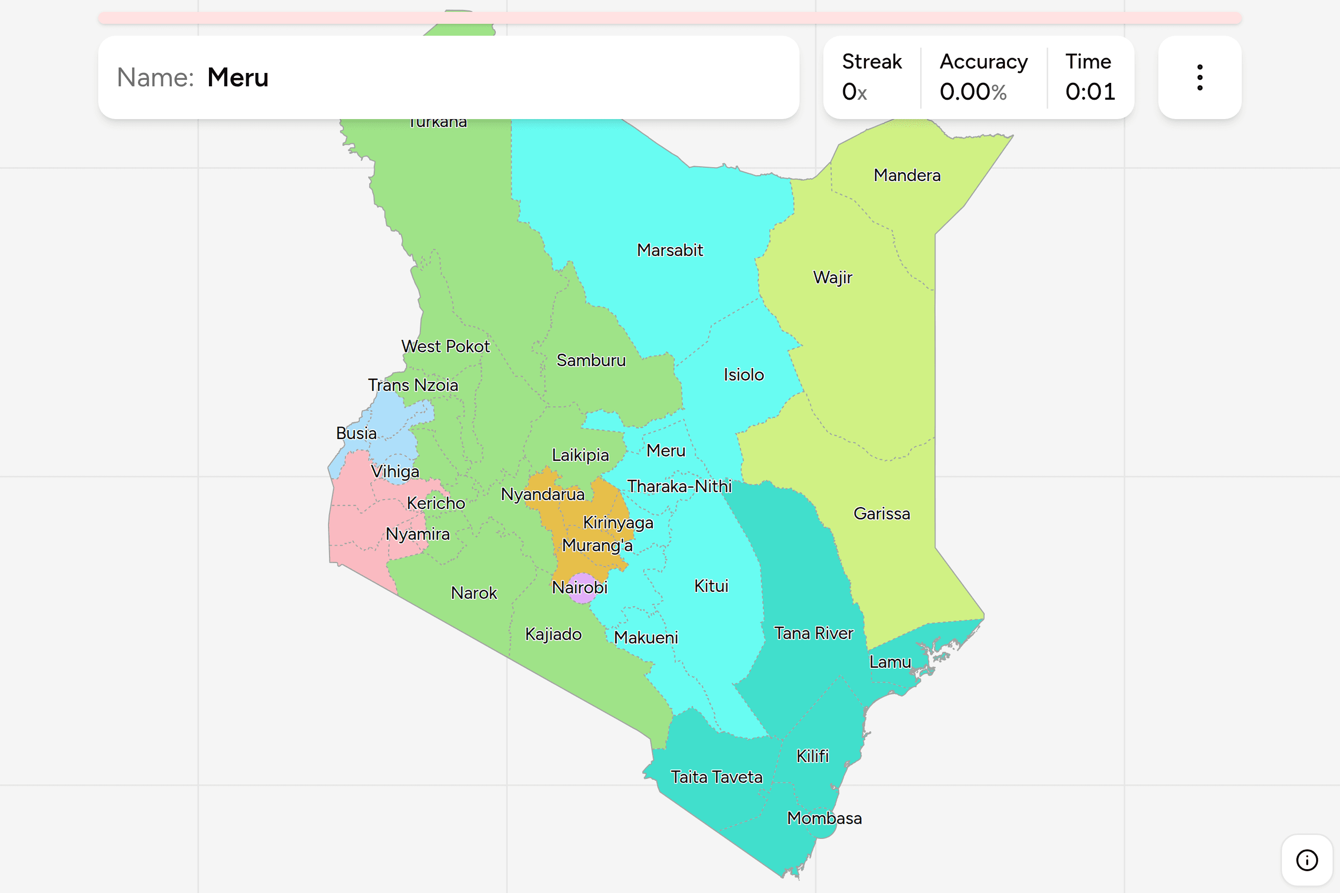
The other African trainers here are Nigeria States, Kenya
Counties, Egypt Governorates, Morocco
Regions, Tunisia Governorates,
South Africa Provinces and South Africa Dialing
Codes. For administrative maps of a similar size,
try Germany States, Poland
Voivodeships and UK
Nations and Regions.
Sources