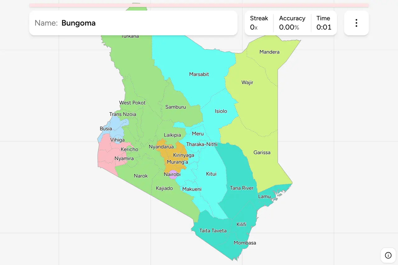
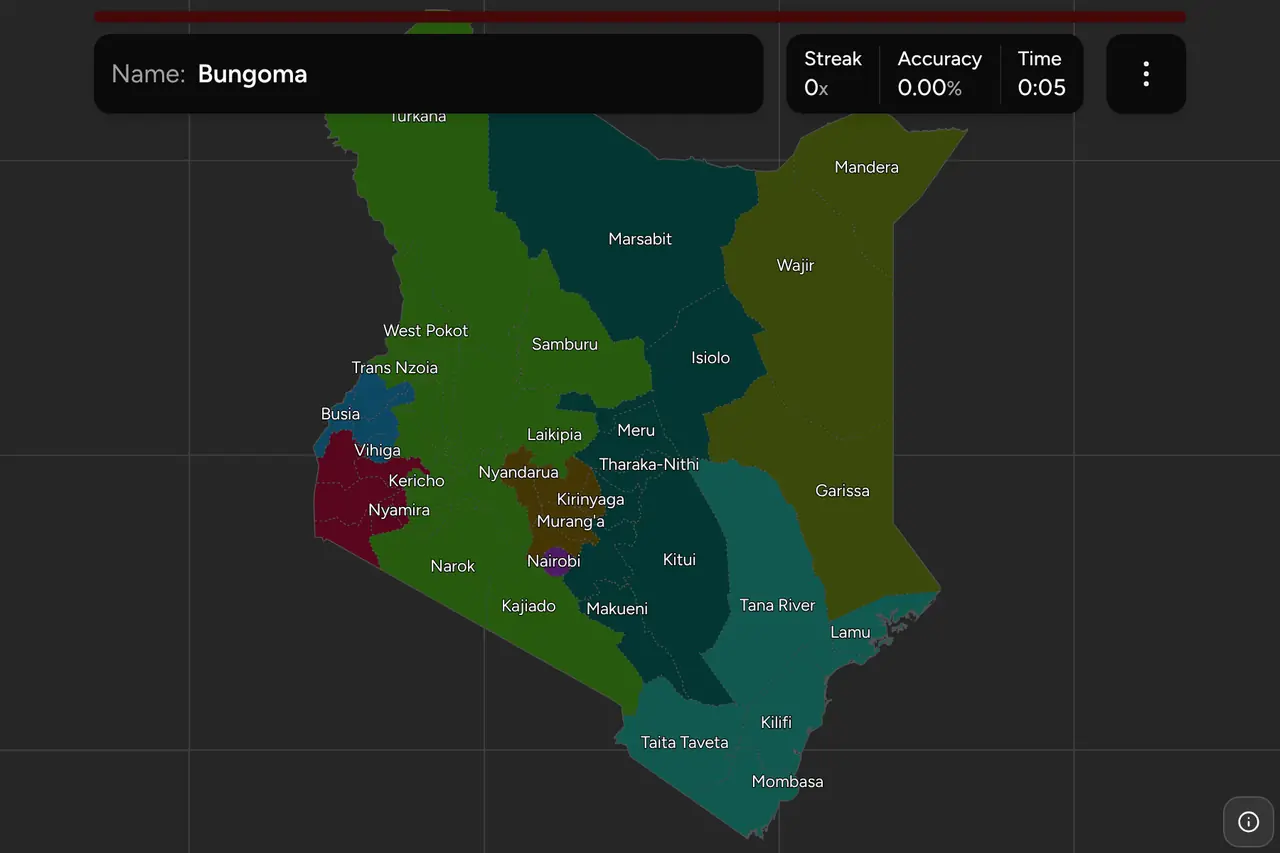
Kenya does not write the county on its number plates, so the name you get in a
round comes off a sign: a county government's logo on a health centre, a welcome
board at a boundary, a distance sign to the next town. That leaves one question,
and it is the hard half: where is that county? This page is all 47 of them,
grouped the way Kenyans still group them, and the game asks you to put each name
on the map.
- The quiz
- Name to place, on the map
- Where it helps
- County signage, town names, road signs
- In the game
- 47 counties
What you are looking at
Kenya has been run by 47 counties since March 2013, and by very little else at
the local level. The 2010 constitution abolished the eight provinces and handed
the counties a governor, an assembly, a budget and a long list of devolved
functions: health, roads below the trunk network, agriculture, water, markets.
That is why the names are worth learning. Devolution put each county's name and
crest on the things a camera sees, which the provinces never did: dispensaries,
water tanks, cattle dips, market sheds, boda boda stages, county road works
signs and the welcome board at every boundary.
The counties are not new lines on the map. The constitution's First Schedule
defined them as the districts as they stood in 1992, which is why the shapes look
older than the institution and why so many of them are still called after the
district town at their centre. What changed in 2013 was which of those units
mattered.
The plate is not the clue here, and it is worth saying because it is in
Kenya's neighbourhood of the map. A Kenyan plate is white at the front and yellow
at the back with a three letter, three digit, one letter registration, and the
letters run in national sequence rather than by county: a KDA car is a car
registered when the KDA series was current, not a car from anywhere in
particular. The county name has to come from something else.
What it usually comes from is a town. Kenyan road signs are in English and give
you the next town and the distance to it, and most counties are named after
theirs. That shortcut breaks in exactly the places you are most likely to
recognise, which is what the section below is for.
How to place one
- Get the climate band first. Kenya splits three ways and the split is
visible from the road. The high country either side of the Rift is green,
steep, densely settled and planted to tea, coffee and maize on small plots
with red soil. The north and east are open, sandy and thinly settled, running
from thorn scrub to something close to desert past Isiolo. The coast is a
third thing again: coconut palms, coral rag, makuti roofs and Swahili
architecture, in a strip perhaps eighty kilometres deep.
- Then find the Rift. The Rift Valley floor is the single most identifying
piece of Kenyan landscape: a flat trough with a wall of escarpment on either
side, soda lakes along the bottom, and a distinct thorny scrub on the floor
even where the highlands above it are green. Standing in it, or looking down
into it, puts you in a narrow band of counties.
- Then read the language on informal signage. English and Swahili are on
everything official. What varies is the shopfronts and the church boards:
Kikuyu around Mount Kenya, Luo on the Lake Victoria shore, Kalenjin through
the western highlands, Kamba east of Nairobi, and Somali with Arabic script
in the three counties of the north east.
- Then narrow inside the old province. The eight below are the shape most
Kenyans still carry, and each is small enough to work through: three counties
in North Eastern, four in Western, five in Central. Getting the old province
right is most of the score.
The traps here are almost all names, and there are three kinds.
Towns that are not their county's namesake. Eldoret is in Uasin Gishu,
Kitale is in Trans Nzoia, Iten is in Elgeyo-Marakwet, Kapsabet is in Nandi, Voi
is in Taita Taveta, Thika is in Kiambu and Naivasha is in Nakuru. Each of those
towns is better known than the county that holds it, so a sign pointing at one is
only useful if you know the pairing.
Names that start the same way. Nyeri, Nyandarua and Nyamira are three
different counties, and Nyanza is a province rather than a county at all. Kisii
and Kisumu are neighbours in the same corner. Kilifi and Kwale are both on the
coast and sit either side of Mombasa. Marsabit and Migori are at opposite ends of
the country.
Names that are something else first. Turkana is a lake, a people and the
second largest county. Lamu is an island, an archipelago and a county. Mombasa is an
island, a city and the smallest county on the map.
Every county, by old province
- Rift Valley14 counties
- Baringo, Bomet, Elgeyo-Marakwet, Kajiado, Kericho, Laikipia, Nakuru, Nandi, Narok, Samburu, Trans Nzoia, Turkana, Uasin Gishu, West Pokot
- Nairobi1 county
- Nairobi
- Eastern8 counties
- Embu, Isiolo, Kitui, Machakos, Makueni, Marsabit, Meru, Tharaka-Nithi
- Central5 counties
- Kiambu, Kirinyaga, Murang'a, Nyandarua, Nyeri
- Coast6 counties
- Kilifi, Kwale, Lamu, Mombasa, Taita Taveta, Tana River
- Nyanza6 counties
- Homa Bay, Kisii, Kisumu, Migori, Nyamira, Siaya
- Western4 counties
- Bungoma, Busia, Kakamega, Vihiga
- North Eastern3 counties
- Garissa, Mandera, Wajir
Those are the eight provinces Kenya was divided into from independence until
2013, and they have no legal existence now. They have everything else. Kenyans
place each other by them, weather bulletins and election coverage are read out by
them, and the regional coordinators the national government still posts around
the country work to roughly the same map. Each can be switched on and off on its
own in the game's start dialog, which makes North Eastern a three county drill
and Central a five.
Two of the eight need a note. Rift Valley is not a region so much as a third
of the country: fourteen counties, from Turkana on the South Sudan border to
Kajiado on the Tanzanian one, holding both the driest and some of the wettest
land in Kenya. If one province is worth drilling on its own, it is this one.
Nairobi was a province of exactly one district and is now a county of exactly
one county, which is why it is a single name in the list. The city has been
administered apart from the districts around it since the colonial period, and
it is the only place on this map where the county boundary is a city boundary.
Worked examples
MombasaThe smallest one, and the easiest to nameMombasa: an island, the bridges and causeways onto it, and not much else. It
is the smallest county in Kenya by a wide margin, well under half the size of
the next smallest, and it is the one target here you are more likely to miss
by tapping than by not knowing. Zoom in before you tap. Everything around it,
north and south along the same coast, is Kilifi or Kwale.
NairobiThe one that is only a cityNairobi: the capital, its own county, and its own province before that. On the
map it is the small block in the south centre, wrapped by Kiambu to the north
and west, with Machakos to the east and Kajiado to the south. It is worth
knowing as a landmark rather than as an answer, because every county in the
crowded middle of this map is easier to place once you have found it.
TurkanaThe big one in the cornerTurkana: the second largest county in Kenya after Marsabit next door, in the
far north west, along the west shore of the lake of the same name and up to
the South Sudan and Uganda borders. Hot, low, arid and thinly settled, with a
landscape nothing like the highlands a hundred and fifty kilometres to the
south. It is the county on this map most easily named from its outline alone,
which makes it a useful anchor for the north.
Frequently asked questions
How many counties does Kenya have?
47. They were created by the 2010 constitution and became the unit of local government after the March 2013 election, replacing the eight provinces and the districts under them. The number has not changed since, and the constitution's First Schedule fixed each county's boundary as that of the district as it stood in 1992.
What were the eight provinces of Kenya?
Central, Coast, Eastern, Nairobi, North Eastern, Nyanza, Rift Valley and Western. They ran from independence until 2013 and were abolished with devolution, but they are still how the country is described in conversation, in weather bulletins and in election coverage. Every county sits inside exactly one of them, because the counties were built out of the districts the provinces contained, and this game lets you drill one province at a time.
Do Kenyan number plates show the county?
No. A Kenyan civilian plate is white at the front and yellow at the back, with a registration of three letters, three digits and a final letter. The letter series runs in national sequence and records roughly when a vehicle was registered rather than where, so a plate will not place you. Government vehicles carry a GK prefix on a red plate, which tells you it is a state vehicle and nothing about the county.
How do you tell which county you are in?
Read the signage. Since devolution the county government's name and crest appear on health centres, water points, market buildings, boda boda stages and road works, and a boundary is usually marked by a welcome sign naming the county you are entering. Failing that, use the next town on a road sign: most counties are named after their main town, though a good number of the best known towns are not, Eldoret in Uasin Gishu and Kitale in Trans Nzoia among them.
Which Kenyan counties are easiest to confuse?
Nyeri, Nyandarua and Nyamira, which start the same way and are not neighbours: the first two are in the old Central province and the third is by Lake Victoria. Kisii and Kisumu, which are near each other and sound alike. Kilifi and Kwale, which sit north and south of Mombasa on the same coast. And Marsabit with Migori, which are about as far apart as two Kenyan counties can be.
Which is the largest county in Kenya, and which the smallest?
Marsabit, in the arid north, is the largest by area, with Turkana beside it a close second, and Mombasa on the coast is the smallest by a wide margin. By population the order is different again: Nairobi is by far the most populous and Lamu the least, which is worth knowing because population is what decides how much of a county you will ever see from a road.
The other African trainers here are Nigeria States, South
Africa Provinces and South Africa Dialing
Codes. For administrative maps of a similar size,
try Philippines Provinces, Turkey
Provinces and Spain Provinces.
Sources