Malawi is a long, narrow country that follows the western shore of Lake Malawi
for most of its length, so a round there is usually decided by where along that
strip you are. Its 28 districts are the unit that matters: they are what the
country's roads, hospitals and elections are organised by, and what a signpost
or a local gives as the answer to "where are you from".
- The quiz
- Name to place, on the map
- Grouped by
- Region: the three of the country
- In the game
- 28 districts
What you are looking at
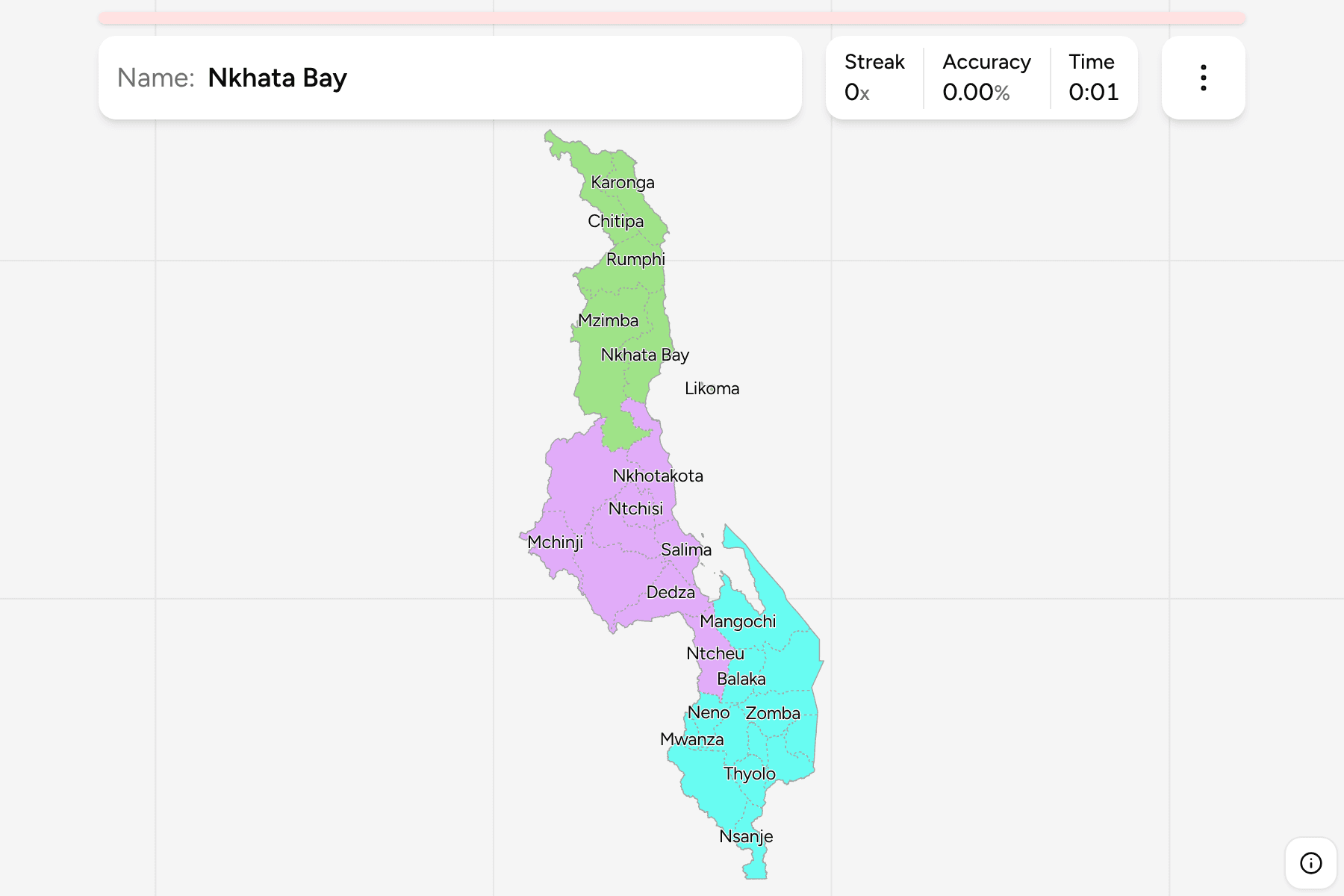
The districts of Malawi as they stand today, including Neno, the most recent
addition, which was cut out of Mwanza in the south. Several districts share the
name of the city inside them: Lilongwe, Blantyre and Zomba are
the ones to know.
They run from very large to very small. Mzimba and Kasungu are broad blocks of
the north and centre, while Likoma, an island in the lake that belongs to Malawi
although it lies off the Mozambican coast, is a few square kilometres. Small
districts get a tap area so they can be hit on a phone.
The groups are the three regions, so the game lets you drill one at a time.
How to place one
- Learn the regions first. The Northern Region is the thin top of the
country, the Central Region holds the capital Lilongwe, and the Southern
Region is the widest part, around Blantyre.
- Follow the lake. Karonga, Nkhata Bay, Nkhotakota, Salima and Mangochi
line the shore from north to south, and give you the order of the east side.
- Leave the south for last. The district map around Blantyre, Thyolo,
Mulanje and Phalombe is the busiest and most mistakes happen there.
Every district, by region
- Northern Region6 districts
- Chitipa, Karonga, Likoma, Mzimba, Nkhata Bay, Rumphi
- Central Region9 districts
- Dedza, Dowa, Kasungu, Lilongwe, Mchinji, Nkhotakota, Ntcheu, Ntchisi, Salima
- Southern Region13 districts
- Balaka, Blantyre, Chikwawa, Chiradzulu, Machinga, Mangochi, Mulanje, Mwanza, Neno, Nsanje, Phalombe, Thyolo, Zomba
Worked examples
LikomaThe islandLikoma is the district that sits in the lake itself, off the Mozambican
shore, and it is the one to look for last on the east side.
LilongweThe capitalLilongwe is the district of the capital, in the middle of the Central Region
and the hub the north to south road passes through.
ChitipaThe far northChitipa is the top of the country, a district against the Tanzanian and
Zambian borders, and a landmark for finding the whole Northern Region.
Frequently asked questions
How many districts does Malawi have?
28, spread over the three regions.
Which region is each district in?
The quiz groups them by region, so you can drill one at a time.
Is Lake Malawi part of the map?
The lake itself is left blank. The districts are drawn along its shore, and Likoma Island, which sits in it, is its own district.
Sources