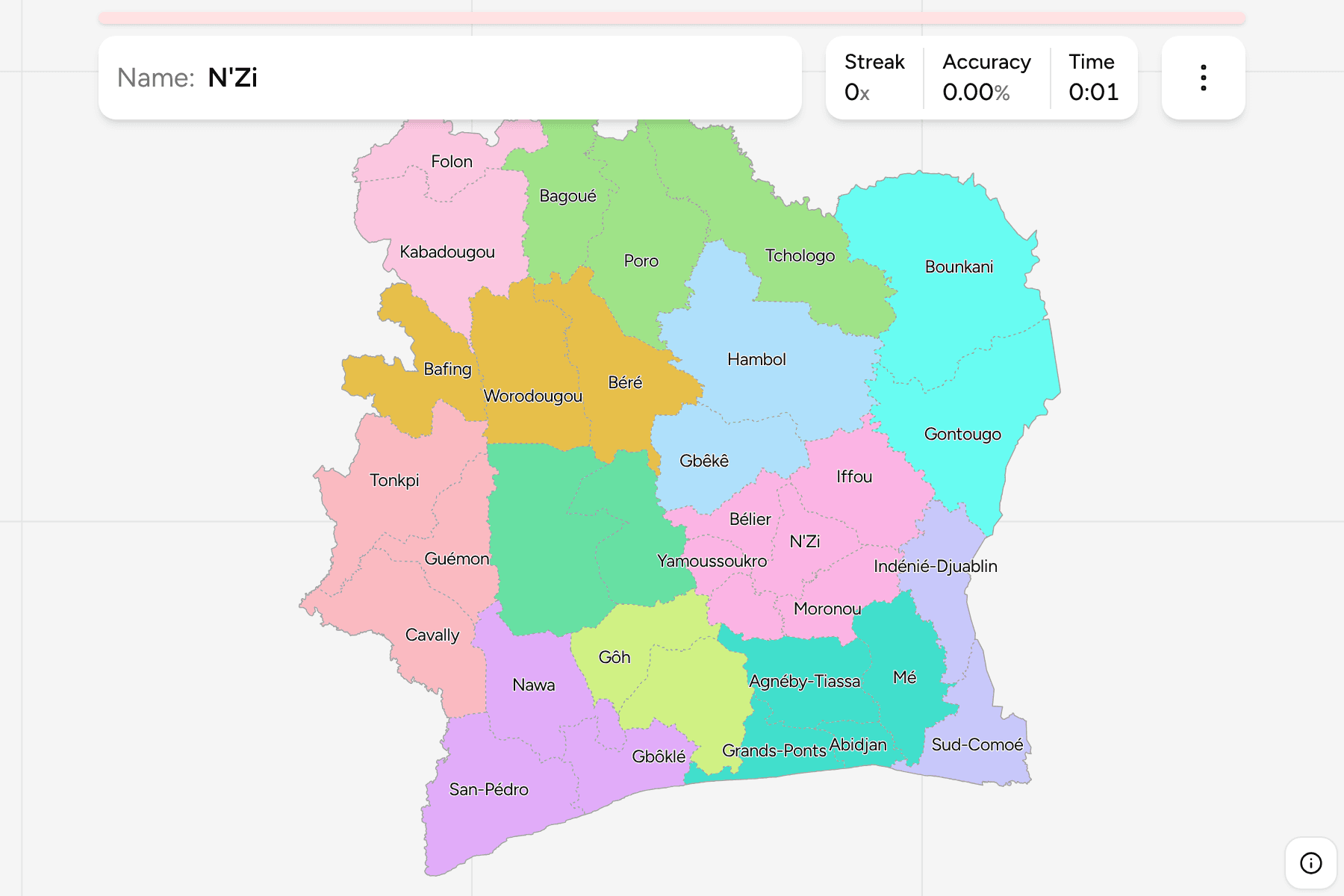
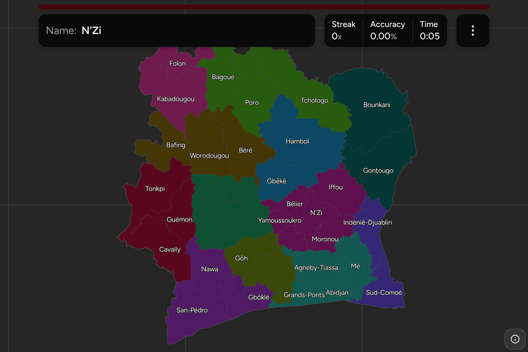
Côte d'Ivoire is divided into 31 regions and two autonomous districts, and that
is the map most people can't draw: a country the size of Germany with Abidjan
and Yamoussoukro as the only names that travel. The regions are named for
rivers, mountains and peoples as often as for towns, so knowing where a town is
does not always tell you which region it governs. This page is all 33, the 12
districts to learn them in, and the changes that make older maps wrong.
- The quiz
- Name to place, on the map
- Where it helps
- Cocoa belt versus savanna, the lagoon coast, the western mountains
- In the game
- 33 regions
What you are looking at
The 31 regions are the second tier of the country's administration, set up in
2011 under the 14 districts above them. Two of those districts, Abidjan and
Yamoussoukro, are autonomous: a single city each, with no regions inside
them, and they are the two smallest areas on the map. This game asks for the 31
regions and both cities, so the answer is always one of 33.
Ivory Coast and Côte d'Ivoire are the same country. The government has
asked since 1986 that the French name be used in every language, and it is the
official one, so the region names here are written the way the country writes
them, accents included.
The number that matters is 31. Before 2011 the country had 19 regions, so a
map older than that, or one printed from an older dataset, draws bigger regions
with different names. The 2011 reform made the districts and regions the
two tiers an official map uses today.
How to place one
- Find the lagoon coast first. Abidjan is the city on the coast, in the
south east. Grands-Ponts, Mé and Agnéby-Tiassa are the three regions around
it, and Sud-Comoé is the one that reaches the Ghana border.
- Then the cocoa belt and the south west. Nawa, Gbôklé, San-Pédro and
Cavally run along and inland from the coast in the south west, towards the
Liberian border. Haut-Sassandra and Marahoué are the forest and cocoa regions
behind them.
- Then the capital in the middle. Yamoussoukro, the political capital, sits
in the centre, and Bélier, N'Zi, Marahoué and Gôh are the regions that touch
it.
- Then the north. Savanes holds Bagoué, Poro and Tchologo along the Mali
and Burkina Faso border, with Denguélé above Woroba in the north west, and
Zanzan holds the two big regions of the north east.
- Then narrow inside the group. The 12 groups below can each be switched on
and off in the start dialog, which is the fastest way to learn them.
The traps are the neighbours that share a name with their district, and the
few regions that are bigger than a district.
Savanes, Zanzan and Montagnes are districts, not regions. The district is
the group of regions, and the game asks for the regions inside it. Bounkani and
Gontougo fill Zanzan, and Tonkpi, Guémon and Cavally make up Montagnes.
Bélier is in two pieces. The Yamoussoukro district sits in the middle of it,
which leaves the region as a northern and a southern half either side of the
capital.
The two cities are in a group, but are not regions. Abidjan is drawn with
the Lagunes group and Yamoussoukro with Lacs, which is where each sat before
2011.
Every region, by group
- Savanes3 regions
- Bagoué, Poro, Tchologo
- Bas-Sassandra3 regions
- Gbôklé, Nawa, San-Pédro
- Zanzan2 regions
- Bounkani, Gontougo
- Woroba3 regions
- Bafing, Béré, Worodougou
- Lagunes4 regions
- Abidjan, Agnéby-Tiassa, Grands-Ponts, Mé
- Montagnes3 regions
- Cavally, Guémon, Tonkpi
- Vallée du Bandama2 regions
- Gbêkê, Hambol
- Gôh-Djiboua2 regions
- Gôh, Loh-Djiboua
- Sassandra-Marahoué2 regions
- Haut-Sassandra, Marahoué
- Lacs5 regions
- Bélier, Iffou, Moronou, N'Zi, Yamoussoukro
- Comoé2 regions
- Indénié-Djuablin, Sud-Comoé
- Denguélé2 regions
- Folon, Kabadougou
The groups are the 14 districts of the 2011 reform, with the two
autonomous cities folded into the districts around them. A district is the
tier a national map is usually coloured by, so what you learn here carries to
any map of the country.
Worked examples
BounkaniThe largestBounkani: the whole north east corner, bordering Ghana and Burkina Faso. It is
the largest region on the map by a wide margin, and a quiet one, with Comoé
National Park, one of the largest protected areas in West Africa, taking up a
big part of it. Its capital is Bouna.
AbidjanThe smallest, and the biggest cityAbidjan: a strip of land on the lagoon coast, the economic capital and the
largest city of the country. It is an autonomous district rather than a region,
and it is among the smallest areas on the map, so if the picture is a port,
towers and a lagoon crossed by bridges, this is the answer.
YamoussoukroThe capital that isn't the cityYamoussoukro: the political capital since 1983, in the middle of the country,
with the Basilica of Our Lady of Peace. It is the other autonomous district and
it cuts Bélier in two.
Frequently asked questions
How many regions does Côte d'Ivoire have?
31 regions, plus the two autonomous districts of Abidjan and Yamoussoukro, which this game also asks for, so 33 in all. They are grouped into 14 districts. Before 2011 the country had 19 regions, and older maps still show them.
What is the difference between a district and a region?
The district is the top tier and the region sits inside it. Twelve of the 14 districts hold two to four regions each, and the other two, Abidjan and Yamoussoukro, are autonomous districts that are a city and nothing more.
Is the capital Abidjan or Yamoussoukro?
Yamoussoukro has been the political capital since 1983, and Abidjan, on the lagoon coast, is the economic capital and the largest city. Most embassies and businesses are still in Abidjan.
Is it Ivory Coast or Côte d'Ivoire?
Both name the same country. Côte d'Ivoire is the official French name, and the government has asked since 1986 that it be used in every language. Maps in English often still say Ivory Coast.
Why are the groups different from the districts on other maps?
Abidjan and Yamoussoukro are districts on their own, one city each. A group of one city is not much to learn from, so this game puts Abidjan in the Lagunes group and Yamoussoukro in Lacs, the districts around them.
For other West African maps, try Ghana Regions, whose eastern
border Côte d'Ivoire shares, and Senegal Regions. For another
set of second tiers, Tunisia Governorates.
Sources