Botswana is a landlocked country in southern Africa, bordered by Namibia,
Zambia, Zimbabwe and South Africa, and most of its surface is the Kalahari. Its
ten districts cover the country without a gap, and they are the tier that the
census, the road numbering and most of the country's own addresses are written
against. Nearly everyone lives in a thin strip along the eastern border, which
is why the districts are so unevenly sized.
- The quiz
- Name to place, on the map
- Grouped by
- The South East, the Kalahari, the North West and the North East
- In the game
- 10 districts
What you are looking at
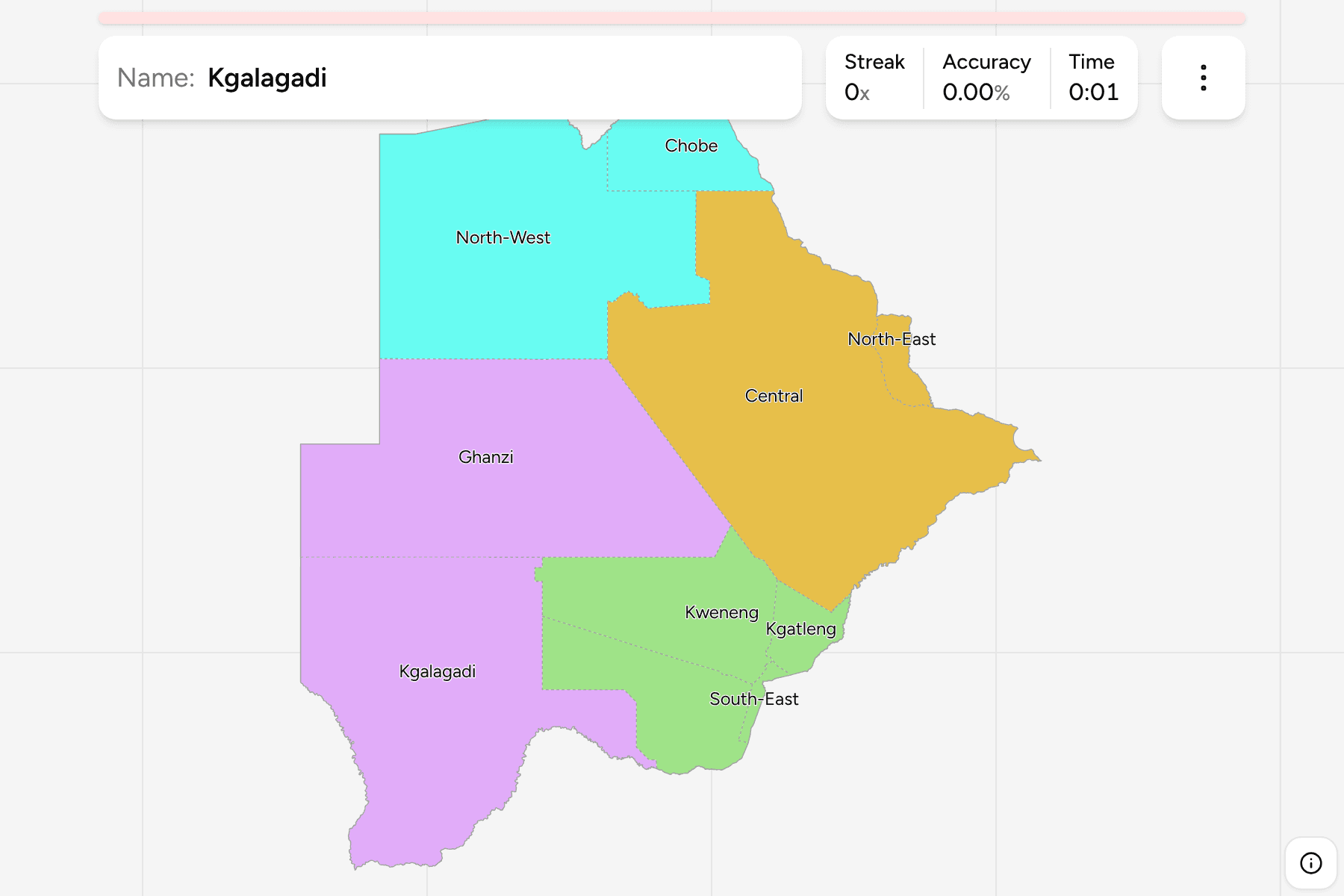
The ten districts of today, named without the word "District" that the official
list adds to each. Gaborone, the capital, is in the South East District, a small
district packed against the South African border, with Kgatleng just north of it
and Kweneng to the west. At the other extreme, Central is the largest by far and
Ghanzi, Kgalagadi and North-West are each many times the size of the whole
south east.
The groups are not an official classification. They are the four parts the
country is usually described in, and a way to learn the map a piece at a time:
the crowded South East, the Kalahari in the west, the North West around the
Okavango and Chobe, and the North East.
How to place one
- Start in the corner. South-East, Kgatleng and Kweneng are the small
districts on the eastern border, with Southern wrapping round them to the
west and south.
- Take the empty west. Kgalagadi runs along the southern border with South
Africa, and Ghanzi sits above it against Namibia.
- Go up the middle. Central is the broad district that fills the east from
the Kweneng line to the Zimbabwe border, and North-East is the small one
above it.
- Finish at the top. North-West holds the Okavango Delta, and Chobe is the
short district at the very top, where four countries meet near the Zambezi.
Every district, by group
- South East4 districts
- Kgatleng, Kweneng, South-East, Southern
- Kalahari2 districts
- Ghanzi, Kgalagadi
- North West2 districts
- Chobe, North-West
- North East2 districts
- Central, North-East
Worked examples
South-EastThe capitalSouth-East is a small district on the South African border, and it holds
Gaborone. Kgatleng is its northern neighbour and Southern the one to its west.
CentralThe largestCentral is the largest district, a broad block across the east of the country
that reaches from the Kweneng line in the south to the Zimbabwe border, with
North-East on its northern edge.
ChobeThe northern tipChobe is the short district at the top of the country, where it meets Zambia,
Zimbabwe and the Caprivi Strip of Namibia, with North-West below it.
Frequently asked questions
How many districts does Botswana have?
Ten, and all of them cover land: the game has no territory outside them. Councils and sub-districts divide them further, and this game does not.
Does Botswana group its districts into regions?
Not in a way this game relies on. The groups here are the four parts the country is commonly described in, and they will not match every list you find.
Why does the map not show Gaborone's city boundary?
The game draws the districts, and Gaborone lies inside the South-East District rather than being a district of its own.
Sources