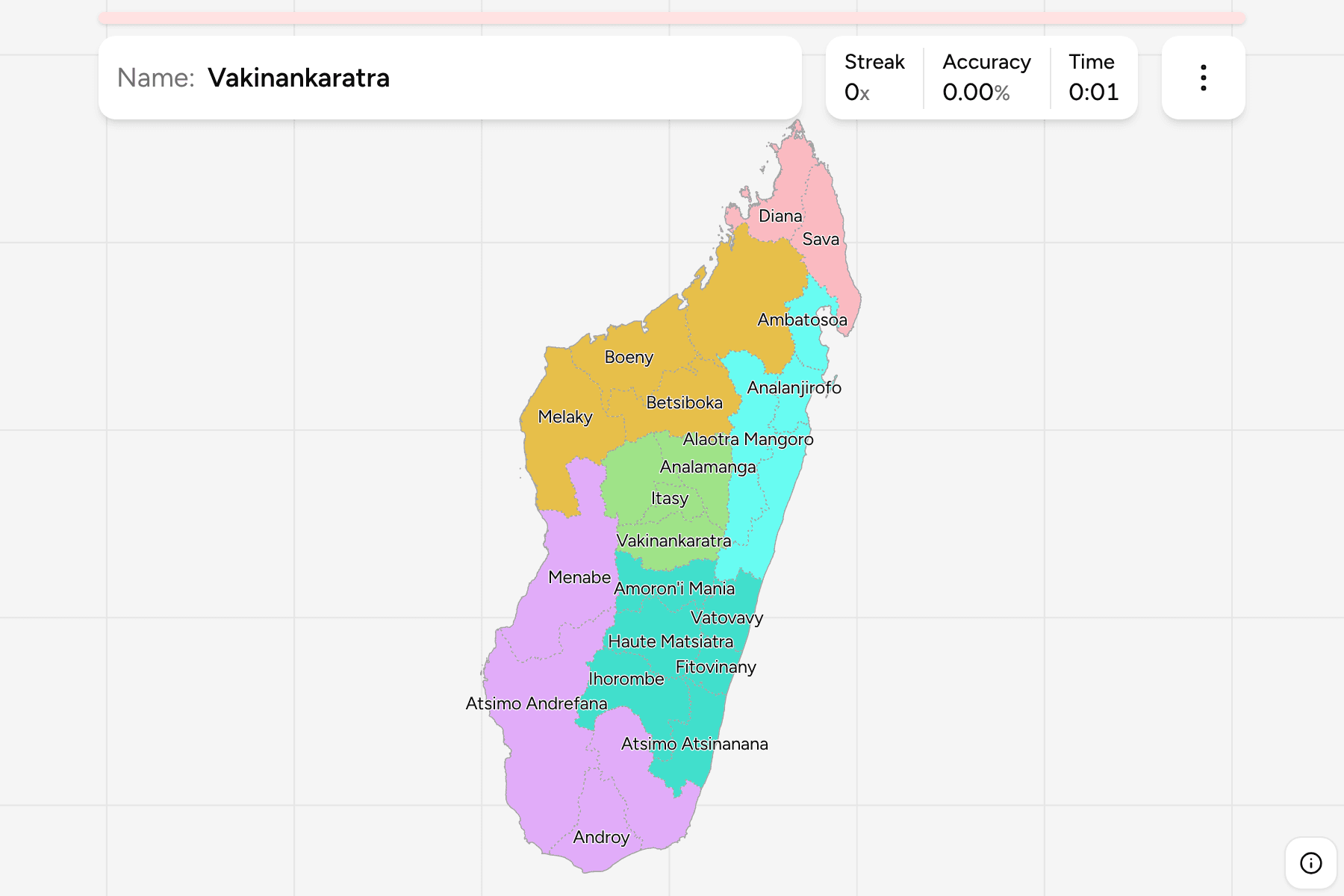
Madagascar is an island of 590,000 square kilometres, and its regions are what
anyone there uses to say where something is: Analamanga for the capital,
Atsimo Andrefana for the dry south west, Sava for the vanilla coast. The list
has grown since many maps were drawn, so one that is more than a few years old
is likely to be missing a region.
- The quiz
- Name to place, on the map
- Grouped by
- The six old provinces: Antananarivo, Antsiranana, Fianarantsoa, Mahajanga, Toamasina and Toliara
- In the game
- 24 regions
What you are looking at
The regions (faritra) of Madagascar, the first tier of the country. Each is
named for something in it: a river, a lake, a plain or a people. Several names
are a direction on a shared stem, such as Atsimo Atsinanana and Atsinanana, or
Atsimo Andrefana, so learn them in pairs.
The newest on the map is Ambatosoa, cut from Analanjirofo in the north east.
The file draws all 24, where the older sources still draw fewer.
The groups are the six provinces the island was divided into until 2009. They
are no longer an administrative level, but they are still how regions are
placed in conversation, which is why they make a good way to learn the map one
piece at a time. The regions are the Madagascar Districts
grouped, so the borders of the two maps match exactly.
How to place one
- Start with the highlands. Analamanga, Vakinankaratra, Itasy and
Bongolava form the block around the capital.
- Run down the east coast. From Sava and Analanjirofo through Atsinanana to
Vatovavy, Fitovinany and Atsimo Atsinanana, the regions are a row of coastal
strips.
- Read the west as large and dry. Sofia, Boeny, Melaky and Menabe are broad
and run to the Mozambique Channel.
- Finish in the south. Atsimo Andrefana, Androy and Anosy hold the spiny
forest and the southern tip.
Every region, by province
- Antananarivo4 regions
- Analamanga, Bongolava, Itasy, Vakinankaratra
- Toliara4 regions
- Androy, Anosy, Atsimo Andrefana, Menabe
- Toamasina4 regions
- Alaotra Mangoro, Ambatosoa, Analanjirofo, Atsinanana
- Mahajanga4 regions
- Betsiboka, Boeny, Melaky, Sofia
- Fianarantsoa6 regions
- Amoron'i Mania, Atsimo Atsinanana, Fitovinany, Haute Matsiatra, Ihorombe, Vatovavy
- Antsiranana2 regions
- Diana, Sava
Worked examples
Atsimo AndrefanaThe biggest of themAtsimo Andrefana is the largest region, filling the south west from the
Mozambique Channel to the plateau.
ItasyThe smallest of themItasy is the smallest region, in the highlands west of the capital, around the
lake it is named for.
AmbatosoaThe newest of themAmbatosoa was made in 2021 from the northern part of Analanjirofo, around
Maroantsetra and the Masoala peninsula.
Frequently asked questions
How many regions does Madagascar have?
24 on this map, which includes Ambatosoa, the newest.
What happened to the provinces?
The six provinces were abolished as an administrative level in 2009. They are used here as groups because they are still how people place a region.
What is below the region?
The districts, which number 120 on this map. They are their own quiz.
The tier below this one is Madagascar Districts. For
another country at this level, see Kenya Counties.
Sources