Morocco puts its administrative geography in front of a camera more readily than
most countries: the number plate ends in a province code, the signs are written
in two alphabets and often three, and the landscape changes character every
hundred kilometres of the drive south. What makes the regions hard is that they
are new. Morocco replaced sixteen regions with twelve in 2015, and a great deal
of what is written about the country, including some of the map data, still
draws the old ones. This page is the twelve that exist, the groups worth
learning them in, and what puts you inside one.
- The quiz
- Name to place, on the map
- Where it helps
- Plate province codes, road signs, landscape bands
- In the game
- 12 regions
What you are looking at
Morocco has been divided into twelve regions since 2015. The reform that made
them was not a tidying up: it cut sixteen regions to twelve, moved provinces
across the new lines, and gave what was left elected regional councils with
budgets of their own, in a country where the region had until then been mostly
an administrative convenience drawn on top of the provinces. The first councils
under the new map were elected that September.
The consequence for anybody learning them is that the old sixteen are still
everywhere. Meknes-Tafilalet, Chaouia-Ouardigha, Doukkala-Abda, Tadla-Azilal,
Gharb-Chrarda-Beni Hssen: all of those were regions within living memory and
none of them is one now. If a map you are learning from has Grand Casablanca on
it as a region the size of a city, it is a decade out of date.
Below the regions sit the provinces and prefectures, which is the tier the
number plate actually encodes, and below those the communes. A region is the
largest unit under the state, run by an elected council alongside a wali
appointed from Rabat.
Most of the names are cities, and the exceptions are the useful part. Seven
of the twelve are simply their principal cities strung together with hyphens,
which makes them easy once you know where the cities are. The other five are
not, and each of them is named after a piece of geography instead: the Oriental
is a direction, Souss-Massa is two rivers, Draa-Tafilalet is a river valley and
an oasis belt, and the two Saharan regions pair a city with a historic
territory. The trap that follows is the obvious one. Agadir is the largest city
in Souss-Massa and is nowhere in its name, and Ouarzazate is the same story in
Draa-Tafilalet.
How to place one
- Read the band of landscape first. Morocco runs through five of them, in
order from the north, and each is a handful of regions wide. The Rif is
steep, wet, limestone and densely farmed, dropping to a Mediterranean coast.
The Atlantic plains behind Rabat and Casablanca are flat, intensively
cultivated and where most Moroccans live. The Middle Atlas is cedar forest
and pasture at altitude, green and cold in winter. The High Atlas is the
wall, with snow on it for much of the year. South and east of that everything
is arid: stone hamada, palm oases along the valleys, pisé architecture the
colour of the ground it is built from, and eventually the flat emptiness of
the Sahara.
- Then read the signs, which are worth more here than in most countries.
Moroccan direction signs carry Arabic and a Latin transcription, usually the
French spelling, and newer ones add Tifinagh, the angular Amazigh alphabet
that looks like nothing else on a road sign anywhere. Tifinagh is a good
Morocco tell against Algeria and Tunisia. Road numbers help too: A for the
motorways, N for the national roads, R for regional, P for provincial.
- Then take the province code off a plate. A Moroccan civilian plate is
white with black characters and comes in three groups: a serial number, a
single Arabic letter, and a one or two digit number that is the province or
prefecture. That number is the strongest single clue in the country, and it
does not answer this quiz on its own, because there are several times more
provinces than regions. It narrows you to a province and you still have to
know which region holds it.
- Then narrow inside the group. The four groups below are small enough to
work through one at a time, and three of the four are three regions each.
The traps are mostly cities and mostly the same shape: a place far better known
than the region that contains it.
Famous towns in unexpected regions. Chefchaouen, the blue one, is in
Tanger-Tetouan-Al Hoceima. Ifrane, the one with the alpine chalets, is in
Fes-Meknes. Essaouira is in Marrakech-Safi rather than with Agadir down the
coast. El Jadida is in Casablanca-Settat. Merzouga and its dunes, and Ait
Benhaddou and the film studios at Ouarzazate, are all in Draa-Tafilalet.
Two regions on the Algerian border. The Oriental runs the length of the
northern half of that border and Draa-Tafilalet takes the southern half, so
"near Algeria" is not an answer. The split is roughly the High Atlas: north of
it and you are in the Oriental, south or east of it and you are in
Draa-Tafilalet.
One tree that answers on its own. Argan grows wild essentially nowhere but
southwestern Morocco. A hillside of short, gnarled, olive-ish trees with goats
in them is Souss-Massa or the Essaouira end of Marrakech-Safi, and almost
nothing else.
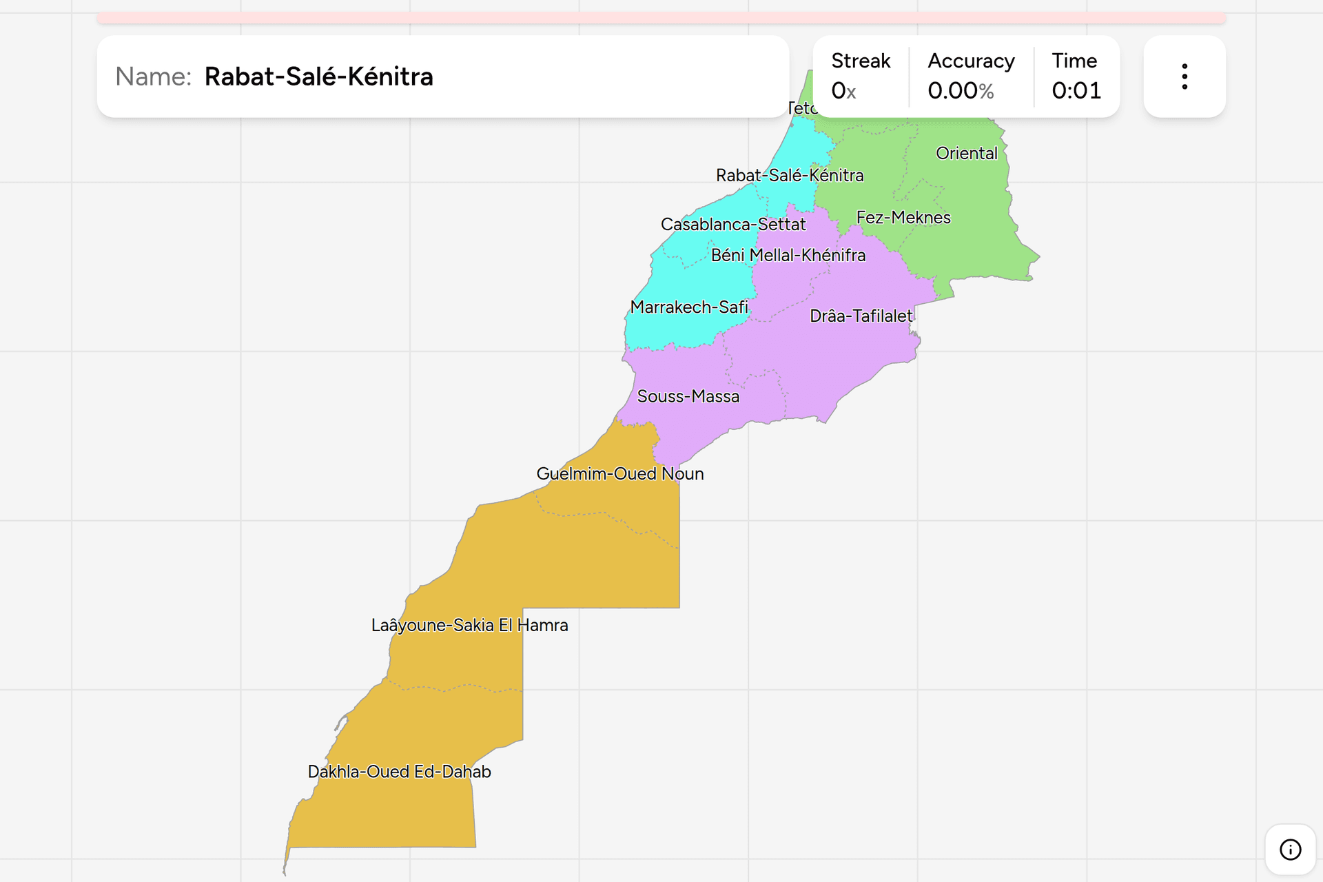
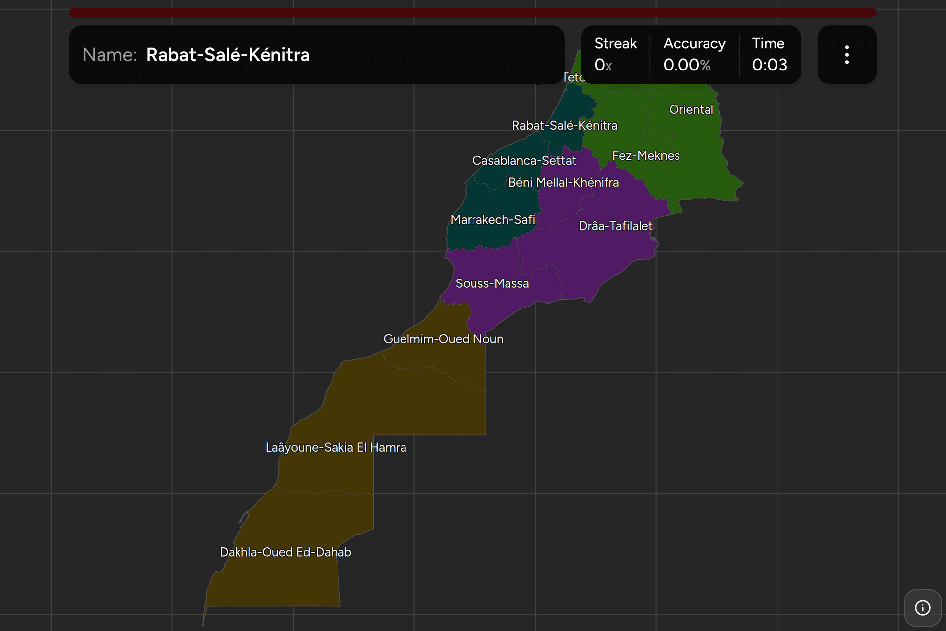
Every region, by group
- North3 regions
- Tangier-Tetouan-Al Hoceima, Oriental, Fez-Meknes
- Atlas3 regions
- Béni Mellal-Khénifra, Drâa-Tafilalet, Souss-Massa
- Atlantic3 regions
- Rabat-Salé-Kénitra, Casablanca-Settat, Marrakech-Safi
- South3 regions
- Guelmim-Oued Noun, Laâyoune-Sakia El Hamra, Dakhla-Oued Ed-Dahab
Those four groups are this site's, not Morocco's. Unlike the Dutch
landsdelen or the old Kenyan provinces, there is no official tier above the
twelve regions to borrow, so the cut above is one made for drilling: each group
is contiguous, each is a piece of the country somebody could point at, and each
can be switched on and off on its own in the game's start dialog.
North is the Rif and the country behind it: the Mediterranean coast, the
Oriental along the Algerian border, and the Saiss plain with Fes and Meknes on
it. Atlas is the three regions the mountains run through, from the Middle
Atlas down the far side of the High Atlas to the Souss valley between the High
Atlas and the Anti-Atlas. Atlantic is the coastal plain, which is the
smallest of the four by area and holds the capital, the largest city and much of
the population. South is Guelmim-Oued Noun and the two Saharan regions below
it, which between them are about two fifths of the map and carry a small
fraction of its people.
Worked examples
Souss-MassaThe one named after rivers instead of its citySouss-Massa: Agadir, Taroudant, Tiznit and the Souss valley running inland
between the High Atlas and the Anti-Atlas. It is the region most likely to be
answered wrongly as "Agadir", which is not a region and never has been. The
giveaway on the ground is the argan, which grows here and in almost nowhere
else on earth, and the second giveaway is the valley itself: flat, irrigated
and citrus-planted, with mountains on both horizons.
Tangier-Tetouan-Al HoceimaThe smallest one, at the top of the mapTanger-Tetouan-Al Hoceima: the whole Mediterranean coast and the Rif behind
it, from Tangier at the strait east to Al Hoceima. It is the smallest of the
twelve by area and the one most often lost under the score panel, so zoom in
before you tap. It is also the wettest and steepest part of Morocco, with a
Mediterranean feel the rest of the country does not have, and it holds
Chefchaouen, which people reliably place somewhere else.
Drâa-TafilaletThe one that is all valleys and no coastDraa-Tafilalet: the only region of the twelve with no sea at all, running
along the southern side of the High Atlas from Ouarzazate east through Tinghir
and Errachidia to the dunes at Merzouga. Everything about it is arid and
linear: oases strung along the Draa and the Ziz, kasbahs in rammed earth, and
a landscape of dark stone between them. If you have come down over the Atlas
and the ground has turned red and empty, you are almost certainly here.
Frequently asked questions
How many regions does Morocco have?
12, since the 2015 regionalisation reform, which replaced the 16 regions in place since 1997. The twelve have elected regional councils and a wali appointed by the king, and they sit above the provinces and prefectures, which are the tier a number plate encodes. Any map showing 16 Moroccan regions, including several widely used boundary datasets, is drawing the country as it was before 2015.
What were the 16 regions of Morocco before 2015?
Tanger-Tetouan, Gharb-Chrarda-Beni Hssen, Taza-Al Hoceima-Taounate, Oriental, Fes-Boulemane, Meknes-Tafilalet, Rabat-Sale-Zemmour-Zaer, Grand Casablanca, Chaouia-Ouardigha, Doukkala-Abda, Marrakech-Tensift-Al Haouz, Tadla-Azilal, Souss-Massa-Draa, Guelmim-Es Semara, Laayoune-Boujdour-Sakia El Hamra and Oued Ed-Dahab-Lagouira. Only the Oriental survived the reform with both its name and roughly its shape.
Do Moroccan number plates show the region?
No, they show the province or prefecture, which is the tier below. A civilian plate is white with black characters and carries a serial number, a single Arabic letter and a one or two digit number that identifies the province. There are far more provinces than regions, so the number narrows you considerably but you still need to know which region the province belongs to. Diplomatic, military and temporary plates use different colours and formats.
What languages are on Moroccan road signs?
Arabic and a Latin transcription, which is usually the French spelling of the place name, and increasingly Tifinagh as well. Tifinagh is the alphabet used to write Amazigh, which became an official language of Morocco in the 2011 constitution, and it appears on newer signs and public buildings. Its angular letterforms are distinctive enough to identify Morocco on their own, since neighbouring Algeria and Tunisia do not sign in it to anything like the same extent.
Does this quiz include Western Sahara?
Yes. Two of the twelve regions, Laayoune-Sakia El Hamra and Dakhla-Oued Ed-Dahab, lie largely or wholly in Western Sahara, a territory the United Nations lists as non-self-governing and whose sovereignty is disputed between Morocco and the Polisario Front. They are regions in Morocco's own administrative division and in the ISO 3166-2 list for Morocco, and Morocco administers most of the territory, so the quiz teaches them the way it teaches the other ten. The game takes no position on the dispute.
Which Moroccan regions are easiest to confuse?
The two on the Algerian border, since the Oriental takes the northern half of it and Draa-Tafilalet the southern half. The two Saharan regions, which look alike from the road and are told apart mainly by whether you are nearer Laayoune or Dakhla. And the three along the Atlantic coast, because Rabat-Sale-Kenitra, Casablanca-Settat and Marrakech-Safi are stacked in the same landscape in the same order as their cities.
Which is the largest region of Morocco, and which the smallest?
The two Saharan regions, Laayoune-Sakia El Hamra and Dakhla-Oued Ed-Dahab, are much the largest by area and together make up roughly two fifths of the country. The smallest is Tanger-Tetouan-Al Hoceima in the far north. By population the order is close to reversed: Casablanca-Settat is by far the most populous and the Saharan regions the least, which is why almost everything you will ever see from a Moroccan road is in the northern third of the map.
The other African trainers here are Egypt Governorates,
Kenya Counties, Nigeria States, South
Africa Provinces and South Africa Dialing
Codes. For administrative maps of a similar size,
try Netherlands Provinces, France
Regions and Poland Voivodeships.
Sources
- Regions of Morocco, the twelve regions, their capitals, and the sixteen they replaced in 2015
- Provinces and prefectures of Morocco, the tier below, which is what a plate's province number points at
- Vehicle registration plates of Morocco, the plate format, and the province numbering on it
- Tifinagh, the Amazigh alphabet that shares Moroccan road signs with Arabic and Latin
- geoBoundaries, the regional boundaries this game's map is built from, drawn from OpenStreetMap