Mauritius is a volcanic island in the Indian Ocean, east of Madagascar, small
enough to cross in an afternoon. Its nine districts fill the island between
them, and the country also governs three outer islands far out at sea:
Rodrigues, Agaléga and St. Brandon.
- The quiz
- Name to place, on the map
- Grouped by
- The north, the east and centre, the south and west, and the outer islands
- In the game
- 12 district or islands
What you are looking at
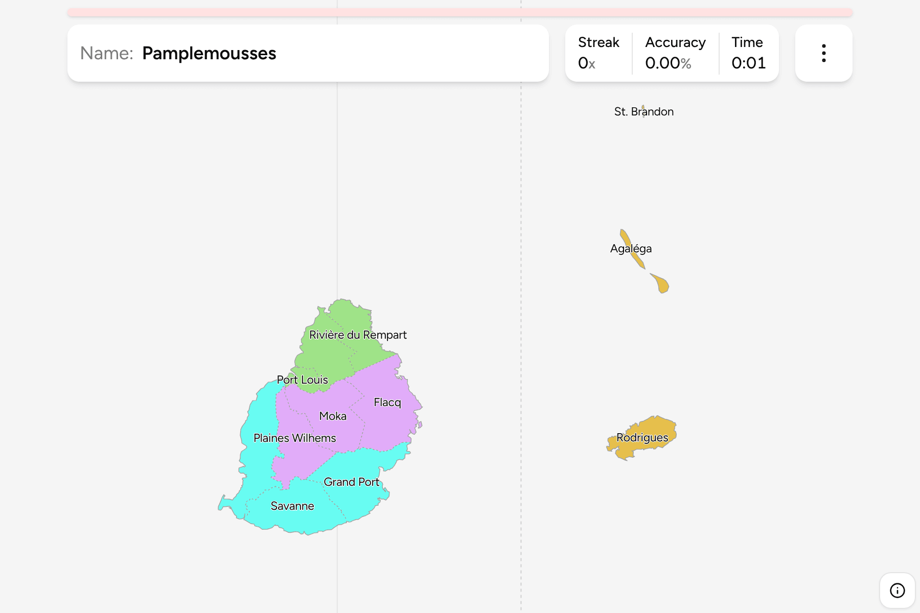
The nine districts of the island of Mauritius, plus the three outer islands as
the country draws them. The outer islands lie hundreds of kilometres from the
main island, so the map moves them into the sea to its east, true to scale, and
a line marks the move. Where they really are, Rodrigues is to the east, St.
Brandon to the north east and Agaléga far to the north.
The groups are not an official classification. They are the north of the
island, the east and centre, the south and west, and the outer islands, a way
to learn the map a piece at a time.
How to place one
- Start with the capital. Port Louis is the small district on the north
west coast, the smallest on the map.
- Go north. Pamplemousses lies just above it and Rivière du Rempart wraps
the northern tip.
- Cross the middle. Moka and Plaines Wilhems sit in the central plateau,
with Flacq filling the east coast.
- Finish in the south. Grand Port, Savanne and Black River run around the
southern and western coast.
- Then the islands. Rodrigues is the largest of the three outer islands,
Agaléga the two slim islands above it, and St. Brandon the speck of an atoll.
Every district, by group
- North3 districts
- Pamplemousses, Port Louis, Rivière du Rempart
- East and centre3 districts
- Flacq, Moka, Plaines Wilhems
- South and west3 districts
- Black River, Grand Port, Savanne
- Outer islands3 districts
- Agaléga, Rodrigues, St. Brandon
Worked examples
Port LouisThe capitalPort Louis is the smallest district and the capital, a strip of harbour on the
north west coast with Pamplemousses to its north and Moka to its east.
RodriguesThe largest outer islandRodrigues is a self-governing island of Mauritius, shown here in the sea east
of the main island although it lies about 560 kilometres away.
St. BrandonThe speckSt. Brandon, also called the Cargados Carajos Shoals, is a chain of low
islets that is nearly invisible at this scale. Tap the dot to the north of
Agaléga.
Frequently asked questions
How many districts does Mauritius have?
Nine, on the island of Mauritius itself. The game adds Rodrigues, Agaléga and St. Brandon, so there are twelve places to name.
Why are the outer islands so close to the main island?
They are not. They are moved next to it so the districts keep the map, and a line separates them from the island.
Why is Port Louis so small?
It is a city district, and the capital sits on a narrow stretch of coast between the mountains and the harbour.
Sources