Montenegro is a small, steep country with a short coast, and the map that most
quizzes still use for it is out of date. Tuzi was split from Podgorica in 2018
and Zeta in 2022, and the files that stop at 21 or 23 municipalities leave both
off. This game draws the 25 of today.
- The quiz
- Name to place, on the map
- Grouped by
- Statistical region: the north, the centre and the south
- In the game
- 25 municipalities
What you are looking at
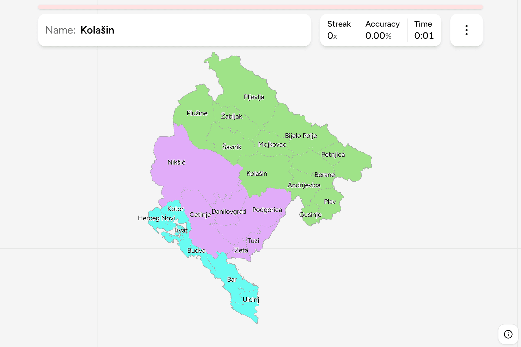
The 25 municipalities (opštine). Two of them carry a special title, Podgorica
as the capital and Cetinje as the old royal capital, but they are municipalities
like the rest. The country groups them into three statistical regions, which
are what the game lets you drill one at a time. They exist for planning and
statistics rather than as a level of government, but they are how the
municipalities are listed.
The sizes are very uneven. Nikšić and Podgorica are each many times the size of
Tivat, a bay town that fits between its neighbours, and the north is a patchwork
of mountain municipalities of middling size.
How to place one
- Start with the south. Six municipalities share the coast, and the
Bay of Kotor holds three of them, Herceg Novi, Kotor and Tivat.
- Anchor on Podgorica. The capital sits in the middle
of the country, and Tuzi, Zeta, Danilovgrad, Cetinje and Bar all
touch it.
- Walk up the Tara and the Lim. The north is thirteen municipalities, and
the rivers that run through Žabljak, Mojkovac, Bijelo Polje and Berane
connect most of them in a line.
- Leave the newest for last. Gusinje, Petnjica, Tuzi and Zeta are small
and recent, and the map you remember may not have them.
Every municipality, by region
- Northern Region13 municipalities
- Andrijevica, Berane, Bijelo Polje, Gusinje, Kolašin, Mojkovac, Petnjica, Plav, Pljevlja, Plužine, Rožaje, Šavnik, Žabljak
- Central Region6 municipalities
- Cetinje, Danilovgrad, Nikšić, Podgorica, Tuzi, Zeta
- Southern Region6 municipalities
- Bar, Budva, Herceg Novi, Kotor, Tivat, Ulcinj
Worked examples
NikšićThe biggest of themNikšić fills the west of the country and reaches the Bosnian border, with
Plužine and Šavnik to the north and Danilovgrad to the east.
TivatThe smallest of themTivat is the smallest municipality, on the inside of the Bay of Kotor. At the
size the whole country fits it is a few pixels wide, which is why the game
gives it a tap area.
ZetaThe newest of themZeta was separated from Podgorica in 2022 and lies north of the capital, on
the plain the river it is named for runs across.
Frequently asked questions
How many municipalities does Montenegro have?
25. Tuzi became a municipality in 2018 and Zeta in 2022, both taken from Podgorica, so maps from before that show 21 or 23.
Are the statistical regions a level of government?
No. The north, the centre and the south are used for planning and statistics only, which is why the game uses them as groups rather than as a quiz of their own.
Why does the game show Cyrillic names?
Montenegrin is written in both alphabets. The Latin name is shown by default, and the Cyrillic form is a switch in the start dialog.
Sources