Estonia is a small, flat country with a lot of coast, and its fifteen counties
are the tier everybody uses: they name the number plate series, the regional
hospital and the weather forecast. Learning them is a matter of reading the
map from Tallinn outwards, across the north, down the Russian border and over
the water to the islands.
- The quiz
- Name to place, on the map
- Grouped by
- Statistical region: North, Northeast, West, Central and South
- In the game
- 15 counties
What you are looking at
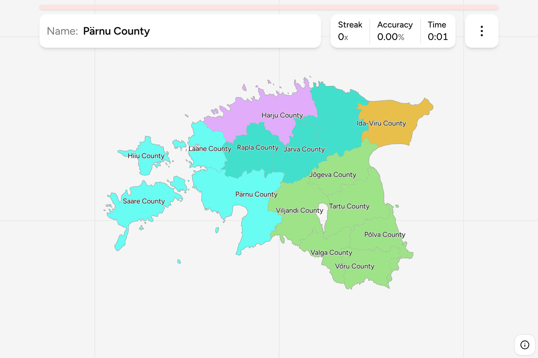
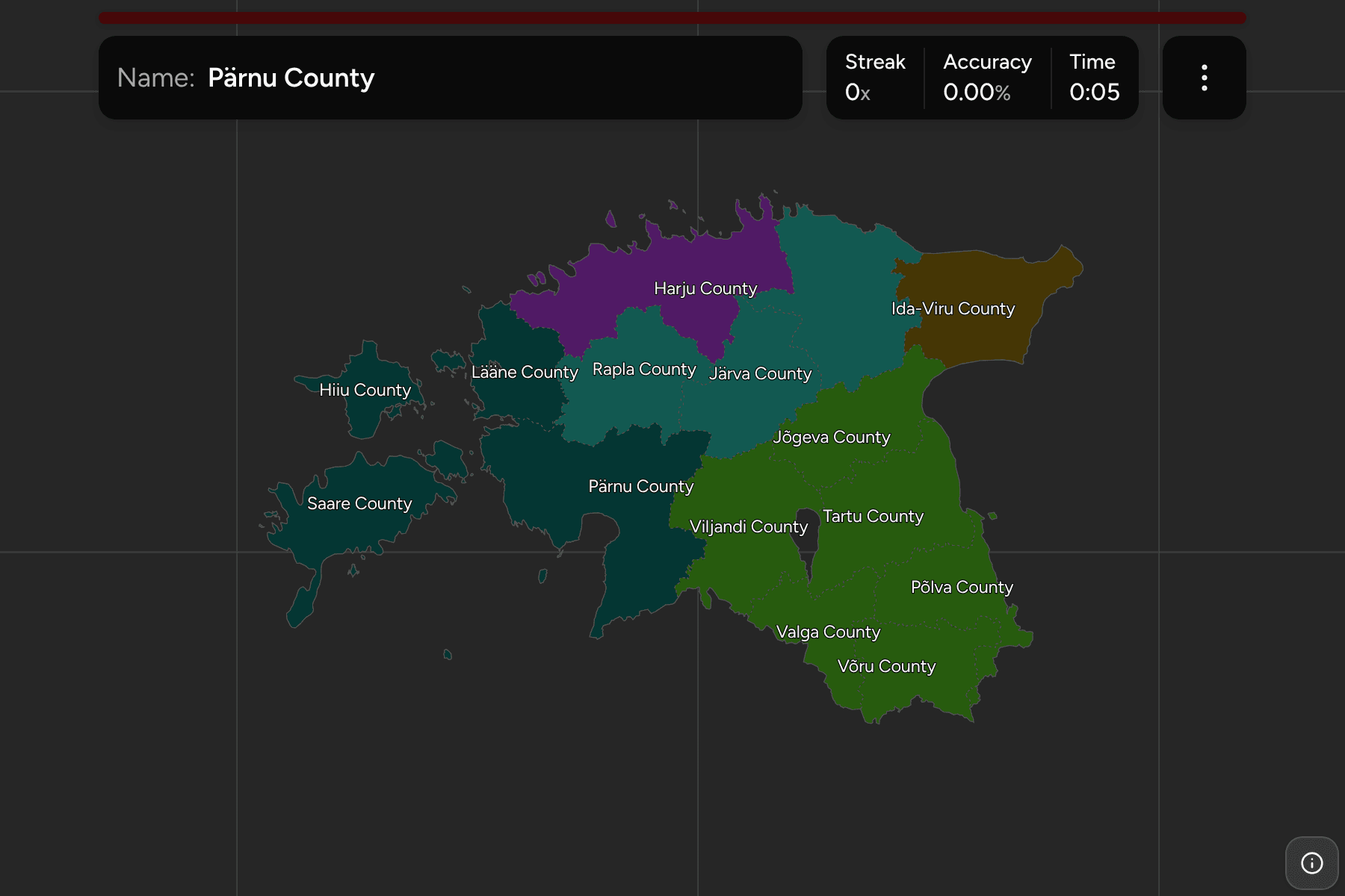
The maakonnad: fifteen counties, each named for its administrative centre or
for the historic land it covers, with Harju around Tallinn and Pärnu the
largest by area. Hiiu County is the smallest and is a single island and its
satellites, and Saare County is Saaremaa, the biggest island in the country,
with Muhu and Ruhnu beside it.
The English names carry the word County and the local name is a switch in the
start dialog, so Harju is Harju maakond. The counties are the municipalities of
Estonia Municipalities dissolved, so the borders of
the two maps match exactly.
The groups are the five statistical regions the country is sorted into for
Eurostat: North, which is Harju alone, Northeast, which is Ida-Viru alone, and
West, Central and South, which hold the rest.
How to place one
- Start with Harju. It is the county around the capital on the northern
coast, and the shape every other county in the north is described against.
- Run east along the coast. Lääne-Viru is next, then Ida-Viru, which ends
at the Narva river and the Russian border.
- Go down the middle. Järva, Rapla, Jõgeva and Viljandi fill the interior
between the coast and the south.
- Finish on the south and the west. Tartu, Põlva, Võru and Valga lie along
the Russian and Latvian borders, Pärnu faces the Gulf of Riga, and Lääne,
Hiiu and Saare are the coast and the islands facing Sweden.
Every county, by region
- South6 counties
- Jõgeva County, Põlva County, Tartu County, Valga County, Viljandi County, Võru County
- North1 county
- Harju County
- West4 counties
- Hiiu County, Lääne County, Pärnu County, Saare County
- Northeast1 county
- Ida-Viru County
- Central3 counties
- Järva County, Lääne-Viru County, Rapla County
Worked examples
Harju CountyThe capital countyHarju holds Tallinn and about two in five of the country's people. It runs
along the Gulf of Finland, with the Pakri peninsula and the Viimsi peninsula
both pushing out into it, and it is the easiest county to place first.
Saare CountyThe big islandSaare County is Saaremaa and the islands around it, including Muhu, which
a causeway joins to the mainland side, and the tiny Ruhnu out in the Gulf of
Riga. Nothing else on the map is a shape like it, which makes it an easy find.
Hiiu CountyThe smallest of themHiiu County is Hiiumaa, a round island north of Saaremaa, and it is the
smallest county on the map. Only Saare County, next to it, is also made
entirely of islands.
Frequently asked questions
How many counties does Estonia have?
Fifteen. They are the first tier of the country, below the state, and they have been stable for decades, even though the municipalities beneath them were merged in 2017.
Which county is the biggest?
Pärnu County in the south-west is the largest by area, and Harju County around Tallinn is the largest by population.
Are the counties the same as the statistical regions?
No. Eurostat sorts the fifteen into five regions, and those are the groups in this quiz. A county is a unit of the state with a governor's office; a statistical region is a unit of the statistics office.
The tier below this one is Estonia Municipalities,
whose counties are the groups there. For another small country at this level, see
Slovenia Regions.
Sources