Bulgaria is a country of long east to west bands: the Danube plain along the
northern border, the Balkan range across the middle, the Thracian plain below it
and the Rhodope mountains on the Greek frontier. Its provinces (oblasti) are
named for their principal town, which makes the map a list of towns before it is
a list of regions, and this page is the full list.
- The quiz
- Name to place, on the map
- Grouped by
- Planning region: the six regions Bulgaria reports its statistics under
- In the game
- 28 provinces
What you are looking at
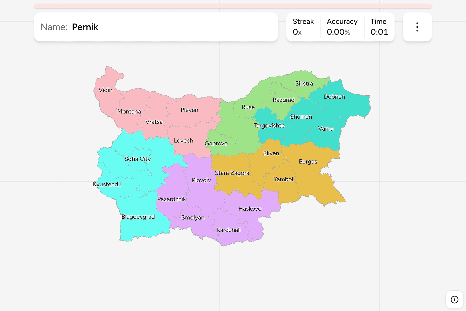
The 28 provinces, which are the tier between the state and the municipality.
Each takes the name of its administrative centre, with two exceptions that catch
people out: Sofia City is the capital on its own, and Sofia Province is the ring
around it, with its centre in the capital but outside its borders. Blagoevgrad,
Burgas, Plovdiv and Varna are the large ones; Gabrovo and Sofia City are the
smallest.
Names are written in English as a Bulgarian map has them. The start dialog can
switch every name to Cyrillic, which is what a road sign in Bulgaria says.
The groups are the six planning regions, the NUTS 2 statistical regions, and the
one that surprises is the Southeast: Stara Zagora sits there with the Black Sea
provinces of Burgas, Sliven and Yambol, not with Plovdiv, which anchors the
South Central. Municipalities for the same map are in
Bulgaria Municipalities, grouped the same way.
How to place one
- Start with the Black Sea coast. Dobrich, Varna and Burgas run down it in
that order, and Burgas is the only province that touches the sea and the
Turkish border.
- Read the Danube as a row. Vidin, Montana, Vratsa, Pleven, Veliko Tarnovo,
Ruse, Razgrad, Silistra and Dobrich are the northern tier, west to east.
- Find the capital pair. Sofia City is a small province inside the larger
Sofia Province, and Pernik and Kyustendil sit to its west.
- Follow the Rhodopes south. Smolyan and Kardzhali are the mountain
provinces on the Greek border, with Haskovo below them.
Every province, by planning region
- North Central5 provinces
- Veliko Tarnovo (Велико Търново), Gabrovo (Габрово), Razgrad (Разград), Ruse (Русе), Silistra (Силистра)
- South Central5 provinces
- Kardzhali (Кърджали), Pazardzhik (Пазарджик), Plovdiv (Пловдив), Smolyan (Смолян), Haskovo (Хасково)
- Southwest5 provinces
- Blagoevgrad (Благоевград), Kyustendil (Кюстендил), Pernik (Перник), Sofia City (София-град), Sofia Province (Софийска област)
- Southeast4 provinces
- Burgas (Бургас), Sliven (Сливен), Stara Zagora (Стара Загора), Yambol (Ямбол)
- Northeast4 provinces
- Varna (Варна), Dobrich (Добрич), Targovishte (Търговище), Shumen (Шумен)
- Northwest5 provinces
- Vidin (Видин), Vratsa (Враца), Lovech (Ловеч), Montana (Монтана), Pleven (Плевен)
Worked examples
Sofia CityThe capital inside a provinceSofia City is a province of one municipality, the capital, and Sofia Province
wraps all of it. Playing the two apart is the first thing the map teaches.
BurgasThe biggest of themBurgas is the largest province, a long stretch of Black Sea coast that
continues to the Turkish border, and the one most of the beach resorts are in.
Stara ZagoraThe one in the wrong regionStara Zagora lies in the middle of the country, and a player expects it with
Plovdiv. It is in the Southeast planning region with Burgas, Sliven and Yambol.
Frequently asked questions
How many provinces does Bulgaria have?
28, counting Sofia City, the capital, as a province of its own. Sofia Province is a separate province around it.
What is the difference between Sofia City and Sofia Province?
Sofia City is the capital and a province on its own. Sofia Province surrounds it and is administered from the capital, but the capital is not part of it.
What are the planning regions?
Six statistical regions, each made up of between four and five provinces. They are what Bulgaria reports regional figures and funding under, and the groups of this quiz.
The tier below this one is Bulgaria Municipalities.
For another country at this level, see Belgium Provinces.
Sources