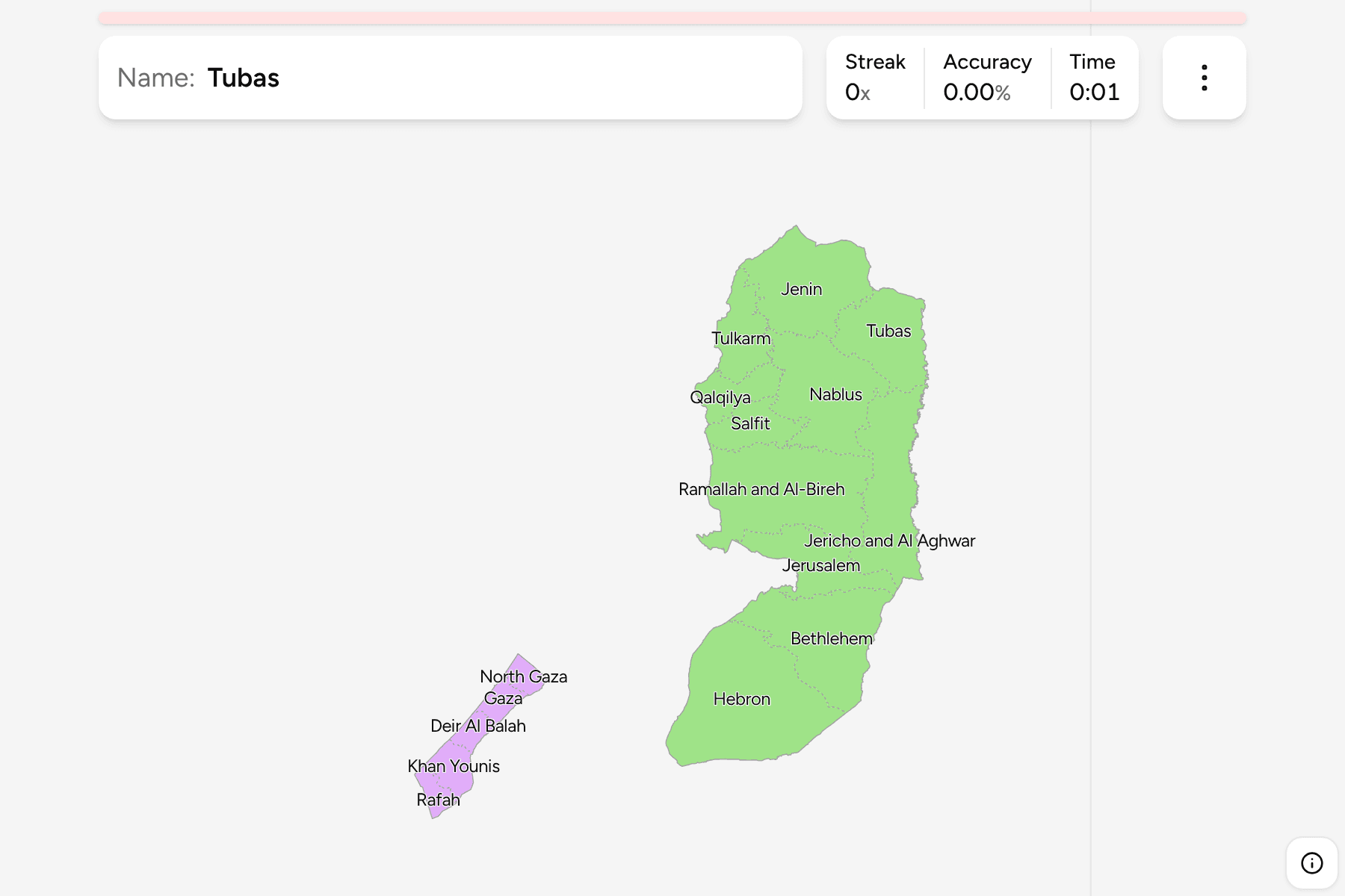
Palestine is made of two pieces of land that do not touch: the West Bank, a hill
country on the western bank of the Jordan, and the Gaza Strip, a narrow coastal
plain on the Mediterranean about 60 kilometres to the south west. The
Palestinian Authority divides the two into 16 governorates, which is what this
game asks for.
- The quiz
- Name to place, on the map
- Grouped by
- The two territories the governorates belong to
- In the game
- 16 governorates
What you are looking at
The governorates of the State of Palestine as the Palestinian Authority
administers them: the West Bank, with East Jerusalem inside the Jerusalem
governorate, and the Gaza Strip. The sizes are very uneven. Hebron alone is
larger than all five Gaza governorates put together, while Salfit and Tubas are
small enough to hide between their neighbours.
The Gaza Strip is only 40 kilometres long, so its five governorates are thin
slices laid end to end from the Egyptian border to the line with Israel in the
north. In the West Bank the governorates are named for their main city, and
they run from Jenin on the northern edge to Hebron in the south.
How to place one
- Split the two territories first. The Gaza Strip is the small piece on the
coast, and the West Bank is everything inland.
- Walk down the Strip. North Gaza, Gaza, Deir Al Balah, Khan Younis and
Rafah follow one another from the northern border to the Egyptian one.
- Find the spine of the West Bank. Jenin, Nablus, Ramallah and Al-Bireh,
Jerusalem, Bethlehem and Hebron run north to south through the hills.
- Fill in the edges. Tulkarm, Qalqilya and Salfit lie on the western side
against the Green Line, and Tubas and Jericho and Al Aghwar run down the
Jordan valley on the east.
Every governorate, by territory
- West Bank11 governorates
- Bethlehem, Hebron, Jenin, Jericho and Al Aghwar, Jerusalem, Nablus, Qalqilya, Ramallah and Al-Bireh, Salfit, Tubas, Tulkarm
- Gaza Strip5 governorates
- Deir Al Balah, Gaza, Khan Younis, North Gaza, Rafah
Worked examples
HebronThe largestHebron is the whole southern end of the West Bank, a broad block reaching
down to the edge of the Negev, with Bethlehem fitted in at its northern tip.
RafahThe far south of GazaRafah is the last governorate of the Strip, on the Egyptian border, with Khan
Younis directly to its north.
Jericho and Al AghwarThe Jordan valleyJericho and Al Aghwar is the long eastern strip of the West Bank beside the
Jordan river and the north end of the Dead Sea, with the hill governorates
stacked up against its western edge.
Frequently asked questions
Why is the map in two pieces?
The West Bank and the Gaza Strip are separate territories with Israel between them, and the governorates of each are drawn where they are. The game groups them by territory.
Does the map match Israel's?
It is the other side of the same line. The Israel Subdistricts game draws the territory inside the Green Line and the Golan Heights, and leaves out the West Bank and Gaza, which this game draws.
Are the names spelled the way I have seen them?
The game uses common English forms such as Ramallah and Al-Bireh and Khan Younis, since Arabic names have no single romanisation.
Sources