Cambodia is built around one lake. The Tonlé Sap swells and shrinks with the
Mekong, and the plains round it hold most of the people and the rice. The
province is the unit that tells you which side of the lake, the river or the
hills a round is on, and there are 25 of them.
- The quiz
- Name to place, on the map
- Grouped by
- Four parts of the country, an unofficial cut
- In the game
- 25 provinces
What you are looking at
The provinces (khaet) of Cambodia, with the capital, Phnom Penh, which has the
same rank. Most are named for their main town, so the name of a province is
usually also the name of a district inside it. Kep, Pailin, Preah Sihanouk and
Phnom Penh are the small ones: the first two are cut out of larger provinces,
and the last two are the port and the capital.
Tboung Khmum, the newest, was split off from Kampong Cham in 2013, so older maps
show one province where this one shows two. Some maps spell it Tbong Khmum.
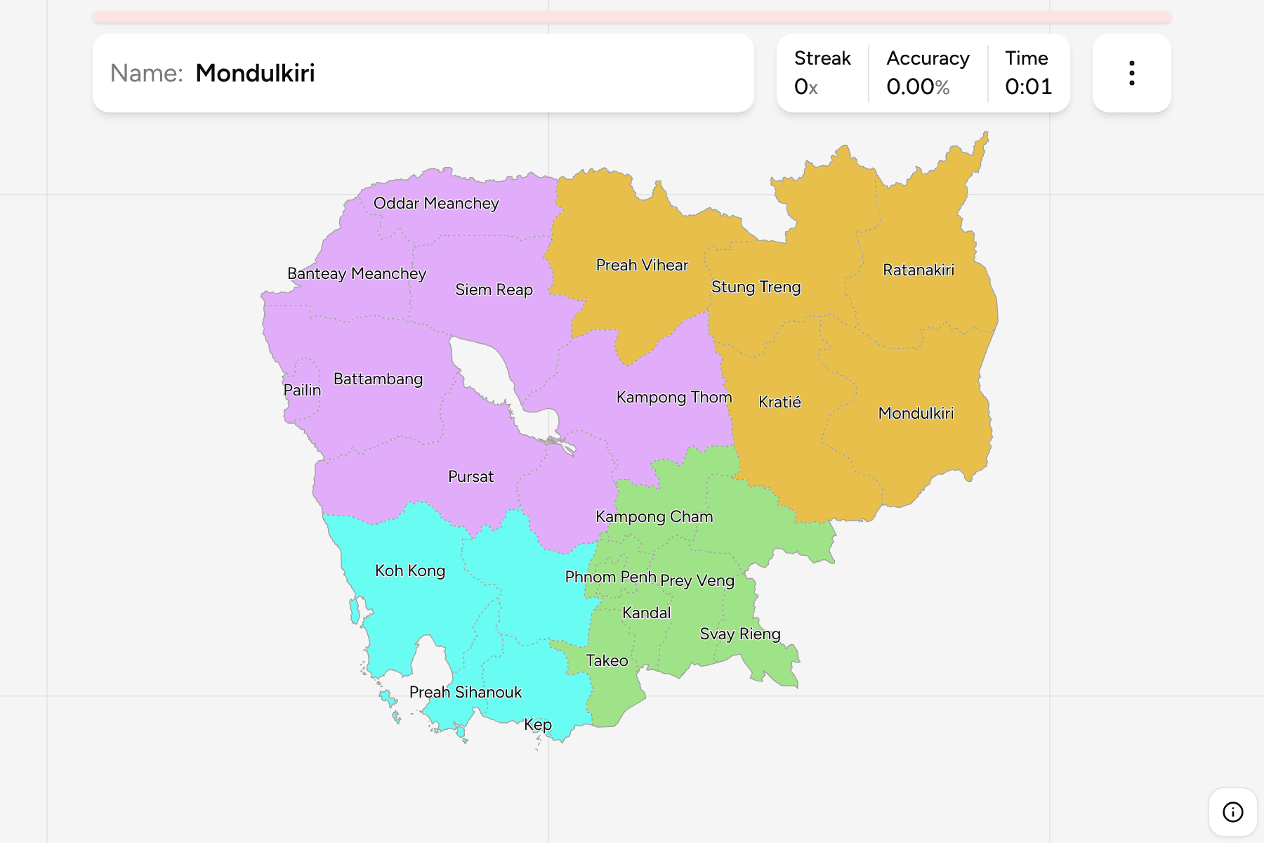
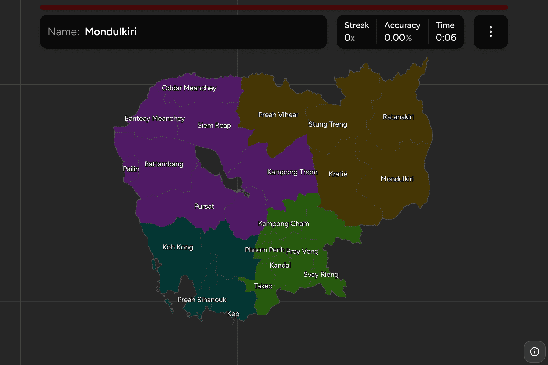
The groups are not an official classification. Cambodia has no tier between the
province and the country, so the quiz cuts the 25 into the central plains, the
Tonlé Sap basin, the south west and the coast, and the north east highlands, to
let you drill it a piece at a time. The provinces are the
Cambodia Districts grouped, so the borders of the two
maps match exactly.
How to place one
- Find the lake first. The Tonlé Sap sits in the middle of the country, and
Siem Reap, Battambang, Pursat, Kampong Chhnang and Kampong Thom are the
provinces round it.
- Then the capital. Phnom Penh is where the Mekong and the Tonlé Sap rivers
meet, with Kandal wrapped round it.
- Read the east as plains. Kampong Cham, Tboung Khmum, Prey Veng, Svay
Rieng and Takeo fill the flat land towards Vietnam.
- Read the south west as a coast. Koh Kong, Preah Sihanouk, Kampot and Kep
run along the Gulf of Thailand, with Kampong Speu behind them in the hills.
- Leave the north east for last. Kratié, Stung Treng, Ratanakiri,
Mondulkiri and Preah Vihear are large and thinly settled.
Every province, by group
- Central plains7 provinces
- Kampong Cham, Kandal, Phnom Penh, Prey Veng, Svay Rieng, Takeo, Tboung Khmum
- Tonlé Sap8 provinces
- Banteay Meanchey, Battambang, Kampong Chhnang, Kampong Thom, Oddar Meanchey, Pailin, Pursat, Siem Reap
- South-west and coast5 provinces
- Kampong Speu, Kampot, Kep, Koh Kong, Preah Sihanouk
- North-east highlands5 provinces
- Kratié, Mondulkiri, Preah Vihear, Ratanakiri, Stung Treng
Worked examples
Siem ReapThe one with the templesSiem Reap is the province north of the Tonlé Sap that holds Angkor, the temple
complex that most visitors to Cambodia come for. It is one of the biggest on
the lake side, and a useful anchor for the provinces round it.
KepThe small one on the coastKep is one of the smallest provinces, a stretch of coast east
of Kampot, known for its crab market. It is easy to overlook beside the larger
provinces on either side.
Tboung KhmumThe newestTboung Khmum was cut out of Kampong Cham in 2013, east of the Mekong on the
Vietnamese border. Maps older than that show Kampong Cham as one large
province.
Frequently asked questions
How many provinces does Cambodia have?
25: 24 provinces and the capital, Phnom Penh, which ranks alongside them.
Which province is the newest?
Tboung Khmum, created from the eastern half of Kampong Cham in 2013.
Where do the groups come from?
They are an unofficial cut into four parts of the map, so you can drill a piece at a time. Cambodia itself has no tier between the province and the country.
The tier below this one is Cambodia Districts. For
another country at this level, see Bangladesh Divisions.
Sources