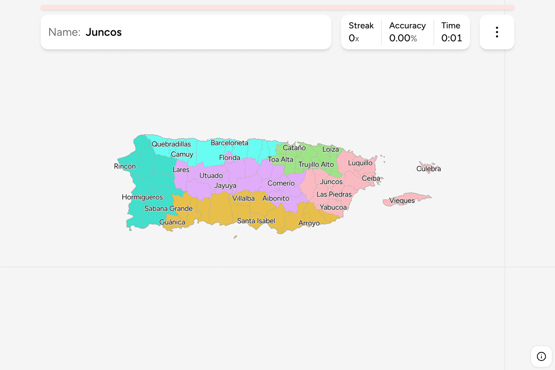
Puerto Rico is a long, narrow island, about 160 kilometres from Aguadilla in the
west to Fajardo in the east, with a mountain range down its middle and the
smaller islands of Vieques and Culebra off the east coast. It is divided into 78
municipios, which are the unit of local government, the unit the island
reports its data by, and the places everybody gives when asked where they are
from. They cover the island without a gap, and none of them is a county or a
district of a larger one.
- The quiz
- Name to place, on the map
- Grouped by
- The San Juan metro area, the north coast, the west, the south, the central mountains, and the east with its islands
- In the game
- 78 municipalities
What you are looking at
The 78 municipalities of today, named in Spanish. San Juan, the capital, sits
on the north coast with the other cities of the metropolitan area around it,
and the island's second city, Ponce, is the large municipality on the south
coast. Vieques and Culebra are municipalities in their own right, and the
smallest places on the map are the tiny coastal ones, which get a circle to tap
instead of a sliver to find.
Mona Island, which belongs to Mayagüez, is left off the map because it lies
60 kilometres out in the Mona Passage and would only add empty sea.
The groups are not an official classification. They are the six parts the
island is usually described in, and they are a way to learn the map a piece at
a time. A few municipalities near a boundary could reasonably be put on either
side of it.
How to place one
- Start with the coasts. The north coast runs from Aguadilla to San Juan,
the south coast from Cabo Rojo to Guayama, and the east is where the island
narrows toward Fajardo.
- Find the capital. San Juan is on the north coast at the island's widest
part, with Bayamón and Guaynabo on its landward side.
- Use the middle as a spine. The central mountains are a belt of inland
municipalities with no coast: Utuado, Jayuya, Orocovis, Aibonito and their
neighbours.
- Leave the islands for last. Vieques and Culebra are off the east coast,
and are the only municipalities that are not on the main island.
Every municipality, by group
- San Juan metro area10 municipalities
- Bayamón, Canóvanas, Carolina, Cataño, Guaynabo, Loíza, San Juan, Toa Alta, Toa Baja, Trujillo Alto
- Central mountains16 municipalities
- Adjuntas, Aguas Buenas, Aibonito, Barranquitas, Cayey, Ciales, Cidra, Comerío, Corozal, Florida, Jayuya, Lares, Morovis, Naranjito, Orocovis, Utuado
- North coast10 municipalities
- Arecibo, Barceloneta, Camuy, Dorado, Hatillo, Isabela, Manatí, Quebradillas, Vega Alta, Vega Baja
- South14 municipalities
- Arroyo, Coamo, Guánica, Guayama, Guayanilla, Juana Díaz, Maunabo, Patillas, Peñuelas, Ponce, Salinas, Santa Isabel, Villalba, Yauco
- West14 municipalities
- Aguada, Aguadilla, Añasco, Cabo Rojo, Hormigueros, Lajas, Las Marías, Maricao, Mayagüez, Moca, Rincón, Sabana Grande, San Germán, San Sebastián
- East and islands14 municipalities
- Caguas, Ceiba, Culebra, Fajardo, Gurabo, Humacao, Juncos, Las Piedras, Luquillo, Naguabo, Río Grande, San Lorenzo, Vieques, Yabucoa
Worked examples
San JuanThe capitalSan Juan occupies the north coast at the island's widest part, with the old
city on an islet at its western end, and is bordered inland by Guaynabo,
Trujillo Alto and Carolina.
PonceThe south coastPonce is the largest city on the south coast, a broad municipality that runs
from the Caribbean up into the mountains, with Juana Díaz to its east and
Peñuelas to its west.
CulebraAn islandCulebra lies east of the main island, with Vieques to its south, and is one of
the two municipalities that are not on the main island.
Frequently asked questions
How many municipalities does Puerto Rico have?
78, and all of them cover land. The game draws every one, including Vieques and Culebra.
Does Puerto Rico have counties or states?
No. It is a territory of the United States, and the municipality is its only tier of local government, so the quiz asks for those.
Why is Mona Island missing?
It is part of Mayagüez, but it lies about 60 kilometres west of the main island, and drawing it would shrink every other municipality to make room for a single small island.
Are the groups official?
No. Puerto Rico publishes no grouping of its municipalities that is both a partition and widely used, so these are the parts the island is commonly described in.
Sources