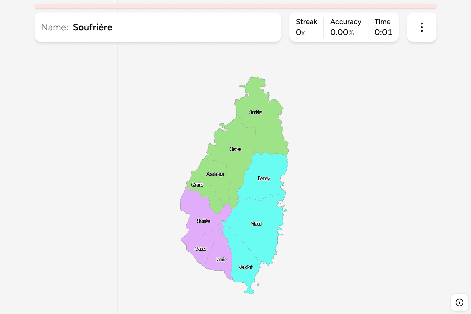
Saint Lucia is a volcanic island in the Windward Islands, between Martinique to
the north and Saint Vincent to the south, and its first-level map has ten
districts: strips of the island that run from the mountainous spine down to the
coast, most of them named in French for a town or a bay.
- The quiz
- Name to place, on the map
- Grouped by
- Northern, south-western and south-eastern districts
- In the game
- 10 districts
What you are looking at
One island about forty kilometres long, cut into ten districts. The capital
Castries sits on the north-west coast and its district is the one most people
know first. The Pitons, the twin volcanic spires on the south-west coast, are in
Soufrière, and the international airport and the island's southern tip are in
Vieux Fort.
The groups are not an official classification. They are the northern districts
around Castries, the south-western districts down the Caribbean coast, and the
south-eastern districts from Dennery round to Vieux Fort, a way to learn the map
a piece at a time.
How to place one
- Start at the ends. Gros Islet is the northern tip and Vieux Fort the
southern one, so they anchor the island before anything else.
- Then the capital. Castries is the large district on the north-west coast,
with Anse la Raye beside it to the south.
- Work down each coast. The Caribbean side runs Canaries, Soufrière,
Choiseul and Laborie, and the Atlantic side runs Dennery and Micoud.
Every district, by group
- Northern districts4 districts
- Anse la Raya, Canaries, Castries, Gros Islet
- South-western districts3 districts
- Choiseul, Laborie, Soufrière
- South-eastern districts3 districts
- Dennery, Micoud, Vieux Fort
Worked examples
CastriesThe capitalCastries holds the capital and its harbour on the north-west coast, and it is
the largest district on the Caribbean side.
SoufrièreThe PitonsSoufrière is the south-west district where the twin Pitons rise straight from
the sea, and the island's best-known landmark.
CanariesThe smallestCanaries is one of the smallest districts, a short stretch of coast between
Anse la Raye and Soufrière that is easy to skip over.
Frequently asked questions
How many districts does Saint Lucia have?
Ten. They are the first level of division, and the quarters of the colonial era became these districts.
Does Saint Lucia group its districts?
Not officially. The groups here are the northern, south-western and south-eastern districts, and they are only a way to learn the map.
Why do so many districts have French names?
The island changed hands between France and Britain many times before 1814, and the names of its towns and bays stayed French.
Sources