Seychelles is an archipelago in the western Indian Ocean, north-east of
Madagascar. Nearly all of its people live on three granite islands: Mahé, with
the capital Victoria, Praslin and La Digue. Its districts are the units of local
government, and most of them are crammed into Mahé, an island about 28
kilometres long.
- The quiz
- Name to place, on the map
- Grouped by
- The north, east and centre, and south and west of Mahé, and the other islands
- In the game
- 26 districts
What you are looking at
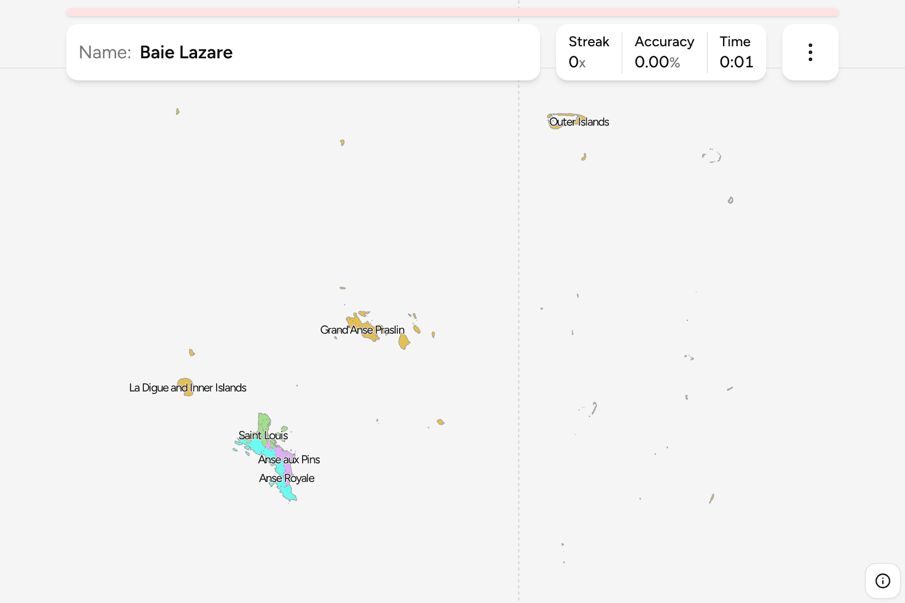
The districts of today. Mahé is cut into slices that are often only a few
kilometres across, so on a phone several of them are drawn with a small circle
to tap. Praslin has two districts, Baie Sainte Anne and Grand'Anse, which share
a name with a district on Mahé: the game calls them Grand'Anse Mahé and
Grand'Anse Praslin. La Digue shares a district with the granite and coral Inner
Islands scattered around it, from Silhouette and North Island to Bird Island at
the northern tip of the country.
The Outer Islands are one district, made of atolls strewn over about a thousand
kilometres of ocean to the south and south-west, including Aldabra, which is
1,100 kilometres from Mahé. The map moves them into the sea to the east of the
Inner Islands and draws them at a third of their size, with a line marking the move, so
that Mahé does not shrink to a speck.
The groups are not an official classification. They are a way to learn the map
a piece at a time: the north of Mahé around Victoria, its east and centre, its
south and west, and the other islands.
How to place one
- Start with Victoria. The capital sits on the north-east coast of Mahé,
with Mont Fleuri, Mont Buxton and Saint Louis around it.
- Go north. Beau Vallon, the beach resort, is on the north-west coast, with
Glacis and Bel Ombre around the northern tip.
- Walk down the east coast. Pointe La Rue, where the airport is, then Anse
aux Pins, Au Cap and Anse Royale.
- Come back up the west coast. Baie Lazare, Anse Boileau, Takamaka and
Grand'Anse Mahé, with Port Glaud in the north-west.
- Leave Mahé. Praslin is the second island, north-east, and La Digue the
small island just off its east end.
Every district, by group
- North of Mahé11 districts
- Anse Etoile, Beau Vallon, Bel Air, Bel Ombre, English River, Glacis, Les Mamelles, Mont Buxton, Mont Fleuri, Roche Caiman, Saint Louis
- East and centre of Mahé6 districts
- Anse aux Pins, Anse Royale, Au Cap, Cascade, Plaisance, Pointe La Rue
- South and west of Mahé5 districts
- Anse Boileau, Baie Lazare, Grand'Anse Mahé, Port Glaud, Takamaka
- Praslin, La Digue and the outer islands4 districts
- Baie Sainte Anne, Grand'Anse Praslin, La Digue and Inner Islands, Outer Islands
Worked examples
English RiverThe capitalVictoria lies in English River, a small district on the north-east coast of
Mahé, squeezed between Saint Louis, Mont Fleuri and the sea.
TakamakaThe southTakamaka is the district at the south-west end of Mahé, below Baie Lazare, and
one of the easiest to place because nothing lies further south.
Outer IslandsThe scattered oneThe Outer Islands are drawn east of the Inner Islands at a third of their size. Their
real positions run from the Amirantes, 250 kilometres south-west of Mahé, to
Aldabra far beyond.
Frequently asked questions
Why are the Outer Islands drawn next to the Inner Islands?
They are a thousand kilometres from end to end, and drawn where they are the three main islands would shrink to a few pixels. The map moves each group of atolls into the open sea to the east, shrinks them to a third of their size and draws a line between them and the rest.
Are the groups official?
No. Seychelles does not group its districts for this purpose, so they are a way to learn the map in pieces.
Sources