The Solomon Islands are a scatter of volcanic islands and atolls in the south
west Pacific, east of Papua New Guinea. The map is worth knowing on its own
terms: the country is more than a thousand kilometres from end to end, almost
all sea, and each province is a chain of islands rather than a block of land.
- The quiz
- Name to place, on the map
- Grouped by
- The western islands, the central islands, and the south east
- In the game
- 10 provinces
What you are looking at
The nine provinces the country has today, and Honiara, the capital, which is a
territory of its own with the standing of a province. Together they cover the
whole country, and every island on the map belongs to one of them.
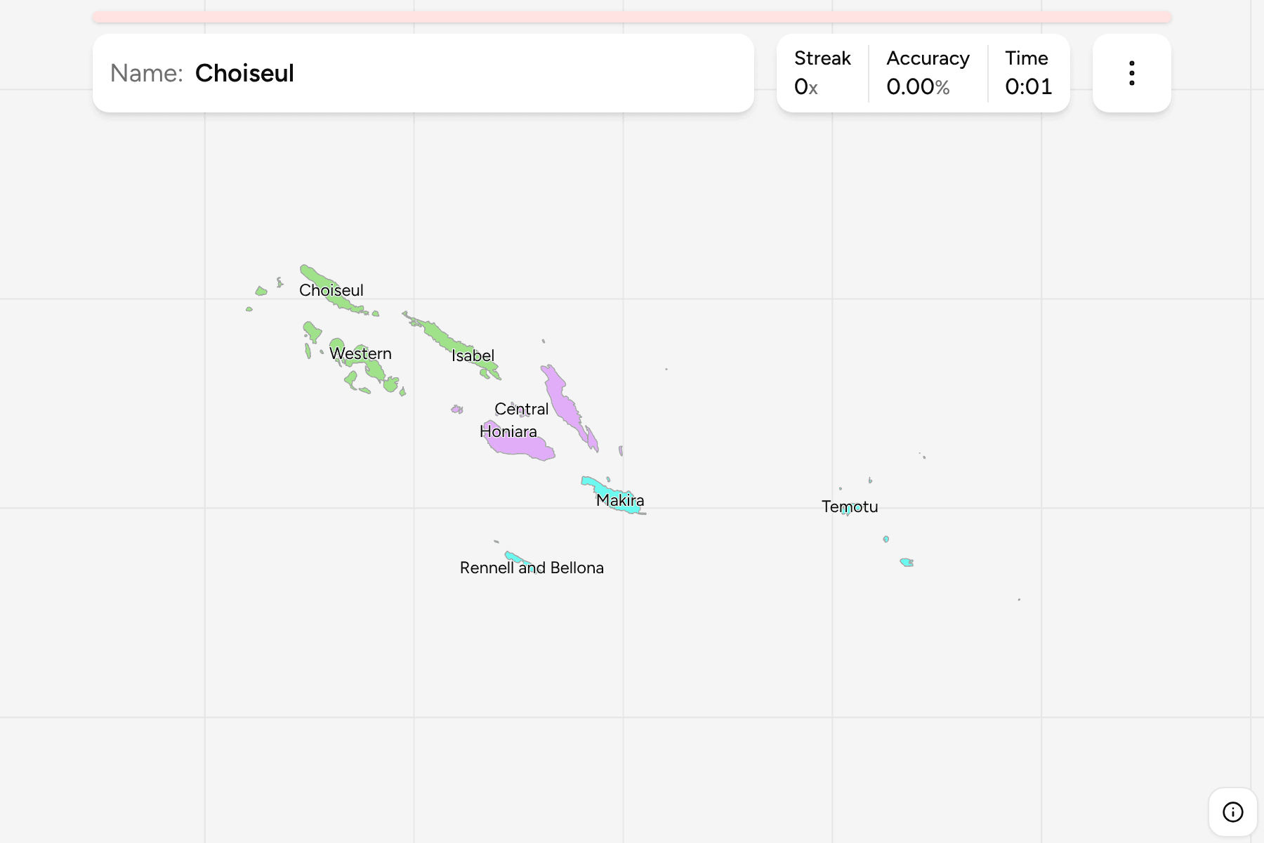
Two long double chains of islands run from the north west to the south east. The
provinces of Western, Choiseul and Isabel sit at the north western end, around
the New Georgia group. Guadalcanal, Malaita and the Central Islands lie in the
middle, with Honiara on the north coast of Guadalcanal. Makira, and the far
flung Rennell and Bellona and Temotu, close the chain at the south eastern end.
The groups are not an official classification. They are three parts the
archipelago is commonly described in, and a way to learn it a piece at a time.
How to place one
- Start with the largest island. Guadalcanal is the big island in the
middle of the map, and Honiara is the speck on its north coast.
- Take the long island beside it. Malaita lies to the north east of
Guadalcanal, across a narrow strait.
- Work out to both ends. Western, Choiseul and Isabel run off to the north
west, and Makira, Rennell and Bellona and Temotu sit off to the south east.
Every province, by group
- The western islands3 provinces
- Choiseul, Isabel, Western
- The central islands4 provinces
- Central, Guadalcanal, Honiara, Malaita
- The south east3 provinces
- Makira, Rennell and Bellona, Temotu
Worked examples
HoniaraThe capitalHoniara is by far the smallest area on the map, a patch on the north coast of
Guadalcanal. Zoom in on the island's northern shore if you cannot find it.
TemotuThe far eastTemotu is the easternmost province, the Santa Cruz Islands, well over a
thousand kilometres from Western and separated from the rest of the country by
open sea.
Rennell and BellonaThe southern outlierRennell and Bellona is a pair of raised coral islands to the south of
Guadalcanal, on their own in the Coral Sea.
Frequently asked questions
How many provinces do the Solomon Islands have?
Nine: Central, Choiseul, Guadalcanal, Isabel, Makira, Malaita, Rennell and Bellona, Temotu and Western. Honiara, the capital, is a territory of its own and is drawn here as a tenth area.
Why is Honiara so small?
It is a city territory on the coast of Guadalcanal, a fraction of the size of any province. It is still a separate area on the map, so you have to find it.
Do the Solomon Islands group their provinces?
Not in a way this game uses. The groups here are three parts of the archipelago, and they will not match every list you find.
Sources