Tuvalu is about 26 square kilometres of land in 750,000 square kilometres of the
south Pacific, one of the smallest countries on Earth, and it is almost all
atoll: rings of coral islets a few metres above the sea. Each of its
inhabited atolls has its own island council, the Falekaupule, so the island is
the unit that an election, a ferry and a school are all counted in.
- The quiz
- Name to place, on the map
- Grouped by
- The northern, central and southern islands
- In the game
- 8 islands
What you are looking at
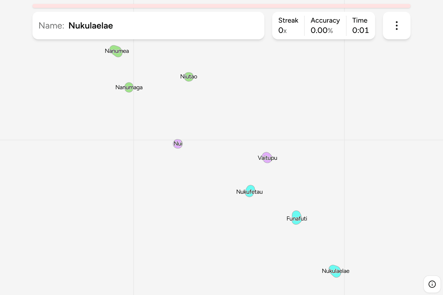
Each atoll is drawn as its land grown a little, because the islets that make it
up are slivers a few hundred metres wide that would not be there to point at.
The shapes are therefore larger than the land, and the sea between them is real:
the chain runs about 600 kilometres from the first island to the last.
The map has eight answers, not nine. The ninth island, Niulakita, lies far to
the south and is administered together with Niutao, so the data this game is
drawn from has no outline of its own for it.
The three groups are the way the country is usually described, not an
administrative tier. They give you a way to learn the chain a piece at a time.
How to place one
- Start with Funafuti. It is the atoll that holds the capital and about
half of the people, in the south of the chain.
- Work north. Nukufetau is the next atoll up the chain, then Vaitupu and
Nui in the middle.
- Then the northern three. Niutao, Nanumaga and Nanumea close the chain
at the top, the last of them the furthest north west.
- Nukulaelae stands alone at the south eastern end, past Funafuti.
Every island, by group
- Northern islands3 islands
- Nanumaga, Nanumea, Niutao
- Central islands2 islands
- Nui, Vaitupu
- Southern islands3 islands
- Funafuti, Nukufetau, Nukulaelae
Worked examples
FunafutiThe capitalFunafuti is a ring of islets around a lagoon some 25 kilometres across. The
capital's government buildings and the airport sit on Fongafale, the
largest islet, in the south east of the ring.
NanumeaThe northern tipNanumea is the northernmost atoll and the furthest from the capital. It is
drawn as two pieces, because its land is split by a channel.
Frequently asked questions
How many islands does Tuvalu have on this map?
Eight, one for each of the eight island councils. Niulakita, the ninth island, is administered with Niutao.
Why are the islands drawn bigger than they are?
The land of an atoll is a thin ring of islets. Each island is drawn with its land grown a little so there is something to tap.
Are the northern, central and southern groups official?
No. They are how the chain is usually described, and are here to help you learn it a piece at a time.
Sources