Timor-Leste is the eastern half of the island of Timor, plus Oecusse, a
coastal exclave on the western half, surrounded by Indonesia, and the island of
Atauro off the north coast. Its municipalities are the units its government,
census and elections are organised around, and they fill the country without a
gap. This is a map worth knowing on its own terms: a young country with a
compact, long and narrow shape that is easy to learn once you have a few
anchors.
- The quiz
- Name to place, on the map
- Grouped by
- Dili and Atauro, the West, the Centre and the East
- In the game
- 14 municipalities
What you are looking at
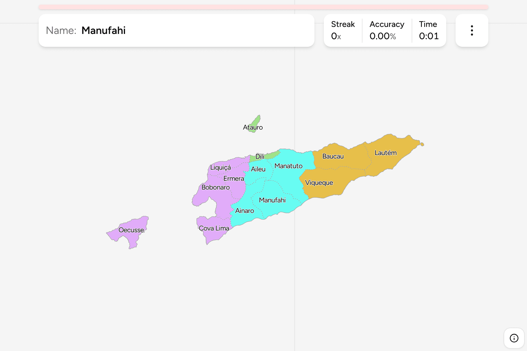
The municipalities of today, named in their usual English spelling. They run
west to east along a long, narrow island: the capital Dili sits on the north
coast, with Atauro, a mountainous island of its own, visible just offshore. Most
municipalities stretch from the north coast to the south coast, so they read as
slices of the country from west to east. Oecusse is the exception, a separate
piece of land on the Indonesian side of the island.
Atauro was part of Dili until 2022, when it became the fourteenth municipality.
Many maps and lists still show thirteen.
The groups are not an official classification. They are the parts of the
country it is usually described in, and a way to learn the map a piece at a
time.
How to place one
- Start with Dili. It is the small municipality on the north coast, and
Atauro is the island opposite it.
- Go west. Liquiçá, Ermera and Bobonaro follow the north coast and the
Indonesian border, and Cova Lima runs down to the south coast.
- Find the exclave. Oecusse is the piece on the north coast of western
Timor, separated from the rest of the country.
- Go east. Manatuto and Baucau follow the north coast, and Lautém forms the
eastern tip. Viqueque and Manufahi face the south coast.
- Fill the middle last. Aileu and Ainaro are the mountain municipalities
with no coast at all.
Every municipality, by group
- Dili and Atauro2 municipalities
- Atauro, Dili
- West5 municipalities
- Bobonaro, Cova Lima, Ermera, Liquiçá, Oecusse
- Centre4 municipalities
- Aileu, Ainaro, Manatuto, Manufahi
- East3 municipalities
- Baucau, Lautém, Viqueque
Worked examples
OecusseThe exclaveOecusse is the only municipality that does not touch the rest of the
country. It lies on the north coast of western Timor, with Indonesia on every
land side.
AtauroThe islandAtauro is the island north of Dili, and the newest municipality. It is small
on the map, so tapping the marker beside it counts.
LautémThe eastern tipLautém is the whole eastern end of the island, the one municipality with no
neighbour beyond it.
Frequently asked questions
How many municipalities does Timor-Leste have?
Fourteen: twelve municipalities, the Special Administrative Region of Oecusse-Ambeno, and Atauro, which became a municipality of its own in 2022. Together they cover the whole of the country.
Why do some lists show thirteen?
Atauro was part of Dili until 2022. Older maps and datasets, including the usual open boundary files, still draw it inside Dili, so the game cuts it out using the administrative post of the same name.
Does Timor-Leste group its municipalities into regions?
Not in a way this game relies on. The groups here are the parts of the country they are commonly described in, and they will not match every list you find.
Sources