Uzbekistan is one of only two doubly landlocked countries on Earth, and its map
is mostly desert with a string of oases along the mountains. Nearly everyone
lives in those oases, so the region is the unit that tells you which valley a
round is in, and there are only fourteen of them.
- The quiz
- Name to place, on the map
- Grouped by
- Five parts of the country, an unofficial cut
- In the game
- 14 regions
What you are looking at
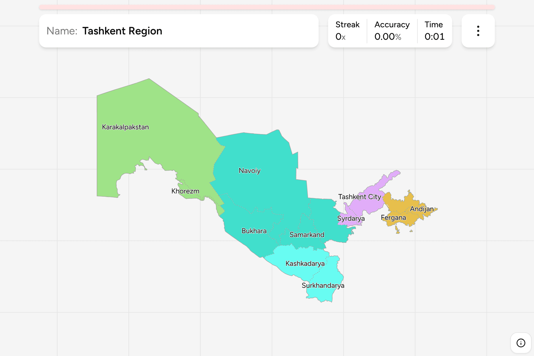
The first tier of Uzbekistan: twelve regions (viloyat), the Republic of
Karakalpakstan and the city of Tashkent, which is a unit of its own. Tashkent
the city and Tashkent Region around it are two different answers, and the
region does not include the city even though it surrounds it.
Karakalpakstan is the giant. It fills the whole north west, more than a third of
the country, and holds most of the dried bed of the Aral Sea. It is an
autonomous republic with its own constitution, but on the map it is one shape.
Khorezm is the small oasis region on the Amu Darya just south east of it, and
south of Khorezm the desert Navoiy and Bukhara regions run to the Turkmen border.
The rest of the country lies along the mountains in the south and east. Samarkand
and Jizzakh follow the Zarafshan valley, Kashkadarya and Surkhandarya run down
to the Afghan border, and the Fergana Valley in the far east is shared between
three small regions, Andijan, Namangan and Fergana, packed around a basin that is
also partly in Tajikistan and Kyrgyzstan.
The groups are not an official classification. Uzbekistan has no tier between
the regions and the country, so the quiz cuts the fourteen into the west, the
centre, the south, the Fergana Valley and the Tashkent area to let you drill it a
piece at a time. The regions are the Uzbekistan Districts
grouped, so the borders of the two maps match exactly.
How to place one
- Start with Karakalpakstan. It is the huge one in the north west and the
only region with a border on the Aral Sea.
- Find the Fergana Valley. Andijan, Namangan and Fergana are the three small
regions packed into the far east, with Tashkent Region on their western edge.
- Follow the Zarafshan. Samarkand and Jizzakh are the two central regions in
the foothills, Navoiy is the desert beyond them, and Bukhara lies at the end.
- Finish at the Afghan border. Surkhandarya is the narrow region in the far
south, with Kashkadarya above it.
Every region, by group
- West2 regions
- Karakalpakstan, Khorezm
- Tashkent3 regions
- Syrdarya, Tashkent City, Tashkent Region
- South2 regions
- Kashkadarya, Surkhandarya
- Fergana Valley3 regions
- Andijan, Fergana, Namangan
- Centre4 regions
- Bukhara, Jizzakh, Navoiy, Samarkand
Worked examples
KarakalpakstanThe biggest of themKarakalpakstan is the largest region by far, the whole north west of the
country. Most of it is the Kyzylkum and Ustyurt deserts, and its capital Nukus
stands on the Amu Darya, not far from where the Aral Sea used to be.
Tashkent CityThe city that is a regionTashkent is the capital and a first-level unit of its own, a small patch inside
Tashkent Region in the north east. It is small enough to need a tap area, and
zooming in is the way to reach it.
KhorezmThe small oasisKhorezm is a small, densely farmed region on the lower Amu Darya, with the old
walled city of Khiva at its heart. It sits against the Turkmen border,
surrounded on three sides by Karakalpakstan.
Frequently asked questions
How many regions does Uzbekistan have?
Fourteen first-level units: twelve regions, the Republic of Karakalpakstan and the city of Tashkent.
Why are the groups not official?
Uzbekistan has no administrative tier between the regions and the country, so the quiz groups them into five parts of the map by position.
What is below the region?
The districts, which number about 200. The quiz carries 199 of them, and they are their own quiz.
The tier below this one is Uzbekistan Districts. For
another country at this level, see Kazakhstan Regions.
Sources