Guinea is the water tower of West Africa. The Niger, the Senegal and the Gambia
all rise in its highlands, and a photo taken there is as likely to show red
laterite road, a river valley or a hillside of mango trees as a town. The region
is the first tier of the country, and there are only eight pieces to learn.
- The quiz
- Name to place, on the map
- Grouped by
- The four natural regions, with Conakry on its own
- In the game
- 8 regions
What you are looking at
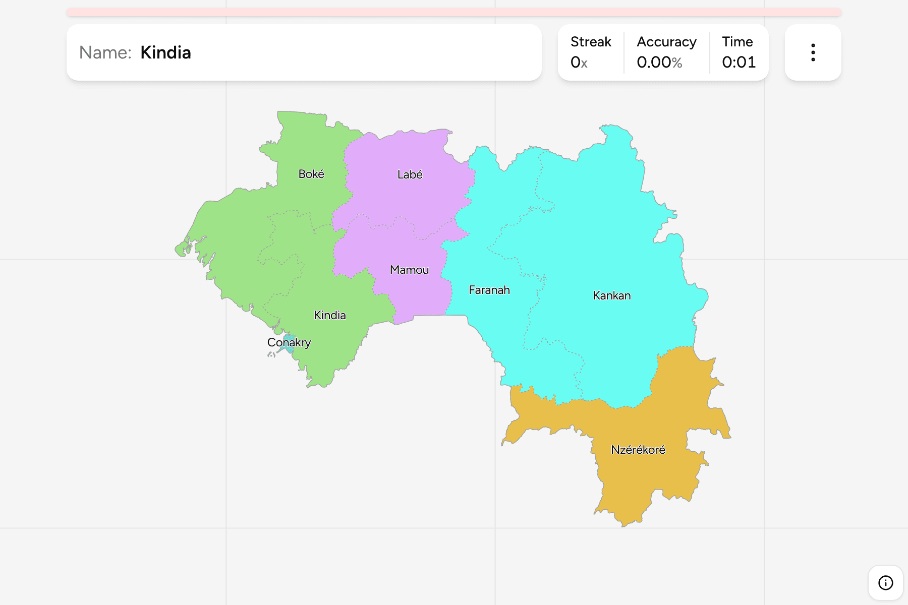
The seven administrative regions of Guinea and the capital, Conakry, which has
the status of a special zone and is drawn as a piece of its own. Six of the
regions are named for their main town: Boké, Kindia, Labé, Mamou, Faranah and
Kankan. The seventh is Nzérékoré, in the south-east corner.
Guineans also talk about the country as four natural regions, and the quiz
groups the regions that way. Lower Guinea is the coast, Middle Guinea is the
Fouta Djallon plateau, Upper Guinea is the savanna of the east, and Forest
Guinea is the wet south-east around the Liberian and Ivorian borders. They are
not an administrative tier, so the groups are a way to drill the map a piece at
a time. The regions are the Guinea Prefectures grouped,
so the borders of the two maps match exactly.
Conakry sits at the end of a narrow peninsula on the Atlantic, and is far
smaller than any of the others, so it has a tap area of its own.
How to place one
- Start with Conakry. The capital is the tiny piece on the coast, with the
Kindia region wrapping round it.
- Take the coast as two. Boké is the north-western region, on the border
with Guinea-Bissau and Senegal, and Kindia is the one below it, down to Sierra
Leone.
- Find the plateau. Labé is the northern region of the highlands, and Mamou
is the small one below it, in the middle of the country.
- Read the east as two. Kankan is the largest region by far and fills the
north-east on the Malian border. Faranah is the one beneath it, and Nzérékoré
is the corner that reaches Liberia and Côte d'Ivoire.
Every region, by group
- Lower Guinea2 regions
- Boké, Kindia
- Middle Guinea2 regions
- Labé, Mamou
- Upper Guinea2 regions
- Faranah, Kankan
- Forest Guinea1 region
- Nzérékoré
- Conakry1 region
- Conakry
Worked examples
ConakryThe one that is a cityThe capital has a status of its own and is far smaller than any of the
regions. It is a small piece on the coast, and on a phone it needs a careful
tap.
KankanThe big oneKankan is about twice the size of any other region and fills the north-east of
the country, so it is the easiest to place and the one that makes the others
look small.
LabéThe heart of the highlandsLabé is the centre of the Fouta Djallon, the plateau where the Senegal and the
Gambia begin their journey to the sea.
Frequently asked questions
How many regions does Guinea have?
Seven, and the special zone of Conakry, which has the same rank and is its own piece on the map.
What are the four natural regions?
Lower Guinea on the coast, Middle Guinea on the Fouta Djallon plateau, Upper Guinea in the east and Forest Guinea in the south-east. The quiz groups the regions that way, and Conakry stands apart.
The tier below this one is Guinea Prefectures. For
another country at this level, see Senegal Regions.
Sources