Iceland is an island of lava fields, glaciers and fjords, and almost nobody lives
away from the coast. Two thirds of the people are in the south west corner, so
a round here is mostly a question of which coast you are standing on and how
far you are from Reykjavik. There are eight regions to learn.
- The quiz
- Name to place, on the map
- Grouped by
- Quarter of the island: the southwest, the west, the north, and the east and south
- In the game
- 8 regions
What you are looking at
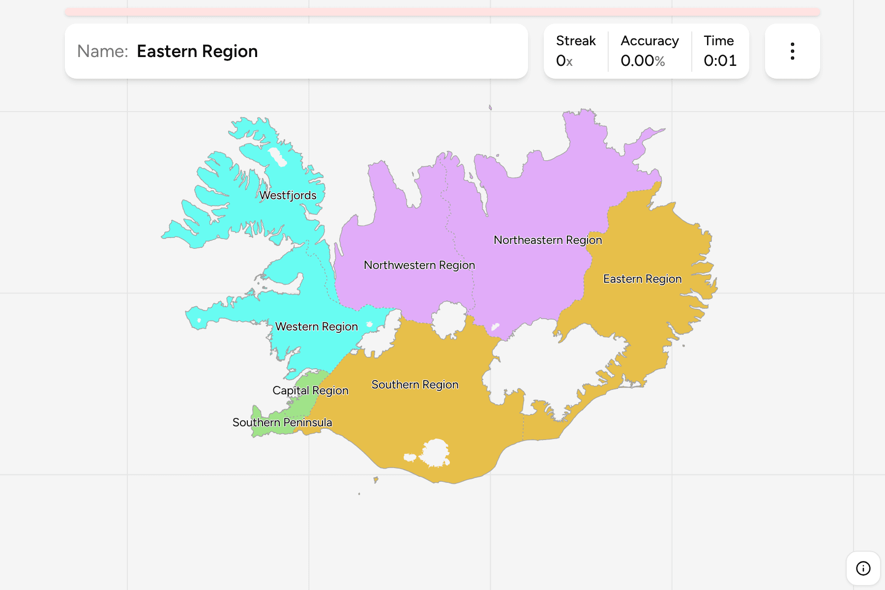
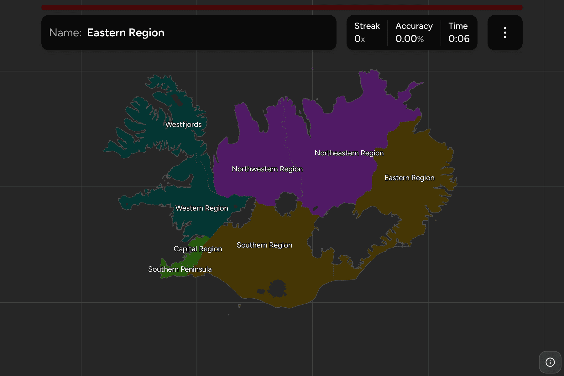
Eight landsvæði, the regions Statistics Iceland reports on. The two small ones
are in the south west: the Capital Region, around Reykjavik, and the Southern
Peninsula (Suðurnes) beside it, home of Keflavik airport. Both have a tap area
wider than their outline.
The rest are large and easy to tell apart once you know the coast. The
Westfjords are the island's northwest arm, nearly cut off by a narrow neck of
land. Northwestern and Northeastern Iceland share the north coast, split at
the Tröllaskagi peninsula, and the Eastern Region holds the fjords of the east.
The Southern Region is the biggest, a long coast of black sand and glacier
outwash that includes the Vatnajökull ice cap.
The groups are the four quarters the regions are named for, which is how people
talk about them rather than an official classification. The local name is a
switch in the start dialog: the Westfjords are Vestfirðir, the Southern Region
is Suðurland.
How to place one
- Start with the arm. The Westfjords are the big peninsula in the north
west, and the one shape nothing else resembles.
- Find the capital pair. The Capital Region and the Southern Peninsula are
the two small shapes in the south west corner.
- Walk the ring road. Western, Northwestern, Northeastern, Eastern and
Southern follow each other around the island.
Every region, by quarter
- Southwest (Capital Region, Southern Peninsula)2 regions
- Capital Region, Southern Peninsula
- North (Northwestern, Northeastern)2 regions
- Northeastern Region, Northwestern Region
- West (Western Region, Westfjords)2 regions
- Western Region, Westfjords
- East and South (Eastern, Southern)2 regions
- Eastern Region, Southern Region
Worked examples
Southern PeninsulaThe one with the airportThe Southern Peninsula is the Reykjanes peninsula, a thin finger pointing at
Greenland. Keflavik international airport is here, so it is the first part of
Iceland most visitors see, and the first one to learn is that it is not part
of the Capital Region.
WestfjordsThe arm in the northwestThe Westfjords are joined to the rest of the island by a neck only a few
kilometres wide. Nearly everything on this coast is a fjord, which is why it
is the least visited and the most thinly populated of the eight.
Frequently asked questions
How many regions does Iceland have?
Eight. They are called landsvæði in Icelandic and are the regions Statistics Iceland reports on.
Why is there no municipalities quiz?
Iceland has 61 municipalities after the mergers of recent years, and the freely available boundary files still draw 69 or 74 of them. A map with the wrong count would teach the wrong answer, so there is no game until a source draws the current ones.
For another country at this level, see Estonia Counties.
Sources