A region narrows an Italian round down to a quarter of the country, and the
province is the tier that names a town. It is the two letters at the end of a
number plate, the second line of every postal address and the unit Italians use
when they say where somebody is from, which is why it is the half of the
country worth learning once the regions stop being a challenge.
- The quiz
- Name to place, on the map
- Where it helps
- Plate codes, road signs, town names, postal addresses
- Grouped by
- Ripartizione geografica: North West, Centre, North East, South and Islands
- In the game
- 110 provinces
What you are looking at
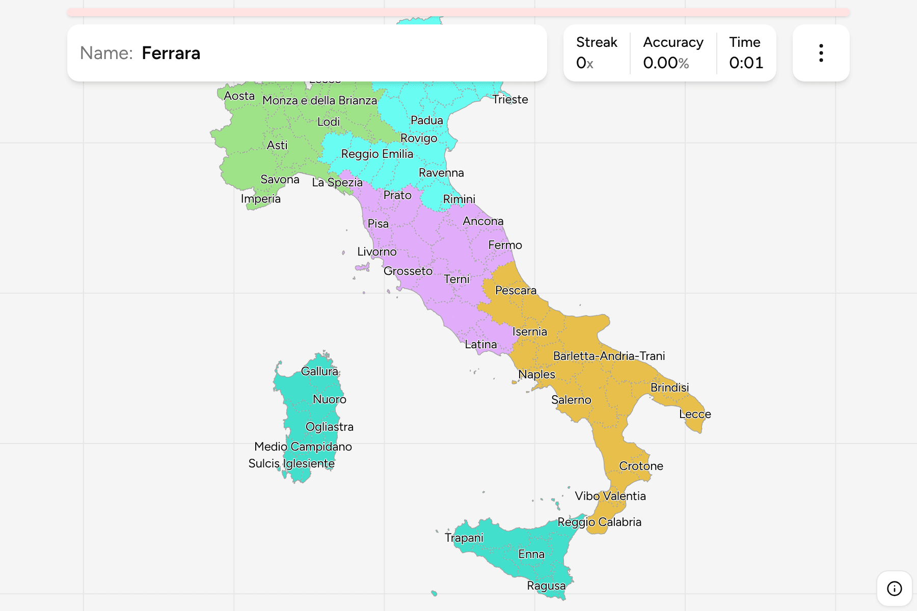
The map is the provinces and metropolitan cities as ISTAT draws them on 1
January 2026. A metropolitan city is a province in everything but name: in 2015
the largest urban areas, Rome, Milan, Naples, Turin and the like, swapped their
provincial council for a metropolitan one with the same borders, so the map
does not tell them apart and neither does this game. Valle d'Aosta is the odd
one out, a region with no provinces under it that is counted as a single unit
here, and Bolzano and Trento are the two autonomous provinces that between them
make up Trentino-Alto Adige.
Most provinces are named for their chief town, and where the town is well known
in English the name here is the English one: Turin, Milan, Naples, Rome,
Florence, Venice, Genoa, Syracuse, Padua and Mantua. Every name can be switched
to the Italian form in the start dialog, which is the one on the road signs.
Sardinia is the part of this map that is newer than most of the internet.
The island was redrawn in 2025, when the region abolished the province of Sud
Sardegna it had created in 2016 and brought back Gallura, Ogliastra, Medio
Campidano and Sulcis Iglesiente, with Sassari made a metropolitan city beside
Cagliari. Older maps, and the older datasets many quizzes are built from, still
show the five-province island, so a name you learnt there may not be one here.
The smallest provinces are too small to tap comfortably at the scale of the
whole country. Trieste, Prato and Monza e della Brianza are the usual victims,
and the smallest of them carry a tap area wider than their shape; zoom in for
the rest.
How to place one
- Take the code off a plate first. A plate carries the province as two
letters in the blue band on the right: RM for Rome, MI for Milan, NA for
Naples, TO for Turin, BO for Bologna, FI for Florence. It narrows a round
further than anything else you can read from a photograph, and it is the
reason people who have driven in Italy know more of this map than they think.
Plates issued between 1994 and 1999 carry no code, and a fair number of those
are still on the road.
- Then read the sign language. German beside Italian is Bolzano, French
beside Italian is Valle d'Aosta, and Slovene around Trieste and Gorizia is
those two provinces and no others.
- Then read the road. Autostrade are numbered A and belong to the state or
a concessionaire. Provincial roads carry SP and the number of the province's
own network, which is the clue on a quiet road: the sign at a junction names
the next town, and the next town is usually in the same province.
- Then work out the region and narrow inside it. The five groups in the game
are the same ones the regions game uses, so that is the step to take if the
rest has told you nothing.
The traps are the ones a nearby big city sets.
The province is named for a city that is not always the biggest in it.
Barletta-Andria-Trani is three towns sharing a name because none of them would
yield, Verbano-Cusio-Ossola is three districts, and Monza e della Brianza is a
province that was split off Milan in 2004 and now wraps around its northern
edge.
Several are small enough to be missed entirely. Trieste, Prato and Gorizia
are a few hundred square kilometres each, against Bolzano or Sassari at several
thousand, so the map is far from evenly spaced and the clusters are in the north.
Every province, by group
- North West25 provinces
- Alessandria, Aosta (Valle d'Aosta), Asti, Bergamo, Biella, Brescia, Cuneo, Como, Cremona, Genoa (Genova), Imperia, Lecco, Lodi, Monza e della Brianza, Milan (Milano), Mantua (Mantova), Novara, Pavia, Sondrio, La Spezia, Savona, Turin (Torino), Varese, Verbano-Cusio-Ossola, Vercelli
- Centre22 provinces
- Ancona, Ascoli Piceno, Arezzo, Florence (Firenze), Fermo, Frosinone, Grosseto, Livorno, Latina, Lucca, Macerata, Massa-Carrara, Perugia, Pisa, Prato, Pistoia, Pesaro e Urbino, Rieti, Rome (Roma), Siena, Terni, Viterbo
- North East22 provinces
- Belluno, Bologna, Bolzano, Forlì-Cesena, Ferrara, Gorizia, Modena, Piacenza, Padua (Padova), Pordenone, Parma, Ravenna, Reggio Emilia, Rimini, Rovigo, Trento, Trieste, Treviso, Udine, Venice (Venezia), Vicenza, Verona
- South24 provinces
- L'Aquila, Avellino, Bari, Benevento, Brindisi, Barletta-Andria-Trani, Campobasso, Caserta, Chieti, Cosenza, Catanzaro, Foggia, Isernia, Crotone, Lecce, Matera, Naples (Napoli), Pescara, Potenza, Reggio Calabria, Salerno, Taranto, Teramo, Vibo Valentia
- Islands17 provinces
- Agrigento, Cagliari, Sulcis Iglesiente, Caltanissetta, Catania, Enna, Messina, Nuoro, Ogliastra, Oristano, Gallura, Palermo, Ragusa, Syracuse (Siracusa), Sassari, Trapani, Medio Campidano
Those five groups are the same ones the regions game uses. They are the
ripartizioni geografiche, the cut ISTAT publishes every national figure in, and
each province sits in exactly one because each region does. Each can be switched
on and off on its own in the start dialog, which is the quickest way to learn
the map a quarter at a time.
Worked examples
BolzanoThe one that answers itselfBolzano, or Bozen: the northern half of Trentino-Alto Adige, Austrian until
1919 and German speaking ever since. Every sign has two languages on it, the
towns have two names, and the architecture is Alpine, with onion domes and
steep roofs. A plate reading BZ is the only one in Italy whose owner is likely
to be speaking German.
TriesteThe one at the edgeTrieste: the smallest province on the map, a strip of limestone coast hung
under Slovenia at the head of the Adriatic. It was the Habsburg empire's port
and still looks it, with grand waterfront squares, Slovene on the signs of the
villages above the city, and a plate code that most Italians will tell you
they have seen on the road once.
GalluraThe one that did not exist last yearGallura Nord-Est Sardegna: the northeast corner of Sardinia, with the Costa
Smeralda and the Maddalena archipelago, and a province in its own right again
since 2025. Olbia is its largest town and Tempio Pausania the historic one. If
an older map puts it inside Sassari, that is why.
Frequently asked questions
How many provinces does Italy have?
110 provinces and metropolitan cities as of 2026, counting Valle d'Aosta as the one unit it is. That is three more than the 107 many datasets still carry: Sardinia replaced its five provinces with eight in 2025, so the old Sud Sardegna is gone and Gallura Nord-Est Sardegna, Ogliastra, Medio Campidano and Sulcis Iglesiente are back.
What is the difference between a province and a metropolitan city?
Very little on the map. A metropolitan city replaced the province around each of the largest urban areas in 2015 and kept its borders, so Rome, Milan, Naples, Turin, Florence and the rest are drawn exactly as they were. What changed is the governing body: a metropolitan city has a mayor who is the mayor of the capital town and a council elected by the municipalities inside it, where a province has a president and its own council.
Do Italian number plates show the province?
Yes. A current plate carries the province as two letters in the blue band on the right, next to the year of issue: RM for Rome, MI for Milan, NA for Naples, TO for Turin. Plates issued between 1994 and 1999 carry no code at all. Since there are more than a hundred provinces and only twenty regions, the code narrows a round far more than the region does.
Why is Valle d'Aosta only one province?
Because it is a region too small to be divided: the Valle d'Aosta region has no provinces under it, and the functions of one are carried out by the region itself. ISTAT counts it as a single unit at this level, which is why it is one answer here and the number plate code AO is the only two letters it has.
How are the provinces grouped in this game?
Into the five ripartizioni geografiche that ISTAT publishes every national figure in: North West, Centre, North East, South and Islands. A province sits in the same group as its region, and they are the same five groups the regions game offers, so what you learn there carries over.
Which provinces are easiest to confuse?
The ones that wrap around a better-known neighbour: Monza e della Brianza against Milan, Fermo against Ascoli Piceno in the Marche, and Barletta-Andria-Trani against Bari and Foggia in Apulia. And on the islands, the new Sardinian provinces, if what you learnt was the five-province map.
For the tier above, try Italy Regions. For other European
maps of a similar size, France Departments, Spain
Provinces and Germany Districts are
the same kind of question in their own countries.
Sources